A pulse in a lesser-known tropical wave will bring increased risk of tropical cyclone activity over northern Australia in the coming week.
What are tropical waves?
Earth’s tropical atmosphere contains a number of large-scale waves that influence cloud and rainfall patterns throughout the year. The most well-known tropical wave is called the Madden-Julian Oscillation (MJO), which is a region of enhanced cloud and rainfall that moves from west to east near the equator, recurring roughly every 30 to 60 days.
However, there are several other tropical waves that can influence weather patterns near northern Australia, and one of these is called an equatorial Rossby wave.
What is an equatorial Rossby wave?
Equatorial Rossby waves travel through the tropical atmosphere from east to west at roughly the same speed as the MJO (but in the opposite direction). Equatorial Rossby waves typically produce an alternating sequence of high and low pressure systems on either side of the equator, resulting in mirrored zones of cloudiness and clear weather in the tropics of both hemispheres.
An equatorial Rossby wave is currently passing to the north of Australia, causing areas of enhanced cloudiness on either side of the equator at Australian longitudes.
The map below shows the modelled influence of the equatorial Rossby wave, with areas of enhanced and suppressed convection (cloudiness) north and south of the equator.
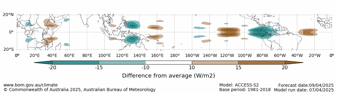
Image: Forecast outgoing long-wave radiation anomaly for April 9, 2025, associated with the equatorial Rossby wave. The green areas show where cloud cover is expected to be enhanced, while the brown shading represents suppressed cloud cover. Source: Bureau of Meteorology.
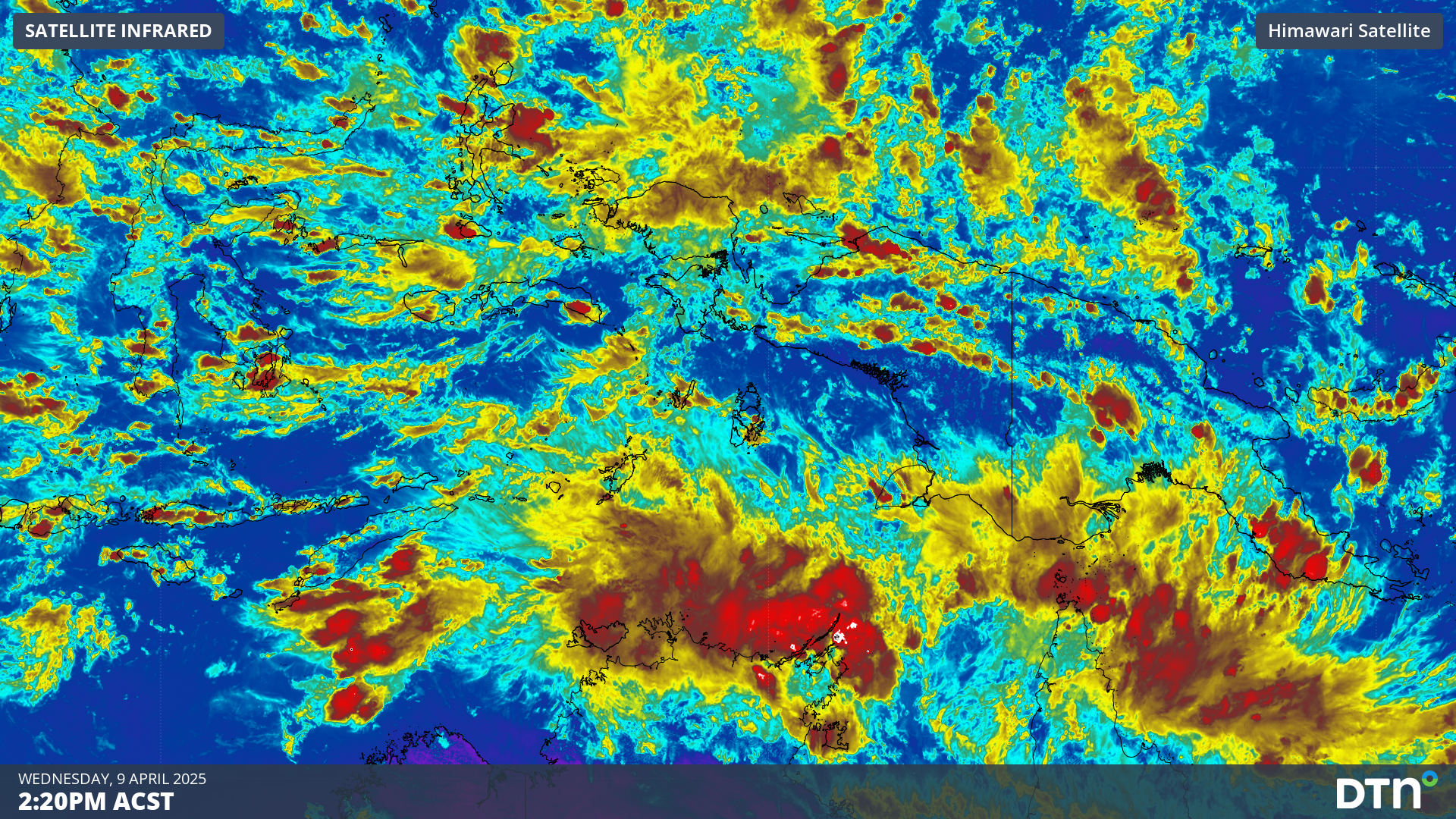
These areas of enhanced cloud can clearly be seen to the north of Australia in satellite images captured on Wednesday.
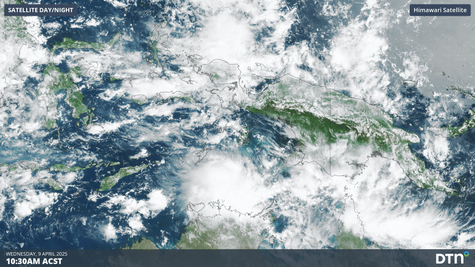
Image: Satellite imagery showing increased cloudiness over the Top End and near West Papua on Wednesday, April 9.
These areas of increase cloudiness are associated with increased convective activity, which can become organised into tropical lows and tropical cyclones.
Potential for tropical cyclone activity in the coming week
The area of cloud near Australia’s Top End is forecast to become increasingly organised within this pulse of favourable atmospheric conditions. Tropical Low 29U is expected to form out of this area of increased convection over the Arafura Sea. As the low tracks west, there is a moderate chance of it becoming a tropical cyclone from Friday, April 11, most likely north of the Kimberley, as seen in the image below.
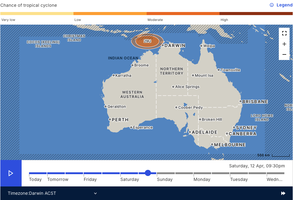
Image: Chance of tropical cyclone formation near Australia on Saturday, April 12. Source: Bureau of Meteorology.
While this system is expected to remain to the north of Australia’s coastline over the coming week, a period of heavy rain and thunderstorms may affect the far north of the country as moist winds wrap around the system. As seen in the image below, rainfall amounts of 100-200mm are expected over parts of the Top End and Cape York Peninsula over the coming week.
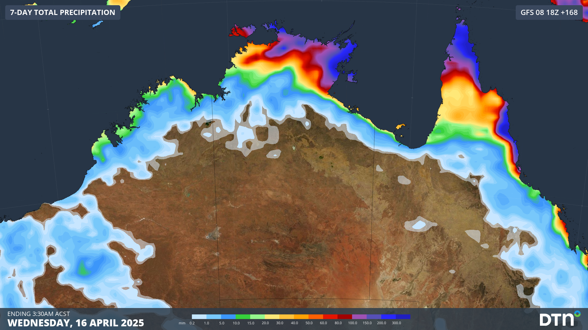
Image: Forecast rainfall over the next week across northern Australia.
By mid-next week, Tropical Low 29U, which could be Tropical Cyclone Errol, should be well northwest of WA. While uncertainty becomes increasingly elevated, some computer models have the system potentially swinging back towards WA’s northwest over the late week period.
How DTN APAC can help
As the climate delivers increasingly severe weather events, their potential to impact your business operations grows.
DTN APAC specialises in industry-leading forecast, alerting and threat analysis of tropical cyclones, offering you expert, customised solutions when the weather turns wild.
Providing rapid-update forecast information, we alert you to any low-pressure system gaining power within your region and, unlike other providers, can track its development out to 7 days. This gives you the time to prepare and safeguard your staff, sites and assets.
You will have the most precise weather intelligence charting rainfall, wind speeds and potential storm surges to help you make critical decisions quickly. Whether it’s adjusting key work schedules, protecting your staff or securing your site, we have the alerting capability to keep you steps ahead of the storm.
We will support you 24/7, keeping you informed and making your critical decisions easier.
To find out more about large range of products and services contact us at sales.apac@dtn.com


