There are early indications that a tropical cyclone could form near the Solomon Islands next week, with some forecast models suggesting the system could briefly enter Australia’s area of responsibility.
Australia’s official tropical cyclone season runs from November until April. During this 6-month period, we typically see around 9 to 10 tropical cyclones forming in Australia’s area of responsibility.

Image: Map showing Australia’s area of responsibility (AOR) for tropical cyclone monitoring. Source: Bureau of Meteorology
But while most tropical cyclones near Australia form between November and April, they can develop in or near the Australian Region at any time of year.
In late July 2022, a rare winter tropical cyclone formed over the Indian Ocean to the west of the Cocos-Keeling Islands. Another mid-year cyclone occurred in 2015 when Tropical Cyclone Raquel formed near the Solomon Islands on July 1. Raquel became the first tropical cyclone on record to form in Australia’s Eastern Region during July.
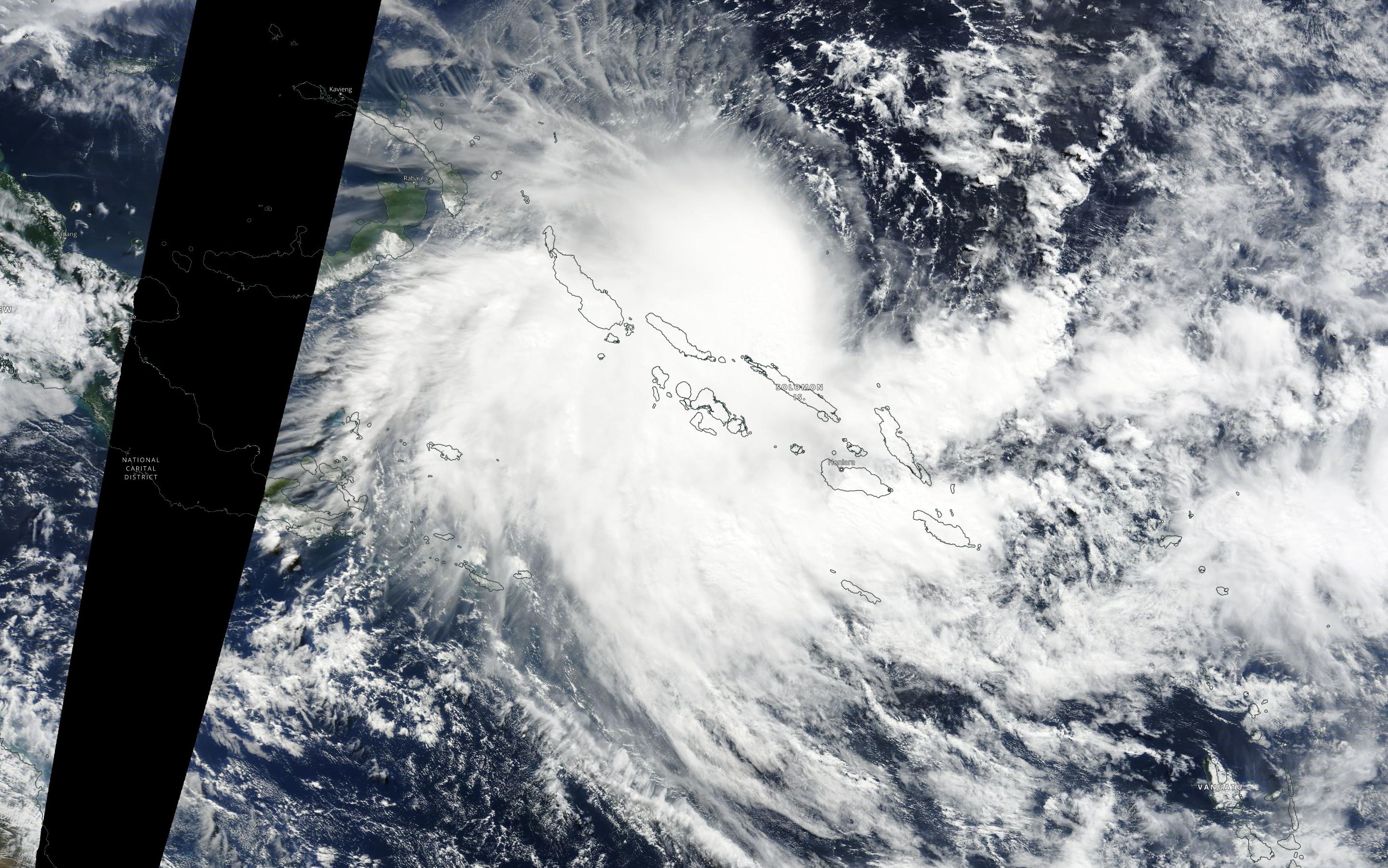
Image: Tropical Cyclone Raquel near the Solomon Islands on July 1, 2015. Source: NASA Worldview
There have been a couple of tropical cyclones near the fringes of the Australian Region during October, including Alex in 2001 and Oscar in 1983. However, these were both located over the Indian Ocean, near the Australian Region’s western boundary. In modern satellite-based records, we have not seen a tropical cyclone inside Australia’s Eastern Region during October.
Could this be about to change?
A low pressure system is expected to form to the east of the Solomon Islands on Thursday or Friday. While the future development of this system is highly uncertain at this stage, some forecast models suggest it could gain strength move towards Australia’s area of responsibility early next week.

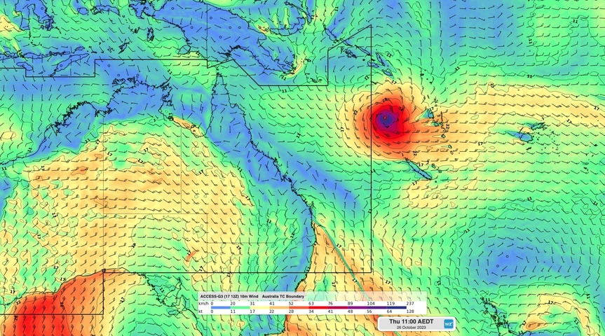
Image: Forecast wind speed and direction at 11am AEDT on Thursday, October 26, 2023, according to the ACCESS-G model, showing a potential tropical cyclone near the eastern boundary of Australia’s area of responsibility.
The Bureau of Meteorology have designated this system as Tropical Low 01U and are currently giving it a low chance (5 to 20%) of developing into a tropical cyclone on the weekend and a moderate chance (25 to 50%) from early next week.
The Bureau’s 7-day tropical cyclone outlook, which is newly operational this year, shows that this system could enter the far northeastern corner of the Australian Region at some stage early next week based on current model guidance. However, it is important to note that all forecast models show no signs that this system will directly affect Australia.
Tropical cyclones are notoriously difficult to predict and the future development and movement of Tropical Low 01U is highly uncertain at this early stage in its development. Weatherzone’s meteorologists will continue to monitor this system closely and bring more updates in the coming days if necessary. For more information about our tropical cyclone services, please contact us at apac.sales@dtn.com.


