A line of severe thunderstorms is moving onshore towards the southwest of WA, which could produce heavy rainfall and large hail on Thursday morning.
These thunderstorms are forming on a trough offshore ahead of an approaching cold front and sweeping across the region. The image below shows a shelf cloud over Bunbury on Thursday morning.
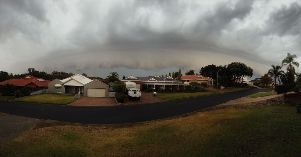
Credit:@the_greenhouse_goddess
Cape Naturaliste has recorded 12.2mm in the half an hour leading up to 8am WST on Thursday, meanwhile Wilydowns recorded 64.6mm in the two hours to 7:50am.
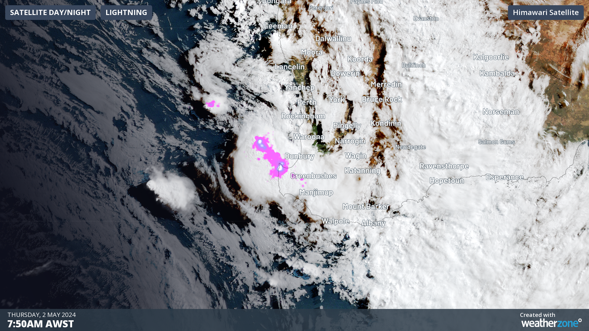
The image below shows a 400km long line of thunderstorms moving into the state’s southwest on Thursday morning, in a ‘train-like’ fashion as the storm cells follow each other’s path.
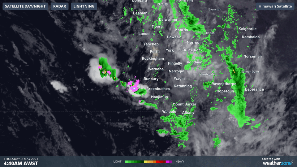
Image: Himawari satellite image showing cloud, rain and lightning in the three hours leading up to 7:40am AWST on Thursday, May 2.
This movement thunderstorms is commonly known as the ‘train effect’, which is when thunderstorms and the associated heavy rainfall repetitively impact the same location.
This train effect could cause flash flooding in the region over the next few hours. These thunderstorms are also moving over a very dry landscape, which could increase this risk of flash flooding further.
The map below shows the forecast rainfall on Thursday, with widespread falls of 5-15mm forecast in the Central West, Goldfields, Central Wheat Belt, South West and Southern Coastal districts. Pockets of heavier rain are also possible.
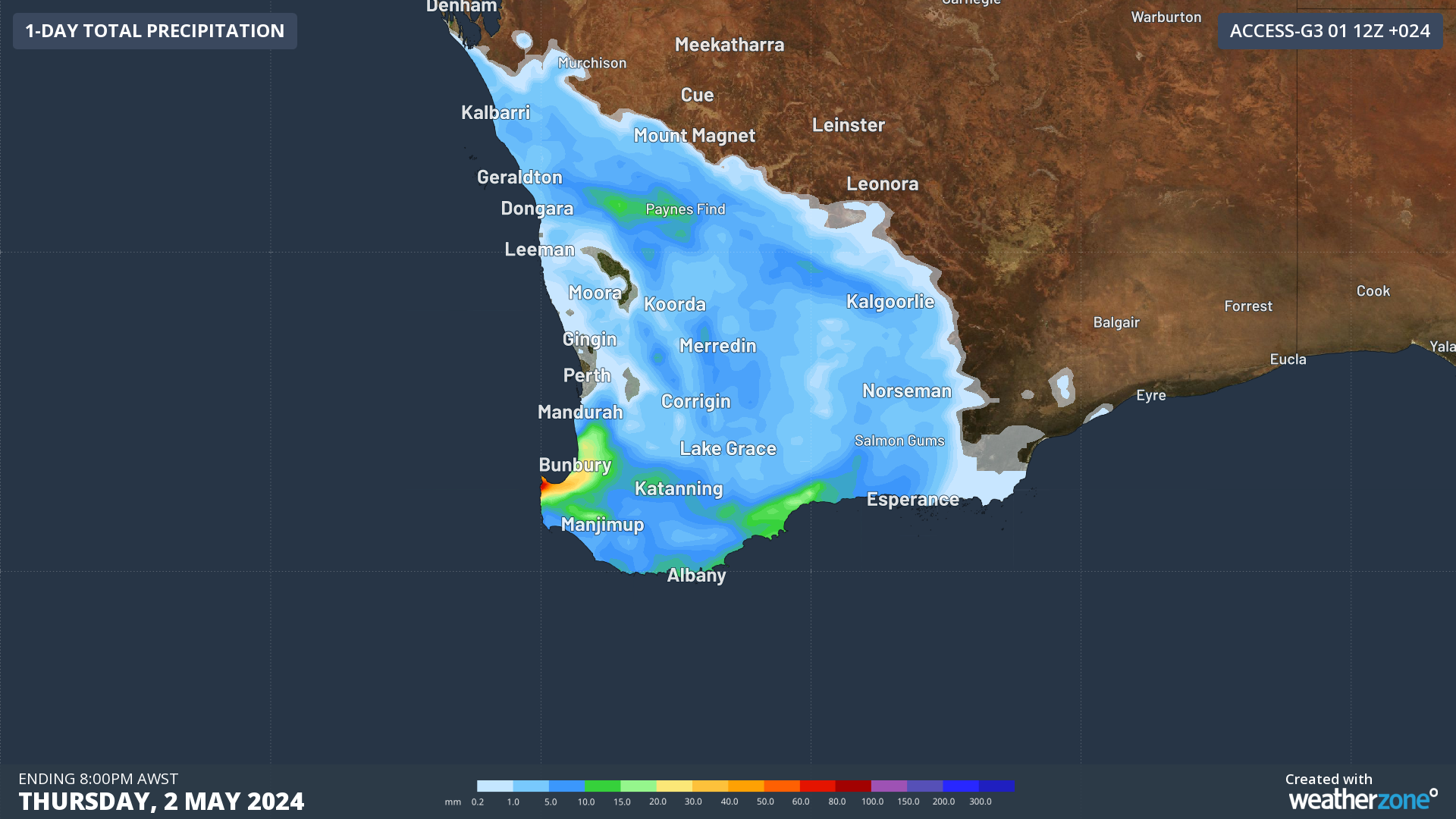
Image: Accumulated rainfall forecast for the day leading up to 8pm AWST on Thursday, May 2, according to Access-G
Looking ahead, rainfall should ease on Friday and Saturday across WA, however a low pressure system near South and South East Coastal districts on Sunday and early next week will bring another burst of rainfall to those districts.
Stormtracker is our Global Information System (GIS) tracking tool, providing multiple weather layers and zoom controls overlaid on a map of your location and infrastructure. You can choose a snapshot or full screen view, depending on your requirements. The maps allow you to monitor all weather, and specifically any systems likely to cause risk for your business. You also have the capacity to observe:
- real time lightning and thunderstorm alerts
- localised lightning strike frequency
- official warnings for storm, cyclone, wind, flood and fire
- sentinel hotspot fires and fire agency current incidents
Stormtracker’s radar imagery updates every 10 minutes, so you are always able to respond rapidly to changing conditions. You can customise alerting to notify you when your staff or infrastructure are under threat. With increased situational awareness, your ability to make informed decisions quickly is optimised.
DTN APAC’ experience and intelligence gives you a clear path through complex situations. Let us assist you, offering actionable insight when extreme weather poses risk to your business. For more information, please contact us at apac.sales@dtn.com.


