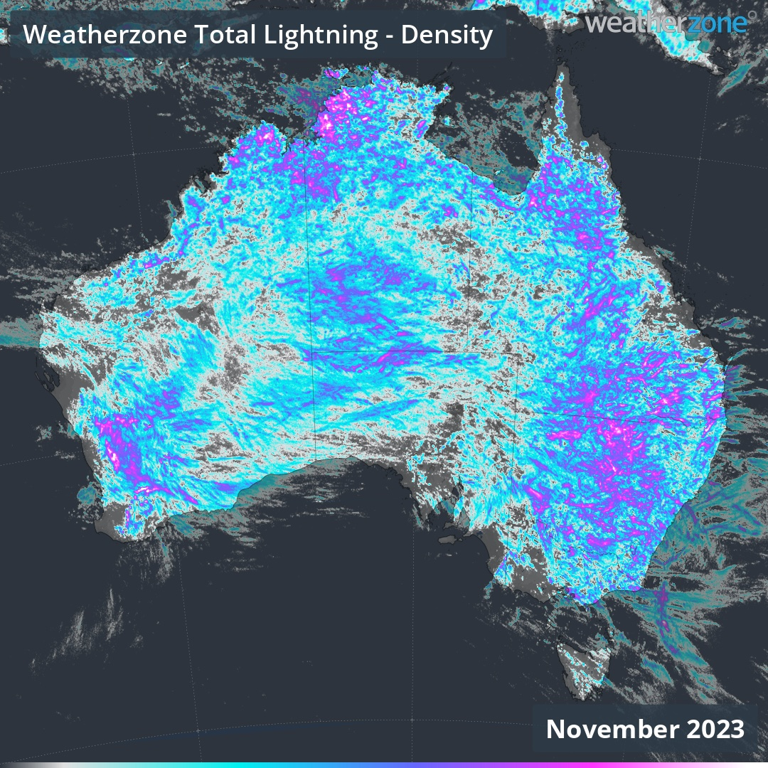
November 2023 was a prolific month for thunderstorms in Australia, with 40.5 million lightning strikes detected over the Australian region in the last 30 days.
Late-spring is typically a stormy time of year in Australia due to an abundance of warm air, moisture and atmospheric instability. But even by these typically stormy standards, November 2023 was a BIG month for lightning in Australia.
Total Lightning Network detected 40,465,119 individual lightning pulses over the Australian region during November. This count included all lightning detected inside a box bounded by 180ºE to 160ºE and 5ºS to 49ºS.
The map below shows how November’s thunderstorms played out, with storms persisting through every day and night and large amounts of lightning hitting every state and territory.
Video: Lightning pulses (cloud-to-ground and cloud-to-cloud) lightning strikes detected by Weatherzone’s Total Lightning Network in November 2023.
November’s thunderstorms also brought some welcome rain to parched and fire-weary parts of Australia. While September and October were collectively Australia’s driest two-month period on record, November rainfall was above average over large areas of the Australian mainland. Broad areas of eastern Australia and pockets of most other states and territories even saw monthly rainfall totals falling in the top 10 percent of historical records.
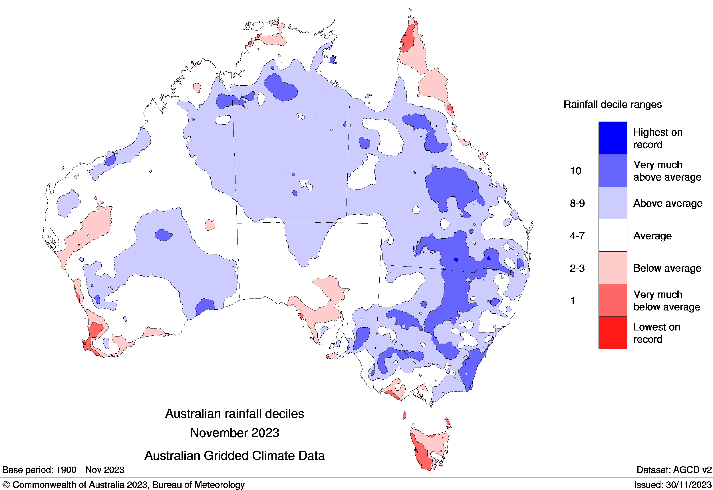
Image: Observed rainfall deciles during November 2023. Blue areas show where rainfall was above average. Source: Bureau of Meteorology.
There were several reasons November produced so many thunderstorms over Australia:
- Abnormally warm sea surface temperatures surrounding Australia provided abundant moisture for storm development
- A positive Southern Annular Mode (SAM) during the first half of the month helped to further increase moisture levels over the country’s east and southeast
- A wavy jet stream over Australian longitudes caused weather systems to slow down and produce lengthy spells of storms over the region
The shifting climate is bringing increasingly severe weather events, so it’s time to safeguard your business against the potential damage lightning can cause.
Our Total Lightning Network is the intelligent solution that goes above and beyond to increase your lead time before the storm hits.
We utilise a vast global sensor network, created with our partner Earth Networks. Over 1200 sensors in 40+ countries provide a worldwide view of both intra-cloud (IC) and cloud-to-ground (CG) lightning strikes, enabling businesses to plan and respond with the most precise insight available.
Offering unsurpassed accuracy, with real-time detection to <200m, we integrate with your existing systems to keep your enterprise operating within your defined severe weather thresholds.
Leave nothing to chance. Be confident working outdoors with the most sophisticated lightning alerting system, delivering intelligence to any device across your business network. For more information, please contact us at apac.sales@dtn.com.


