
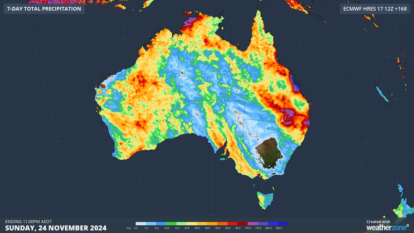
It’s going to be another big week of severe weather in Australia, with widespread thunderstorms hitting multiple states, heavy rain drenching central Queensland and a heatwave spreading across southern Australia.
Late-spring is always a volatile time for weather in Australia and this month is living up to that reputation.
Last week, daily thunderstorm activity produced 12.78 million lightning strikes over Australia, with more than 2.5 million of these occurring on Sunday alone.
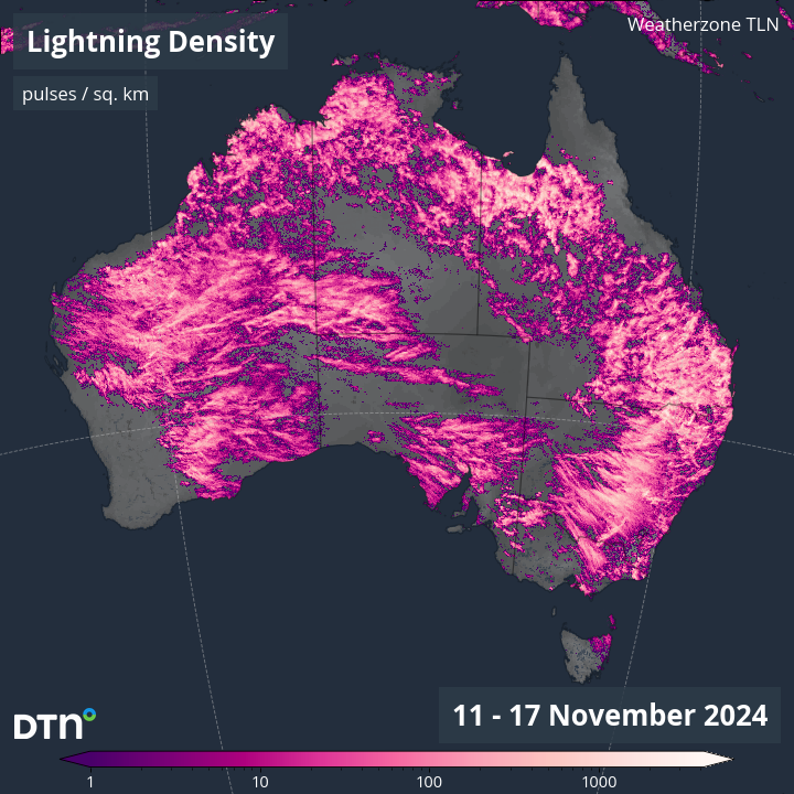
Image: Observed lightning density during the week ending on November 17, 2024.
This prolific thunderstorm activity will continue this week, with daily storms likely to hit multiple states and territories.
Thunderstorms in Australia this week
Storms will occur over large areas of the county this week due to broad areas of low pressure interacting with copious airborne moisture and widespread atmospheric instability.
This week’s storms will mainly affect parts of NSW, Qld, the NT and WA between Monday and Friday, before also spreading to parts of southern Australia from the weekend.
As we saw last week, severe thunderstorms are a good chance on most days this week, so be sure to keep up to date with the latest severe thunderstorm warnings in your state or territory.
Heavy rain in central Queensland
Rain will increase over Qld from the middle of this week as moisture-laden easterly winds feed into a deepening coastal trough. This rain will start on Wednesday and could increase on Thursday as the coastal trough deepens. Some models even suggest that a low pressure system could form near the central coast of Qld around Thursday, which would further enhance the risk of heavy rain and flooding.
The image below shows one computer model’s prediction for accumulated rain this week, showing potential for more than 200 mm of rain along parts of Qld’s central coastline.
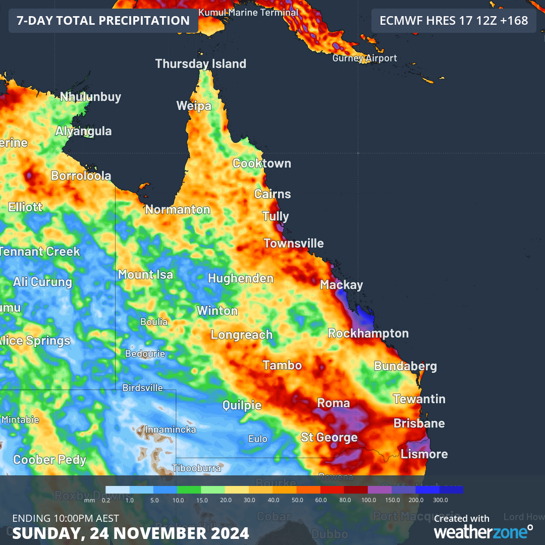
Image: Forecast accumulated rain during the 7 days ending at 10pm AEST on Sunday, November 24, 2024.
While there is still some uncertainty regarding this week’s rain in central Qld, there is potential for heavy rain and flooding in the state’s central coastal districts around Thursday.
Heat in southern Australia
Another standout feature of this week’s weather will be a pulse of hot air spreading over the country’s south and southeast in the second half of the week.
The impending warmth may be intense and persistent enough to be classified as a severe heatwave in some areas of SA and Vic.
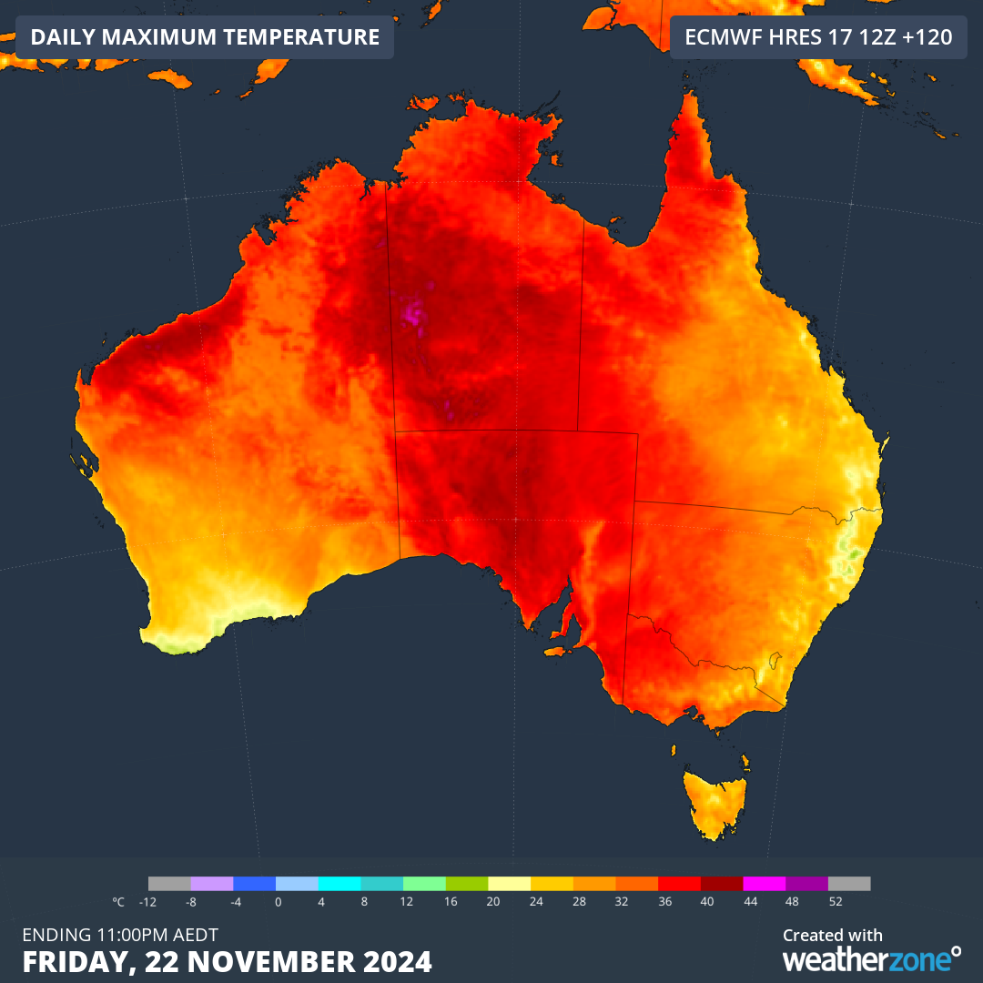
Image: Forecast maximum temperature on Friday, November 22, 2024.
Unfortunately, the rising temperatures will also see a return of elevated fire danger in SA and Vic towards the end of this week, possibly causing extreme fire danger ratings in some areas.
Stormtracker is a severe weather solution that can assist you in observing, in real-time, any storm or event that has the potential to impact your business.
Embedded in DTN’s industry interfaces, the system gives you a time advantage when monitoring conditions developing over your infrastructure and location.
Stormtracker is our Global Information System (GIS) tracking tool, providing multiple weather layers and zoom controls overlaid on a map of your location and infrastructure. You can choose a snapshot or full screen view, depending on your requirements. The maps allow you to monitor all weather, and specifically any systems likely to cause risk for your business. You also have the capacity to observe:
- real time lightning and thunderstorm alerts
- localised lightning strike frequency
- official warnings for storm, cyclone, wind, flood and fire
- sentinel hotspot fires and fire agency current incidents
Stormtracker’s radar imagery updates every 10 minutes, so you are always able to respond rapidly to changing conditions. You can customise alerting to notify you when your staff or infrastructure are under threat. With increased situational awareness, your ability to make informed decisions quickly is optimised.
DTN’s experience and intelligence gives you a clear path through complex situations. Let us assist you, offering actionable insight when extreme weather poses risk to your business. For more information please visit our website or email us at sales.apac@dtn.com.




