
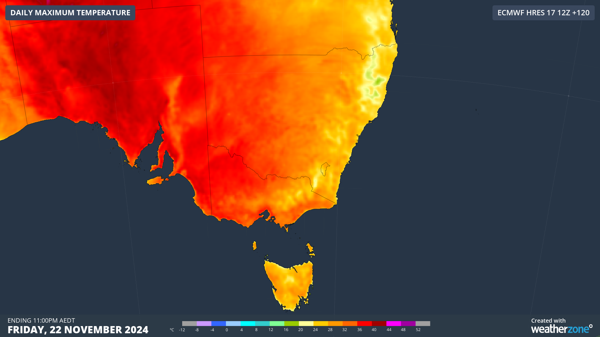
The southern states are set to sizzle for a prolonged period later this week, with maximums set to reach the mid to high 30s in the capital cities.
A stubborn high pressure system over southern Australia will direct hot northerly winds over the southern states for several days before a trough arrives on the weekend.
The run of hot days and warm nights should bring heatwave conditions to parts of SA, Vic, Tas and southwestern NSW from Thursday, November 21. Isolated areas of southern SA and western Vic are forecast to see severe heatwave conditions later this week.
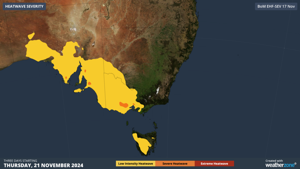
Image: Heatwave severity forecast for three days from Thursday, November 21
The southern and southeastern capital cities daytime temperatures will reach 6 to 12°C above average mid to late this week:
- Adelaide is forecast to see around 5 to 6 days above 29C starting Wednesday, November 20, with temperatures peaking at 35°C on Thursday and 37°C on Friday.
- Melbourne’s mercury will soar into the mid 30s on Friday and/or Saturday depending on high cloud and rainfall.
- Hobart’s maximum temperature should reach 28°C on Saturday.
- Sydney is forecast to see temperatures in the mid to high 20s from the weekend into next week.
- Brisbane is the exception this week with well below average temperatures forecast until early next week.
While Adelaide and Melbourne’s hottest days are not aligned, the cities should see some coincident heat with both capitals forecast to reach the mid to high 30s on Friday, November 22. This could increase the strain on the energy grid with increased demand in several states at the same time.
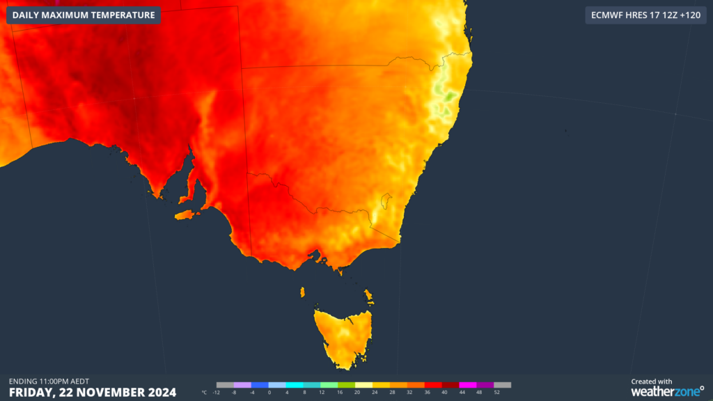
Image: Maximum temperature forecast for Friday, November 22, according to ECMWF
An unseasonably humid atmosphere over southern Australia, should make these temperatures feel up to 3°C warmer than the actual temperature increasing the demand on the energy grid.
Unfortunately, there will be little relief overnight Thursday and Friday for those in Adelaide and Melbourne with minimums of 22 to 23°C forecast.
Looking ahead, the southern capital cities temperatures should drop below the 30s later this week into next as the trough sweeps across the southeast.
Meanwhile, the heat will push northeast towards NSW and Qld, with very early signs that eastern Australia could see a run of heat mid to late next week.
DTN APAC supplies precise weather intelligence to over 75% of the National Energy Market (NEM); and is the trusted provider for the Australian Energy Market Operator (AEMO).
Weatherzone’s next-generation nowcasting and forecasting system, OpticastTM, is independently proven to outperform other industry models, allowing energy traders to respond rapidly to changing conditions. From 14 day forecasting to seasonal outlooks, you have access to complete and powerful weather intelligence giving you the confidence to make the best call.
Meeting the needs of the changing market, Weatherzone utilises high-resolution modelling and local knowledge to provide 5-min granularity observations and forecasts, optimising your market bidding and maximising your profits. These, coupled with briefings from our energy meteorologists, give you full awareness of the associated risk.
Benefit from specialised indices such as apparent temperature, Cooling/Heating Degree Days (CDD/HDD) and Effective Degree Days (EDD) to help accurately predict demand. You can get a clear picture of forecast conditions across the market and quickly assess heat/heatwave potential from 14 days out to 12 months
No matter where your energy trading focus lies, we have the power generation and weather insights to inform your critical decisions, keeping you ahead of the curve.
For more information please visit our website or email us at sales.apac@dtn.com.




