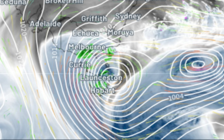
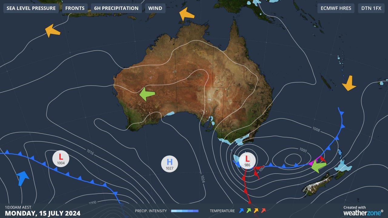
The low pressure system just east of Tasmania has delivered the heaviest rain of the year to many parts of Tasmania as well as wild winds exceeding 100 km/h.
This is a strong, intense low pressure system and it’s drawing in plenty of moisture from the Tasman Sea to the east.
That’s why the chart below shows that the heaviest 24-hour totals have been recorded in the state’s east rather than in the west, as you’d normally expect for a midwinter weather system.
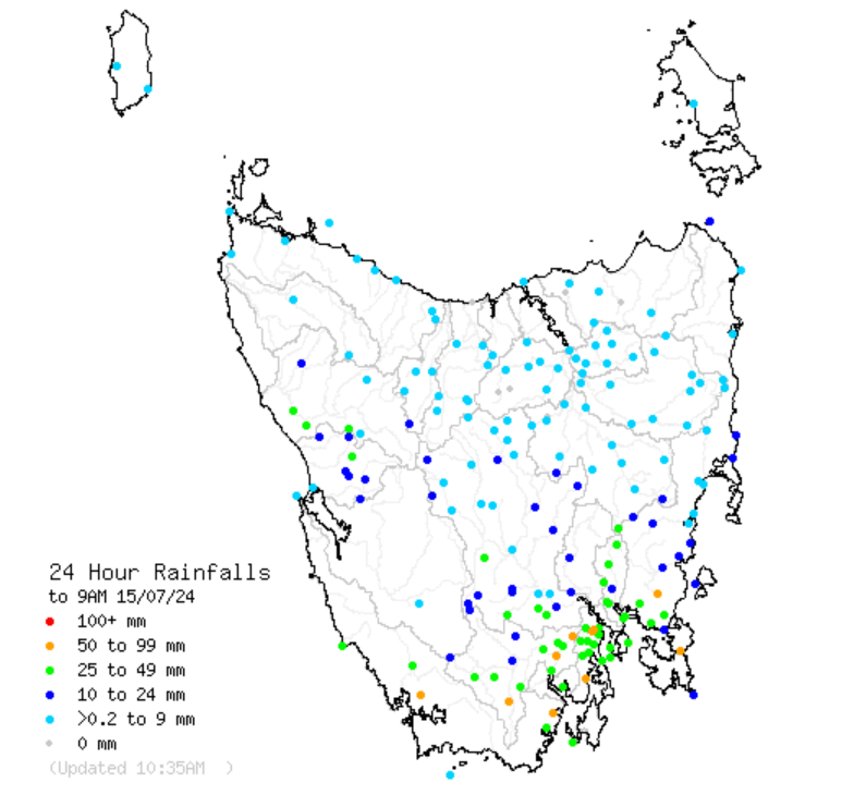
Source: BoM.
Some of the noteworthy observations include:
- Hobart received 32.4 mm of rain to 9 am Monday, its highest daily fall since October 2023. It had already received another 9.6 mm by 11 am Monday.
- Dover, which you might be interested to know is Australia’s southernmost town with a few hundred or more people, received 63 mm to 9 am.
- A gust of 135 km/h was recorded at the notoriously windy spot of Maatsuyker Island just south of Tasmania. What made this reading unusual was the southeasterly direction. The strongest gust at kunanyi/Mount Wellington was 117 km/h just after 9 am.
- The gauge at kunanyi/Mt Wellington received 45 mm to 9 am, and a further 17.4 mm to 11 am, so it’s really coming down as we write this story. That’s rain, not snow, by the way, and here’s where this story gets interesting.
A large cold airmass with Antarctic origins has moved north of Tasmania, and light snow is currently falling on the mainland alpine region. That snow is expected to intensify later today into Tuesday.
Snow showers are being reported all the way up on parts of the NSW Central and Northern Tablelands at elevations much lower than the mountains. There was also 15 cm of snow reported overnight at Ben Lomond, Tasmania’s only commercial ski resort, which is located near Launceston in the state’s north.
But southern Tasmania is currently much warmer than both the north of the state and the southeastern part of the mainland, due to a warm front wrapping around the low which our meteorologists have illustrated on Monday’s synoptic chart.
If you look at the 24-hour observations for kunanyi/Mt Wellington, you can see that it was freezing up until midnight before a quite dramatic warming occurred with the temperature reaching 5°C before 9 am – right at the time of day when you’d expect it to be coldest.
That’s the situation just before midday on Monday. As the week progresses, cold air will return to Tasmania and the snow level will again drop to as low as 700 metres.
There will also be more rain for Hobart for much of the week (heaviest in the first few days) and that’s good news for a city which – like much of Tasmania – has experienced a very dry start to 2024.
Meanwhile as this low starts to push more and more moisture onto the mainland, heavy snow can be expected in the mountains with further snowfalls in lower-lying areas. We’ll be covering that situation as it unfolds in the next 72 hours.
For more information please contact us at apac.sales@dtn.com.


