A flurry of severe thunderstorms hit Sydney on Monday, causing heavy rain and lots of lightning.
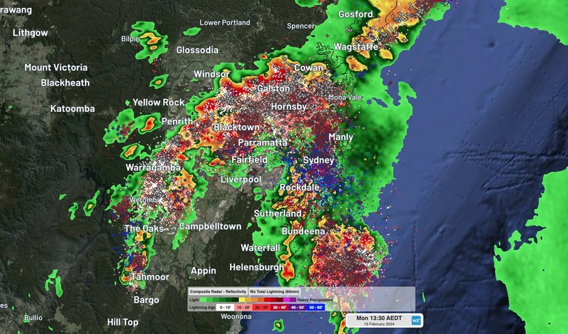
A line of thunderstorms started approaching Sydney from the east shortly before midday. By 12:30pm, a new thunderstorm cell had formed directly over the CBD, producing loud thunder, lightning and heavy rainfall.
Several other storms then popped up across the Sydney Basin and by 1:30pm, the radar and lightning tracker were a kaleidoscope of colours as multiple storms assaulted the city and its surrounding suburbs.
Sydney’s Observatory Hill weather station, which is Sydney’s official weather observing site, received 8mm of rain in 10 minutes before going offline at 12:30pm.
Hersley Park picked up 18 mm in the one hour ending at 1:30pm, while unofficial observations suggested rain rates reached 30 mm in 15 minutes around Randwick.
The rain was so heavy that the Harbour Bridge couldn’t be seen from Circular Quay, forcing people to scramble for shelter. According to reports, four people were taken to hospital after the tree they were sheltering under at the Royal Botanic Gardens was struck by lightning.
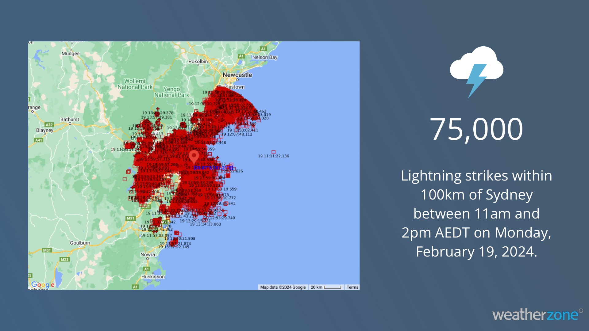
Total Lightning Network detected around 75,000 lightning strikes within a 100km radius of Sydney’s CBD between 11am and 2pm AEDT on Monday.
Storms will continue to affect the eastern half of NSW and southern Qld this afternoon and tonight, so be sure to check the latest warnings for the most up-to-date information.
Stormtracker is our Global Information System (GIS) tracking tool, providing multiple weather layers and zoom controls overlaid on a map of your location and infrastructure. You can choose a snapshot or full screen view, depending on your requirements. The maps allow you to monitor all weather, and specifically any systems likely to cause risk for your business. You also have the capacity to observe:
- real time lightning and thunderstorm alerts
- localised lightning strike frequency
- official warnings for storm, cyclone, wind, flood and fire
- sentinel hotspot fires and fire agency current incidents
For ore information, please contact us at apac.sales@dtn.com


