It’s a chilly one this Friday across the most heavily populated corner of the country, as a thick layer of cloud prevents the sun’s warmth from bumping up temperatures.
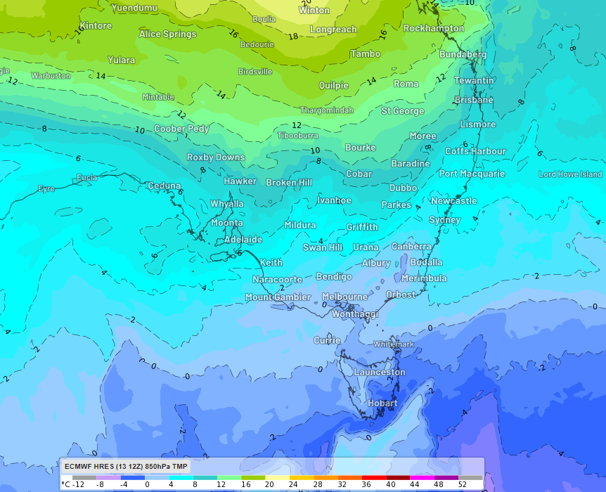
Take a look at the chart below at midday on Friday, June 14.
- The first feature of interest is the widespread cloud covering almost all of NSW and Victoria.
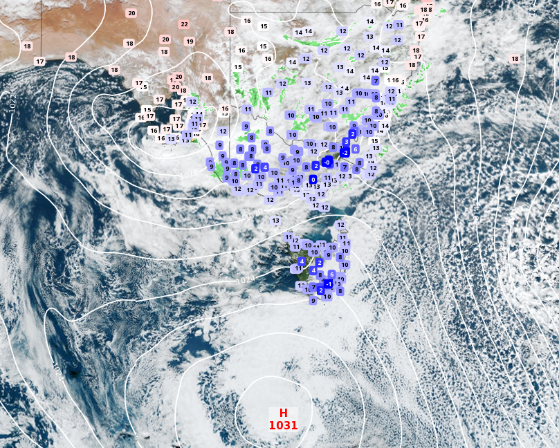
- You light also notice the lack of rain in most areas, with only a few smallish green radar blobs here and there despite the broad area of cloud. Rain is increasing in some areas, however, as we move into Friday afternoon.
- Thirdly, you can’t miss those temperatures. It’s pretty rare to have such a large area with temps topping out at 15°C or lower at midday, even in June. Only the north coast of NSW is slightly warmer.
- Fourthly, the patterns of isboars shows the cause of it all – frigid air circulating around that high pressure system centred over the ocean south of Tasmania.
As Weatherzone meteorologist Ashleigh Madden wrote on Friday morning, this pattern is not going to change in a big hurry, which means cold weather in store across the weekend.
The #snowmaking guns are firing around the clock at #Hotham! Temps dipping to -4.7°C this morning. ???????? pic.twitter.com/FqGuoENP7x
— Hotham (@_hotham) June 13, 2024
Is this a ‘cold snap’?
Not really, no.
Despite widespread reports of a “cold snap” in Australian media today, this is not your typical cold snap – which usually refers to an active cold front crossing the southeast bringing strong winds, rain, hail, and snow on the tablelands and mountains.
The current set-up is a little different.
We actually had an active cold front pass through SE Australia on Tuesday into Wednesday. So if there was a cold snap in Australia this week, it happened as the front passed through southeastern Australia.
Hot on the heels of the front was a northwest cloudband, and those two systems have combined to bring the current chilly temps, with lingering cold air from the front being trapped under a layer of cloud.
This is preventing diurnal (daytime) heating and it’s why Sydney was only 13.9°C at midday on Friday and may fall short of its predicted top of 17°C.
It’s also why Melbourne had its coldest day in five years on Thursday.
Looking ahead to the weekend, areas of showers and light rain will persist across Victoria and southern NSW on Saturday before skies start to clear inland with a prolonged spell of cold, frosty nights ahead.
Showers will develop along the coast of NSW and eastern Vic on Sunday, making those areas feel very wintry too.
Will we see cold winter days and nights ahead as we approach the winter solstice and the shortest day of the year on June 21?
Absolutely.
A cold snap? There’s no technical definition of the term, but not really, no.
Weatherzone Business has grown to become the outright leader within the Australian energy market, serving wind, solar, hydro, trading, utilities and network companies.
You can’t control the weather, but you can gain precision insights to optimise your response. What lights us up is providing your energy business with tailored weather information to reduce your risk and keep you moving ahead of the curve.
Our services cover all aspects – from wind and solar generation to demand forecasts, wholesale markets to retail so, no matter where your company sits, we have solutions for you. We have worked closely with market participants to create products that meet the evolving needs of the sector, aiming to increase safety and profitability for our customers.
Benefit from the timely delivery of accurate weather information, allowing informed and effective decision-making. For more information please contact us at apac.sales@dtn.com.


