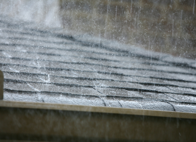
Rain, thunderstorms, powerful winds and dangerous surf will affect parts of eastern and southeastern Australia over the next few days under the influence of a northwest cloudband and two low pressure systems.
The images below show a northwest cloudband traversing Australia over the past three days. This massive band of cloud, which was caused by moisture-laden air originating from the Indian Ocean, has brought rain to parts of every Australian state and territory this week.
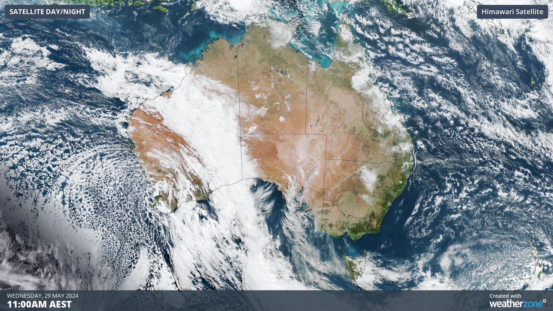
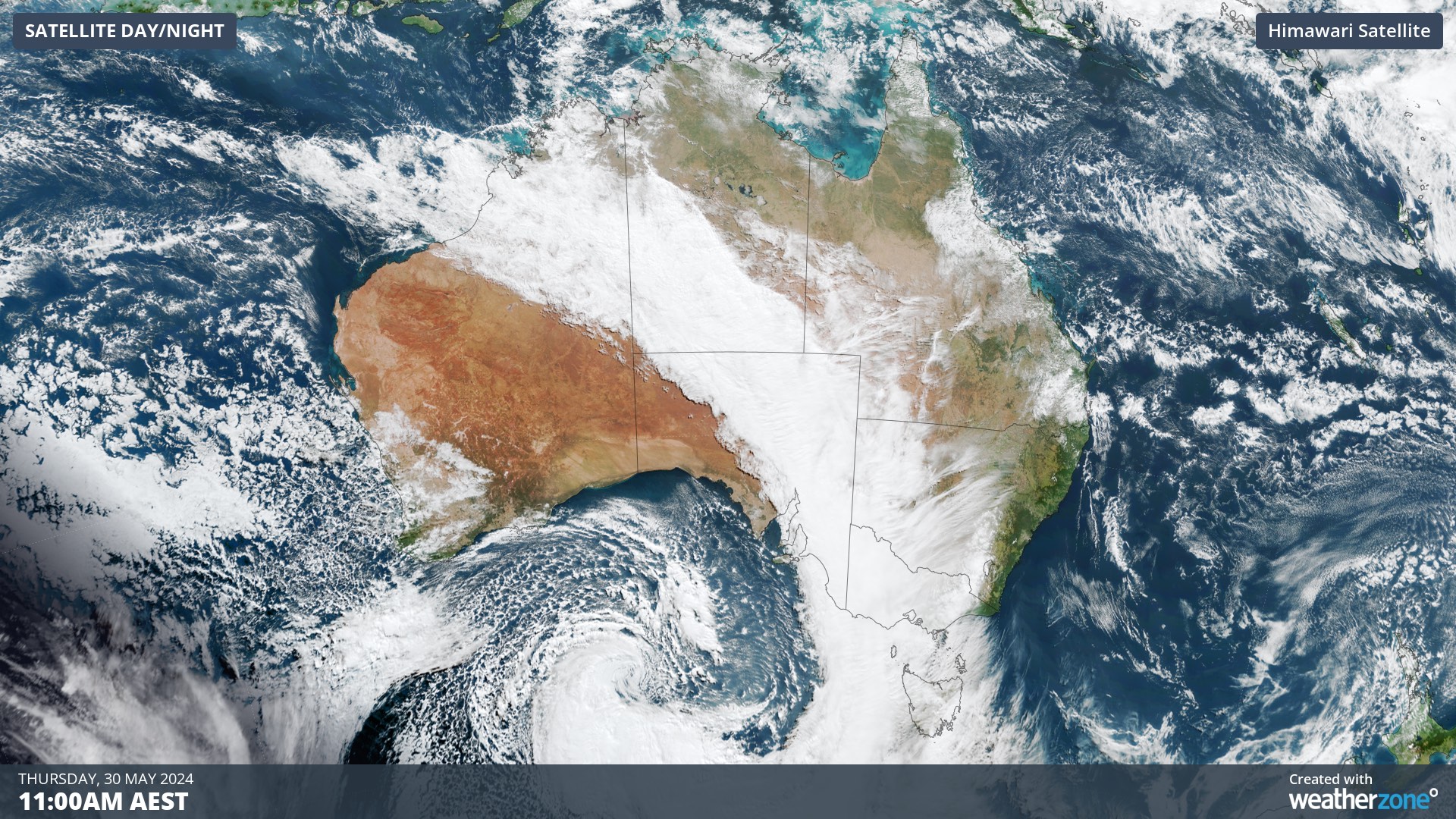
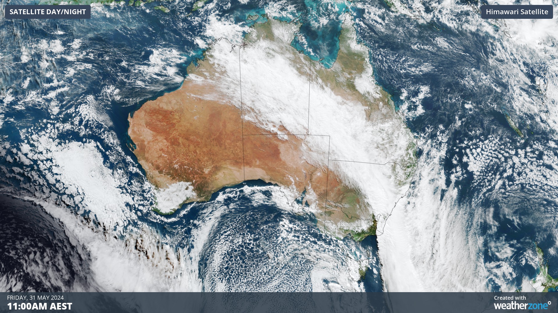
Images: Visible true-colour satellite images showing the progression of a northwest cloudband across Australia between Wednesday and Friday this week.
The northwest cloudband delivered more than 100 mm of rain to parts of southeatern Australia on Thursday into Friday morning. This enormous stream of tropical moisture and two low pressure systems will now cause rain and storms over a broad area of eastern and southeastern Australia from Friday into the weekend.
Rain from the northwest cloudband will mainly affect NSW, the ACT, inland Qld and parts of the NT on Friday. However, an associated low pressure system will also cause showers, damaging winds, thunderstorms and highland snow in Tasmania on Friday.
The low hammering Tasmania on Friday underwent a process called bombogenesis over the Great Australian Bight earlier this week, meaning its central pressure dropped by more than 24 hPa in 24 hours. This rapid pressure drop created an intense low pressure system that will batter Tasmania as it passes close to the state on Friday.
The maps below show how much rain one computer model is predicting over Australia on Friday, and how strong the wind gusts are expected to be across Tasmania during the middle of the day.
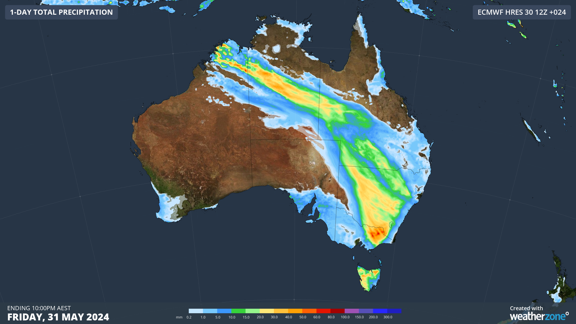

Images: Forecast accumulated rain on Friday according to the ECMWF-HRES model (top) and predicted wind gusts at 1pm AEST on Friday from the ACCESS-C model (bottom).
Wind and rain will ease in Tasmania by Saturday, however wet and blustery conditions will persist in parts of NSW and Qld into the weekend.
A low pressure system is likely to develop off the NSW coast on Saturday and deepen on Sunday in response to a pool of cold upper-level air. While there were indications earlier this week that this system could develop into an East Coast Low, it now looks more likely to develop a few hundred kilometres away from the NSW coast as a Tasman Low.
Tasman Lows are not as dangerous as East Coast Lows because their most severe weather occurs out to sea. However, there is still potential for dangerous weather in NSW on the weekend.
Rain will initially affect northeast NSW and southern and central inland Qld on Saturday morning, before spreading to southeast Qld and central NSW into the afternoon and evening. Southerly winds will also increase along the NSW coast on Saturday in response to the developing Tasman Low.
On Sunday, showers and blustery southerly winds should continue to affect parts of eastern NSW, including Sydney, while large waves will also start to spread along the NSW coast.
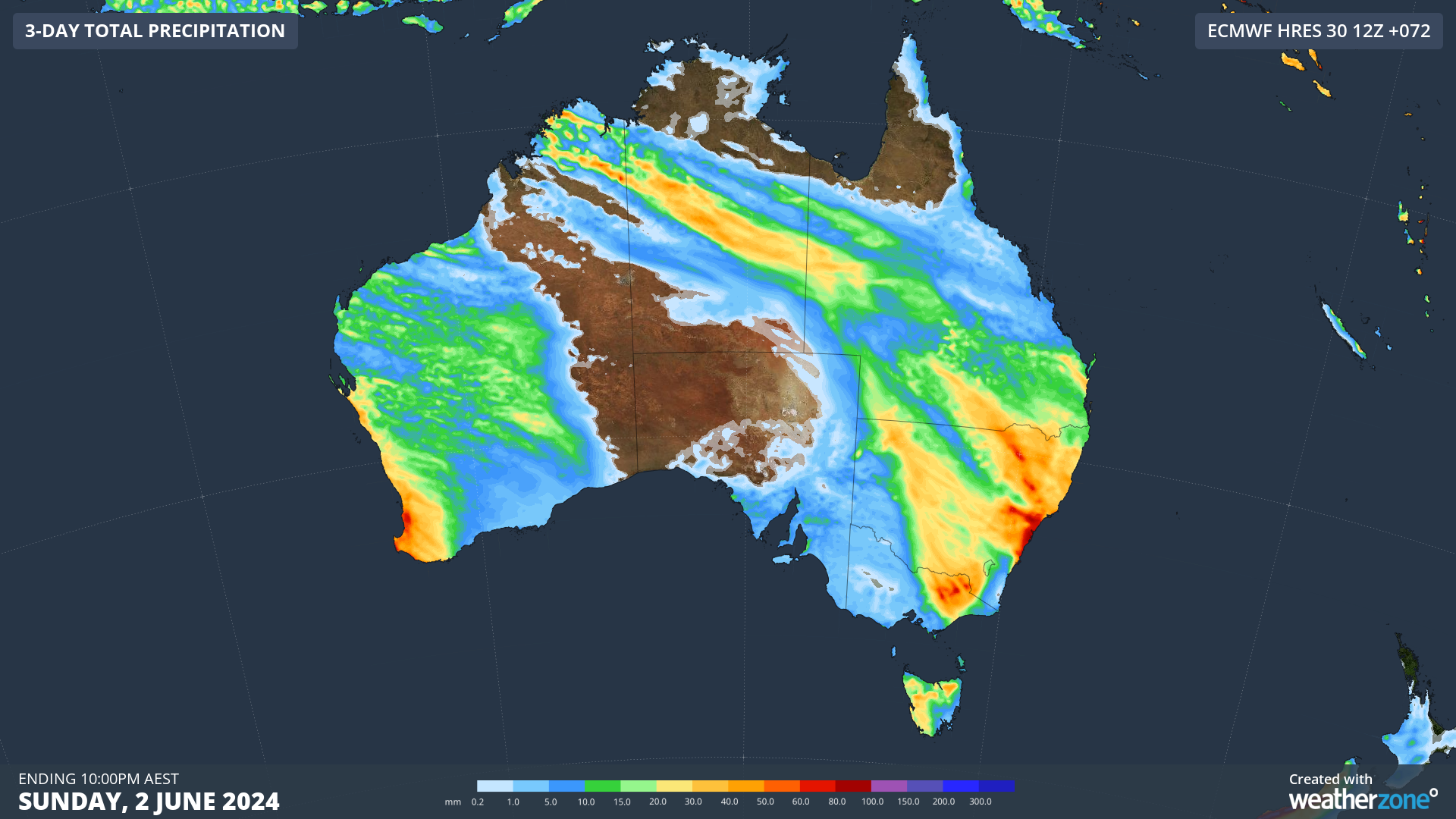
Image: Forecast accumulated rain between Friday and Sunday, according to the ECMWF-HRES model.
There are signs the Tasman Low cold drift south towards Bass Strait on Monday, which would cause rain, wind and waves to increase in eastern parts of Vic and Tas.
Severe weather warnings are in place for damaging winds in parts of southeastern Australia on Friday and more warnings may be issued in the coming days. Check the latest forecasts and warnings for the most up-to-date information.
Stormtracker is a severe weather solution that can assist you in observing, in real-time, any storm or event that has the potential to impact your business.
Embedded in DTN APAC’ industry interfaces, the system gives you a time advantage when monitoring conditions developing over your infrastructure and location.
Stormtracker is our Global Information System (GIS) tracking tool, providing multiple weather layers and zoom controls overlaid on a map of your location and infrastructure. You can choose a snapshot or full screen view, depending on your requirements. The maps allow you to monitor all weather, and specifically any systems likely to cause risk for your business. You also have the capacity to observe:
- real time lightning and thunderstorm alerts
- localised lightning strike frequency
- official warnings for storm, cyclone, wind, flood and fire
- sentinel hotspot fires and fire agency current incidents
Stormtracker’s radar imagery updates every 10 minutes, so you are always able to respond rapidly to changing conditions. You can customise alerting to notify you when your staff or infrastructure are under threat. With increased situational awareness, your ability to make informed decisions quickly is optimised.
DTN APAC’ experience and intelligence gives you a clear path through complex situations. Let us assist you, offering actionable insight when extreme weather poses risk to your business. To find out more, please contact us.


