
It got seriously cold at times in Australia in July, with Tasmania experiencing a deep freeze in the first week of July as the tiny town of Liawenee dipped to –13.5°C.
Other parts of the country also saw extremes of cold, but overall, Australia was much warmer than usual with a nationally averaged temperature that was 0.7°C above the long-term average.
- Maximum temps in July 2024 were 0.62°C above the long-term average.
- Minimum temps in July 2024 were 0.78°C above the long-term average.
If you look at the chart below, you can see that most of Australia had temps of up to a degree above average (the pale yellow zone) or in the 1-2 degree above average range (bright yellow).
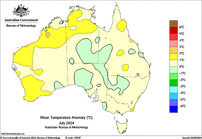
Source: BoM.
Only comparatively small portions of the country experienced cooler than usual temps (pale green).
One of the warmest areas was southwest WA, where Perth Airport experienced its second-warmest July on record, with temps 1.4°C above the long-term average.
Given that Perth exceeded its monthly rainfall for the first time in a year (total 170 mm, July average 146.3 mm), and that you’d normally expect cooler temps with wet weather, it’s possible that the warmth anomaly might have contained some indications related to climate change.
But perhaps the most interesting feature on the chart above is Tasmania.

Image: The race for Tasmania’s average July min temps to be below average went down to the wire. Source: @Nemototasmania Instagram.
As mentioned, Liawenee dipped to –13.5°C in the first week of the month, which was the state’s second-coldest night on record, and remains the coldest temp recorded in Australia to date in 2024.
And that wasn’t just a one-off. Between July 2 and 7, Liawenee fell below –10°C over four consecutive frigid nights, then “warmed up” to –9.7°C, then fell below –10°C again.
That spell of intensely cold nights lasting almost a week seemed to snap-feeze half of Tasmania, and locals are still talking about it.
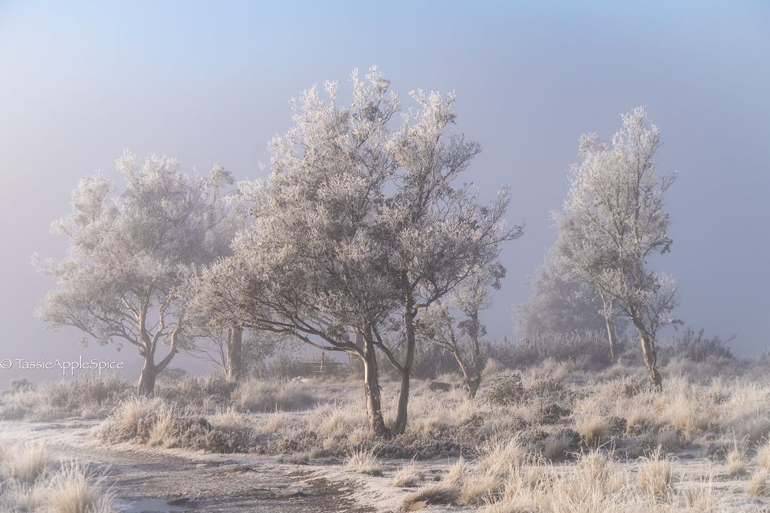
Source: @tassieapplespice Instagram.
But Tasmanian days were not particularly cold for much of July, which bumped up the overall average.
- Tasmania’s nights were marginally colder than average by just 0.06°C (the only state or territory to be below average for either max or min temps in July 2024).
- Tasmania’s days were 0.34°C warmer than usual averaged across the state.
- Indeed, Hobart’s mean daily maximum temperature of 12.9 °C was 1.1 °C above the long-term average of 11.8 °C.
They say a week’s a long time in politics, and it’s a long time in weather too. But a month is longer, and a freezing week here and there in different parts of the country – including snow flurries in southern Queensland – still didn’t make for a cold July overall by long-term Australian standards.
Weatherzone Business, a DTN company, supplies precise weather intelligence to over 75% of the National Energy Market (NEM) participants and is the trusted provider for Australia’s Market Operator.
We offer weather data and analytics to support all aspects of your renewables business, with a wide range of specialised services covering energy generation and weather forecasting, to site-specific severe weather alerting and historical reporting. To find out more, please visit our contact page or email us at apac.sales@dtn.com.


