A weather station at Liawenee just registered the lowest July temperature ever reliably recorded in Tasmania as high pressure continues to build over the state.
A very cold and dry air mass, combined with clear skies and calm winds beneath a strengthening high pressure system, caused temperatures to plummet across Tasmania on Tuesday night.
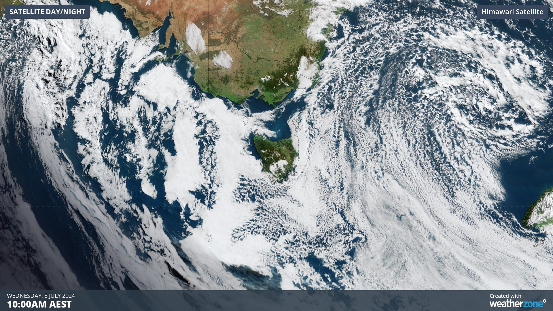
Image: Satellite image showing clear skies over Tasmania on Wednesday morning, with some fog and frost visible on the state’s Central Plateau.
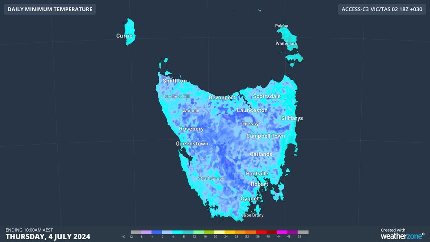
A weather station at Liawenee registered a minimum temperature of -12.9°C shortly after 6am AEST on Wednesday. This was Tasmania’s lowest July temperature on record, beating the previous record of -12.5°C from Butlers Gorge on July 1, 1983. Launceston’s low of -3.1°C on Wednesday was also its coldest July morning in seven years.
Wednesday morning’s bitterly cold temperatures are part of a string of icy mornings that are snap freezing Tasmania this week, under the influence of an abnormally strong high pressure system. This high is so strong that it may challenge Australia’s maximum mean sea level pressure record in the coming days.
Image: Forecast minimum temperatures across Tasmania on Thursday morning, according to the ACCESS-C model.
The highest mean sea level pressure reliably recorded in Australia was 1044.3 hPa at Launceston on June 7, 1976. Mean sea level pressure values of around 1040 to 1042 hPa were being observed in Tasmania on Wednesday morning and higher values are possible over the next few days.
High pressure systems promote cold minimum temperatures because they usually have clear skies, light winds and dry air near at their centre. These conditions are ideal for overnight radiative cooling, which allows the previous day’s warmth to radiate away from the ground into space.
Australia’s lowest temperatures always occur under the influence of high pressure systems exacerbating overnight cooling in winter.
This was the case when Australia registered its lowest temperature on record with -23°C at Charlotte Pass, NSW in June 1994.
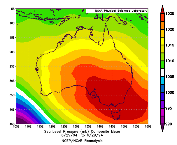
Image: Mean sea level pressure on June 29, 1994 based on NCEP/NCAR reanalysis data, showing a strong high pressure system over southeastern Australia. Source: NOAA
While this week’s high pressure system is not expected to challenge Australia’s all-time minimum temperature record, it is producing the coldest mornings in years for some places.
Benefit from the timely delivery of accurate weather information, allowing informed and effective decision-making. To find out more, please visit our contact page or email us at apac.sales@dtn.com.


