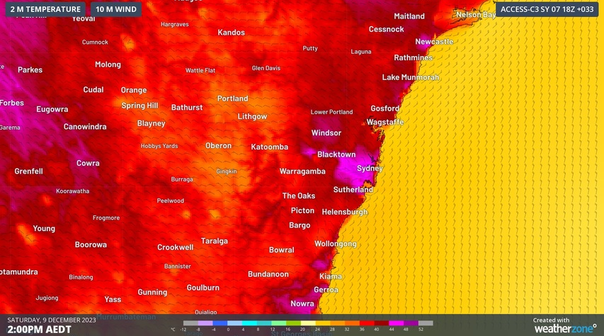
Temperatures are likely to reach the mid-40s in parts of Western Sydney on Saturday as the urban heat island and foehn effects supercharge an early-summer heatwave over eastern NSW.
A mass of very hot air will spread over NSW during the next few days, causing a severe to locally extreme heatwave across most of the state.
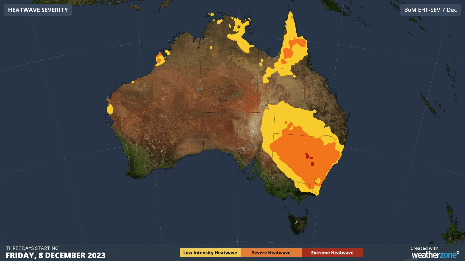
This hot air mass has already caused temperatures to reach the mid-40s in western NSW over the last three days, and similar maximums are predicted in the state’s west on Friday and over the weekend.
On Saturday, the heat will also push into eastern NSW, with temperatures tipped to reach the high-30s to low-40s in some areas. The mercury could even approach 45ºC in parts of Western Sydney by Saturday afternoon, making it the hottest day since early 2020.
Sydney’s eastern suburbs are not forecast to reach 40ºC on Saturday and should top out in the mid-to-high 30s. However, with air likely to be more humid in the eastern suburbs than the western suburbs, they city could still feel hotter than 40ºC during the afternoon.
Western Sydney should be the only place in eastern NSW that gets close to 45ºC on Saturday. The reason this part of the Sydney Basin is able to get so much hotter than the surrounding areas in due to a combination of two phenomena called the urban heat island effect and the foehn effect.
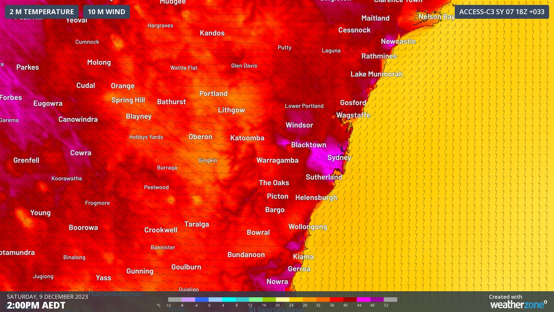
Image: Forecast surface air temperature at 2pm AEDT on Saturday, December 9.
The urban heat island effect refers to the ability of built-up urban environments to absorb and emit more heat than natural environments. The urban heat island effect increases air temperature because:
Buildings and infrastructure absorb more heat from the sun than vegetated natural environments, particularly with dark surfaces like roads and black roofs
Lower levels of veneration in urban areas also reduces the amount of cooling caused by plants themselves
Human activities, including transport and electricity usage, also generate heat
The foehn effect refers to the natural phenomenon of air becoming warmer and drier as it descends to a lower altitude. When westerly winds blow across eastern NSW, air passing over the Blue Mountains will warm up as it descends into the Sydney Basin. The foehn effect can happen at any time of year and has been known to keep Sydney relatively warm even when it is snowing in southern NSW.
In addition to the urban heat island and foehn effects, the air temperature in Sydney is also getting a boost from the background influence of climate change. Sydney’s mean summer temperature has increased by close to 1.6ºC since 1910, which is roughly in line with the warming trend observed across NSW as a whole.
This week’s heat will help cause Extreme fire danger ratings in parts of southern and central NSW on Friday and Saturday, including Sydney on Saturday.
A cool change will flush the heat out of the Sydney Basin late on Saturday, bringing a brief period of relief into next week. However, hot air will linger over western NSW and could spread back over the ranges around the middle of next week.
You can’t control the weather, but you can gain precision insights to optimise your response. What lights us up is providing your energy business with tailored weather information to reduce your risk and keep you moving ahead of the curve.
Our services cover all aspects – from wind and solar generation to demand forecasts, wholesale markets to retail so, no matter where your company sits, we have solutions for you. We have worked closely with market participants to create products that meet the evolving needs of the sector, aiming to increase safety and profitability for our customers.
Benefit from the timely delivery of accurate weather information, allowing informed and effective decision-making. For more information, please contact us at apac.sales@dtn.com.


