The sunspot region that produced last week’s mesmerising aurora displays has just unleashed another strong solar flare, this one even more powerful than anything else seen during the current solar cycle.
In case you missed it, large areas of the Northern and Southern Hemispheres were treated to vivid aurora displays late last week.
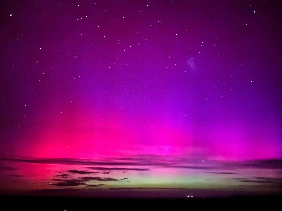
Image: Aurora Australis seen from the Bendleby Ranges, SA on the weekend. Source: @bendlebyranges / Instagram
These colourful night lights could be seen much further outside the polar regions than usual, including Florida and Queensland, thanks to a powerful geomagnetic storm created by multiple coronal mass ejections (CMEs) from the Sun.
At its peak, last week’s geomagnetic storm reached the highest possible level on the G-scale (Extreme – G5), making this the first G5 storm since 2003.
The CMEs that caused last week’s spectacular auroral displays originated from a cluster of sunspots designated Sunspot Region 3664, a region which also produced significant solar flares during the same period. At one point last week, this massive and complex sunspot cluster was about 17 times the diameter of Earth.
FIND OUT MORE CORONAL MASS EJECTIONS AND SOLAR FLARES
While the powerful geomagnetic storm that caused last week’s aurora displays has now calmed down, Sunspot Region 3664 has remained active.
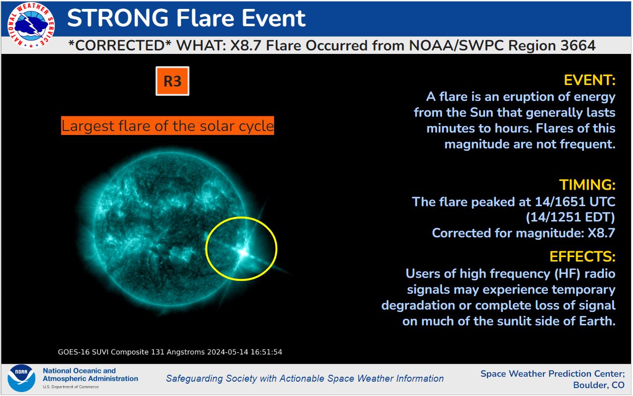
According to NOAA’s Space Weather Prediction Center, a solar flare with a magnitude of X8.7 was detected from Sunspot Region 3664 at 1651 UTC on May 14. X-Class flares are the strongest of four categories and this X8.7 flare is stronger than anything measured last week. In fact, it’s the strongest solar flare detected in the current solar cycle, which begun in 2019 and is expected to peak next year.
WHAT IS THE SOLAR CYCLE? FIND OUT HERE
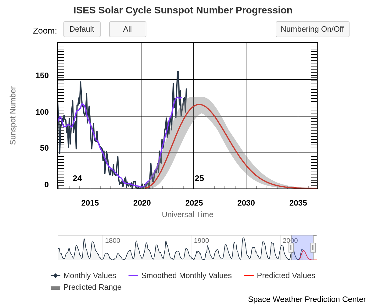
Image: Predicted and observed sunspot numbers of the current solar cycle, which commenced in 2019. Source: NOAA / Space Weather Prediction Center.
However, while the X8.7 solar flare that occurred on May 14 was stronger than last week’s flares, it was not oriented towards Earth when it occurred, and it is currently unclear whether a CME associated with this flare could glance Earth later this week. As of 0030 UTC on May 15, NOAA’s Space Weather Prediction Center said that the CME associated with this week’s X8.7 flare “is currently being analyzed for any Earth-directed component.”
Given the orientation of Sunspot Region 3664 at the time of the X8.7 flare, it is unlikely that we will see a repeat of the weekend’s wide-reaching aurora displays in the coming nights, even if we do see a glancing effect from this event.
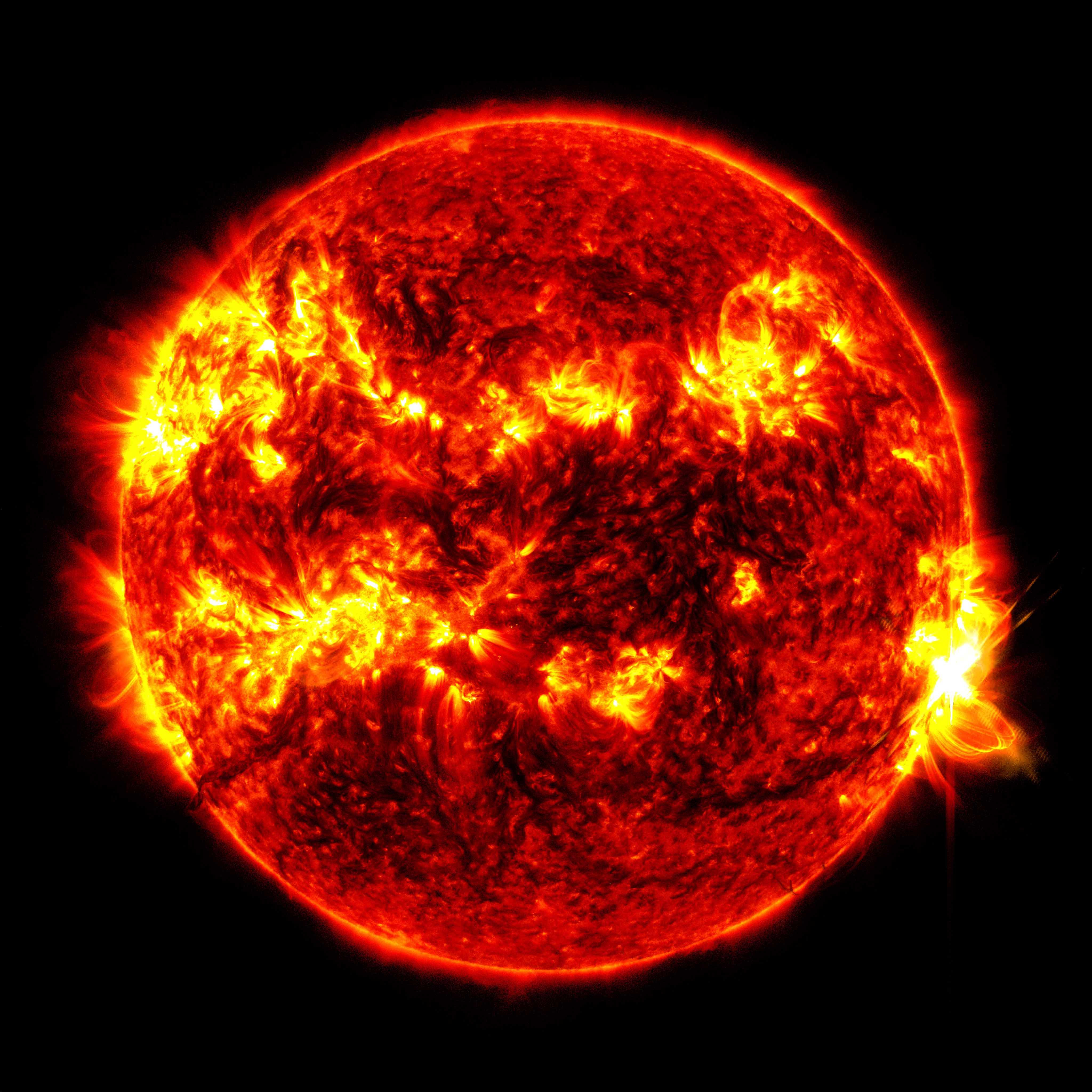
Image: The X8.7 solar flare – as seen in the bright flash on the right – on May 14, 2024. Credit: NASA/SDO
The current solar cycle is expected to peak in 2025 before declining over the next 5 to 7 years. Sunspot activity will remain elevated around the solar cycle’s peak, maintaining an elevated likelihood of aurora displays on Earth. Contact us here.