Prosper in a dynamic world
Search

Perth set to scorch over the weekend


While you’d struggle to find a small patch of blue sky across eastern Australia, summer has arrived early in Perth. Perth’s maximum temperatures are expected to top 34°C on Friday, 37°C on Saturday and 33°C on Sunday.  

Saturday’s daytime temperature is expected to be 9-10°C above Novembers average, the hottest day in eight months (figure 1) 

 temp sat

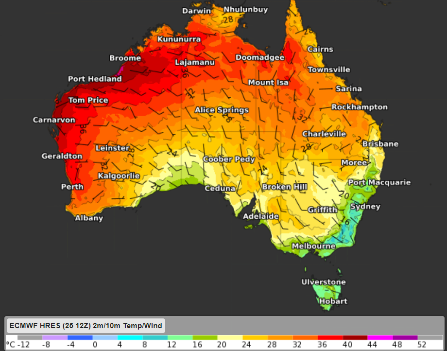
Figure 1: ECMWF 2m temperature and 10m wind at 2pm WST on Saturday, November 27. 

When was the last time Perth was this hot and dry? 

  • The last time Perth reached or exceeded the mid-thirties was way back on March 29 this year, when the mercury peaked at 39.0°C. 
  • The hottest since then was October 15, 2021, when the mercury reached 33.2°C. 
  • As is typical for this time of year, Perth has started to dry out during November, after a super wet October, in which the city tripled its monthly average of 40.9 mm with 122.8 mm, and indeed broke the October rainfall record. 
  • While 40.4 mm of rain fell on November 9, that was just one of three ground-wetting days this month, and no rain is on the cards for the next week. 

So the big dry typical of a Perth summer is on its way, and while temperatures should dip back into the mid-to-high twenties early next week, the heat looks to peak this weekend. 

Why is the west coast warm and dry, while the east experiences a mild and wet summer during La Nina years? 

During La Nina years, high pressure over southern Australia is common, which for Perth means dry and hot easterly winds from the interior of Australia. These easterly winds promote warmer weather for Perth and the west coast (figure 1). 

While easterly winds across the east coast of Australia are humid, cool and produce rain and cloud as they hit the Great Dividing Range. 

Weatherzone’s model Opticast is an industry leader and can forecast maximum and minimum temperatures up to two weeks out, including confidence intervals and risk of extreme heat. For more information, please contact us at apac.sales@dtn.com

Latest news

Satisfy your weather obsession with these news headlines from around the nation, and the world.

DTN Dangerous Thunderstorm Alerts in action with severe thunderstorms disrupting Perth industries

Severe thunderstorms impacted southwest WA and the Perth region on Sunday, December 14, 2025, triggering Dangerous Thunderstorm Alerts (DTA) by DTN for industries and businesses in the region. DTN operates Dangerous Thunderstorm Alerts (DTA) which alert businesses and industries to thunderstorms based on intensity and movement. These alerts provide advanced notice of thunderstorms moving into […]

How Australian East Coast port and maritime operations could be disrupted by tropical cyclones over the next two weeks

Port and maritime operations across Australia’s East Coast could be disrupted by increased tropical cyclone activity in the Coral Sea and southwest Pacific Ocean over the next two weeks. Meteorologists reference a large selection of Numerical Weather Prediction (NWP) models to forecast weather. A number of these NWP models are forecasting the development of tropical […]

Extreme fire danger and severe heatwave conditions spreading across SA, Victoria and NSW

Hot, dry and windy weather causing elevated fire danger and severe heatwave conditions are sweeping across southeastern Australia over the next three days, driving high energy demand and disruption to operations. Clear skies associated a large and slow-moving high pressure system have allowed hot air to build up over parts of northern, western and central […]

Heightened bushfire risk during the 2025-26 summer for WA, Victoria and NSW in latest AFAC Outlook

The Australian and New Zealand Council for fire and emergency services (AFAC) identified western and southern WA, Victoria and inland NSW as key regions that are at risk of heightened bushfire risk this summer. Parts of Australia have experienced severe soil moisture and rainfall deficiencies over the past months and years, while high fuel loads […]