
Rain and thunderstorms will spread over southwestern Australia in the next few days, giving Perth a chance of registering its first wetter-than-average month in more than a year.
The satellite image below shows a large band of cloud highlighting the location of a cold front to the southwest of Australia on Monday morning. The speckled cloud to the south of the cloudband also reveals a large pool of cold air heading towards WA in the wake of the front.
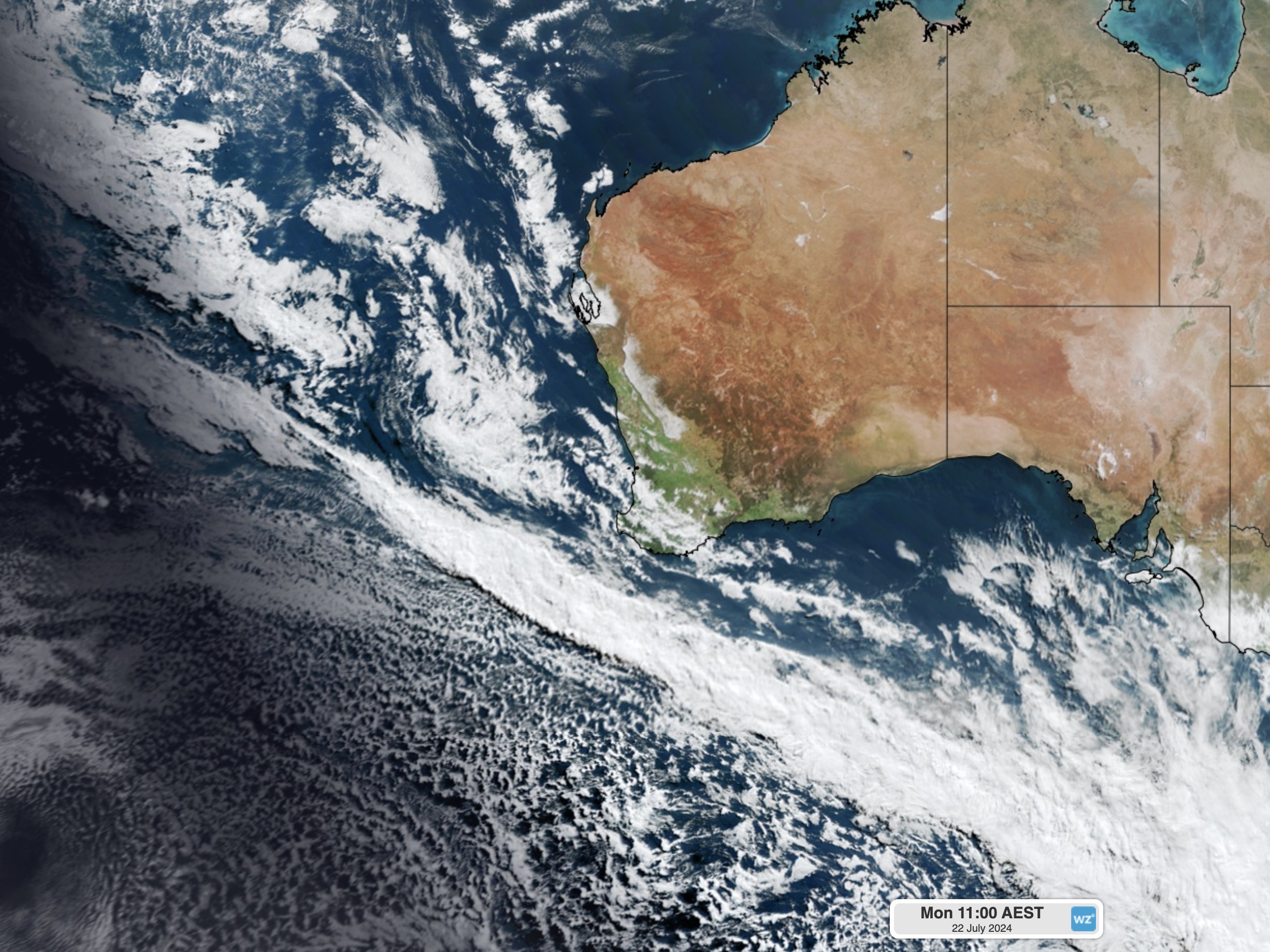
Image: Visible satellite image captured at 9am AWST on Monday, July 22.
The front and an associated trough will cause a wintry mix of blustery wind, rain and thunderstorms to spread over the southwestern half of WA during the first half of this week.
Wind and rain will increase over southwestern districts of WA on Monday ahead of the front. This wet and windy weather, along with some thunderstorms, will then spread further north and east into Tuesday and Wednesday with the passage of the front and trough.
Three-day rainfall totals of 10 to 30 mm are likely over large areas of the South West Land Division from this system. Some rain will also extend up to the Gascoyne and Pilbara districts, and across to the Goldfields, South Interior, Eucla and South East Coastal districts.
The map below shows how much rain one forecast model is predicting over WA between Monday and Wednesday.
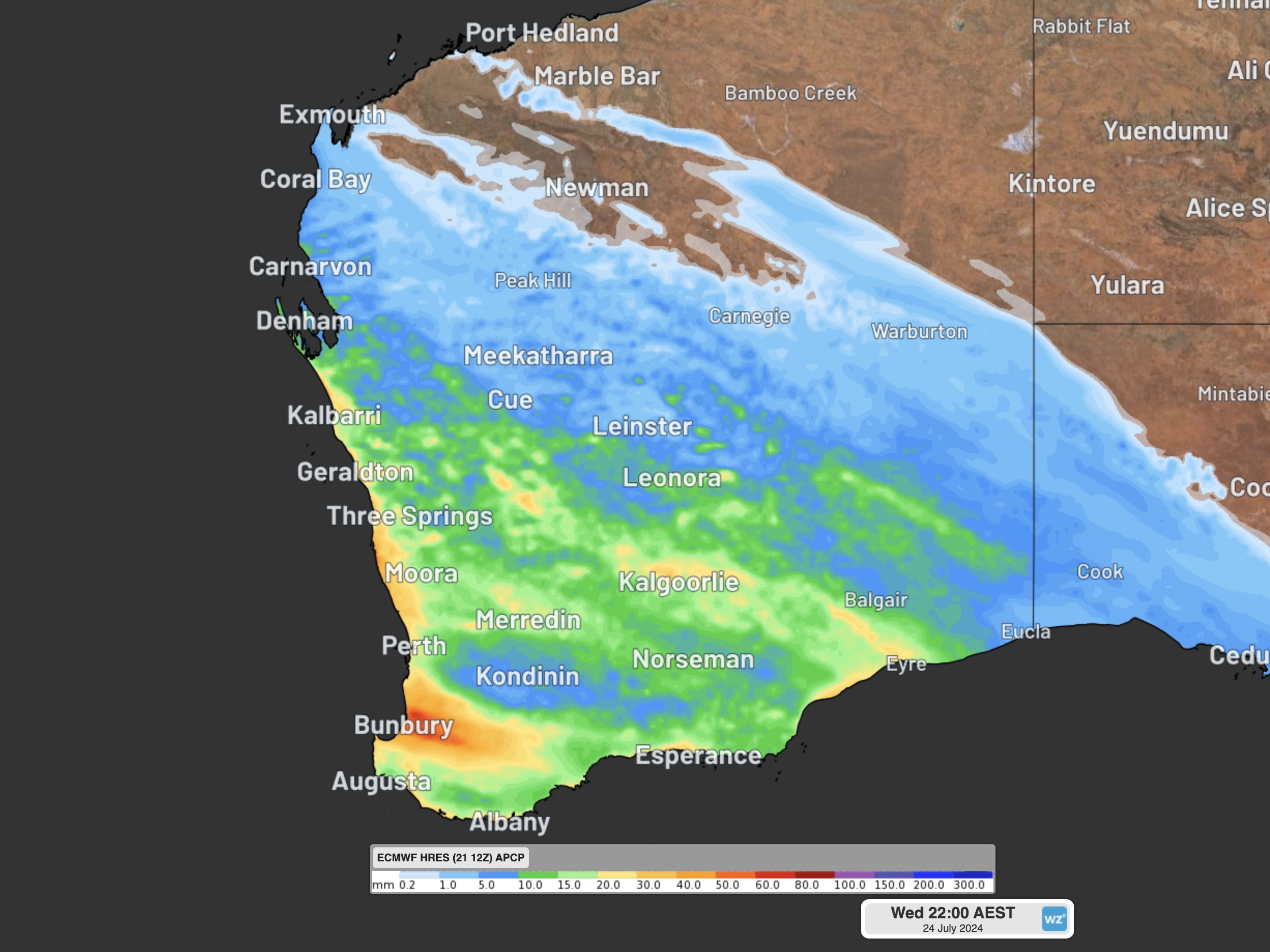
Image: Forecast accumulated rain during the 72 hours ending at 8pm AWST on Wednesday, July 24.
Perth should see at least 20 mm in the first half of the week and could also see some follow-up showers later in the week as onshore winds persist behind the front. This week’s wet weather may be enough to deliver to Perth its first wetter-than-average month since June last year.
- As of 9am on Monday, Perth had received just over 102 mm so far this month.
- The monthly average for July at the city’s Metro weather station is 146.3 mm.
- This means Perth needs to pick up roughly 45 mm of rain before the end of July to make this an above-average month for rainfall.
July is the third consecutive month of healthy rainfall in Perth, which is bringing much-needed relief after an exceptionally long dry spell in the state’s southwest.
The seven months prior to May 2024 was the driest October to April period on record for Perth, with only 23 mm of rain falling in the city. Since then, close to 300 mm has fallen in less than three months, and more is on the way this week. This rainfall is helping to eradicate the multi-season rainfall deficiency that had built up in Perth since the middle of last winter. To find out more, please visit our contact page or email us at apac.sales@dtn.com.


