Thick cloud, rain, strong winds and severe thunderstorms have impacted parts of WA in the last 48 hours, which is set to continue for the next few days.
A low pressure system to the southwest of WA, another to the south and a northwest cloud band are responsible for the wild weather.
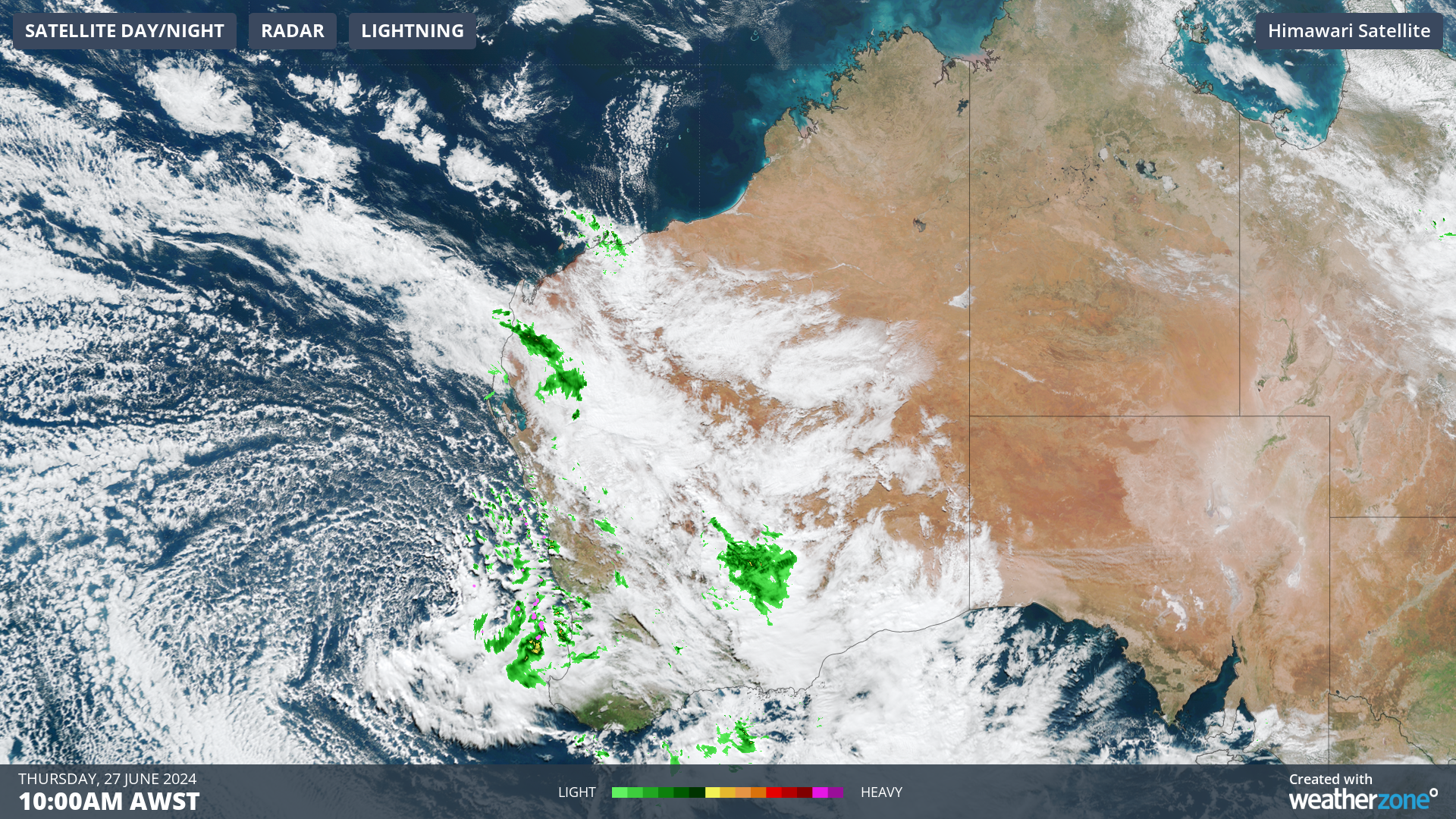
The satellite image below shows thick cloud streaming from the Indian Ocean down to southern WA and SA, with cloud spinning clockwise around a low pressure system to the southwest of WA, bringing with it rain and thunderstorms on Thursday morning.
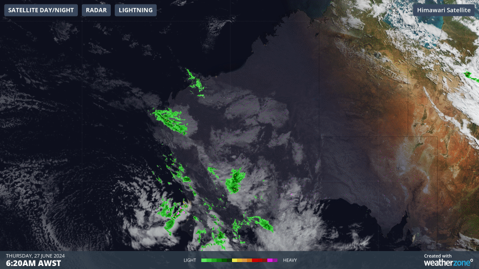
Images: Himawari-9 satellite image for the three hours leading up to 9:20am AWST on Thursday, June 27.
This low and cloudband has been generating decent rainfall across parts of WA during the last few days.
Kalbarri in the Central West has seen more than a months’ worth of rain in the 48 hours leading up to 9am Thursday, June 27. The gauge captured 125mm in this period, well above the June monthly average of 75.6mm.
Decent rain totals fell in also fell in parts of the Pilbara, the southwest and Central west regions of WA in the 24 hours leading up to 9am Thursday, June 27.
- Mandurah, to the south of Perth, had its wettest day in 3 years, with 34.6mm falling in the gauge
- Mardie, in the Pilbara, recorded 40.4mm, its wettest day in two years
- Golden Grove in the Central West observed 27.6mm
In the early hours of Thursday morning, a severe thunderstorm warning was issued for heavy rainfall in the Central West and South West districts, however this has been cancelled as of 8am.
The risk of severe thunderstorms and heavy rainfall will continue on Thursday through to Saturday, as the low pressure system crosses the Central West coast.
During the next three days, widespread falls of 20 to 40mm is forecast across southern and central WA. Isolated falls of 60 to 100mm possible, especially in thunderstorms and on the northern flank of the low along the Central West coast.
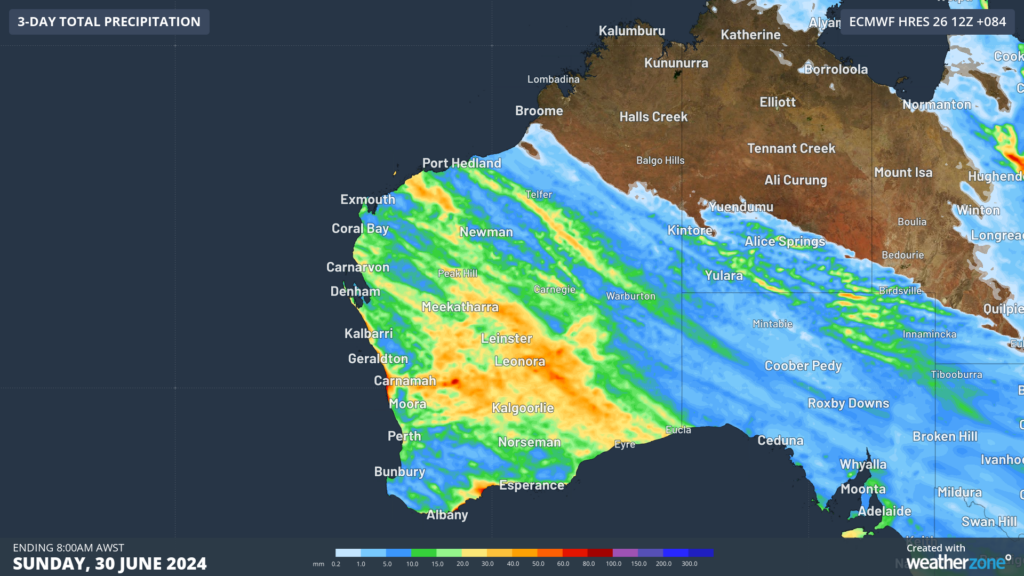
Image: Accumulated rain forecast for the three days leading up to 8am AWST on Sunday, June 30, according to ECMWF
The thick cloud associated with the low and northwest cloud band is reducing solar output in the region, which should continue over the coming days.
The rain and thunderstorms should ease on Sunday as the low weakens over land and the northwest cloudband moves east out of the state.
Looking ahead, another cold front will sweep across the southwest on Tuesday, July 2, bringing another bout of rain, cool temperatures and strong winds to the region.
Miningzone, by DTN APAC, is the only weather tracking and alerting solution purpose-built for the resources sector.
Miningzone is the proven and trusted turnkey solution –deployed at over 400 mines globally – offering you tailored forecasting and alerting systems to protect your valuable staff and assets.
Weatherzone’s integrated services are intuitive and user-friendly, providing you with the specific weather and blast data needed to gain a complete environmental picture.
You will have access to our lightning and severe weather tracking and alerts, EPA-approved blast dispersion modelling, thunderstorm tracking and high precision and site-specific forecasting, along with comprehensive reporting capacity.
Precise, market-leading data is delivered via multiple platforms including Weatherguard – our easy-to-use app – and can be fully integrated into your operational control or SCADA systems. To find out more, please contact us at apac.sales@dtn.com.


