Prosper in a dynamic world
Search

Heatwave to snow on Alps

Light snow has fallen across Tasmania and the alpine areas of New South Wales and Victoria on a day when Victoria’s last ski resort (Falls Creek) closed, proving the weather gods have a cruel sense of humour.

Snow was heaviest in Tasmania, with an accumulation of several centimetres at the tiny club-run ski field of Mt Mawson, two hours northeast of Hobart.

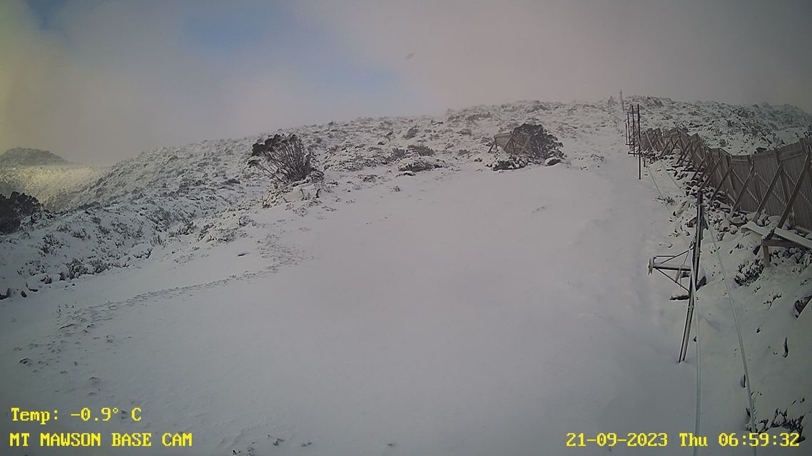
Image: The date stamp reveals all. Source: Mt Mawson.

On the flanks of kunanyi/Mt Wellington just outside Hobart, the snow wasn’t quite heavy. The mountain recorded 1.2 mm of the frozen flaky form of precipitation in the 24 hours to 9 am Thursday, which translates roughly to a centimetre of snow.

A dusting like that will likely be gone by later today, but Hobart’s photographers were out and about on Thursday morning snapping the mountain – and a rogue seagull or two – in all its glory.

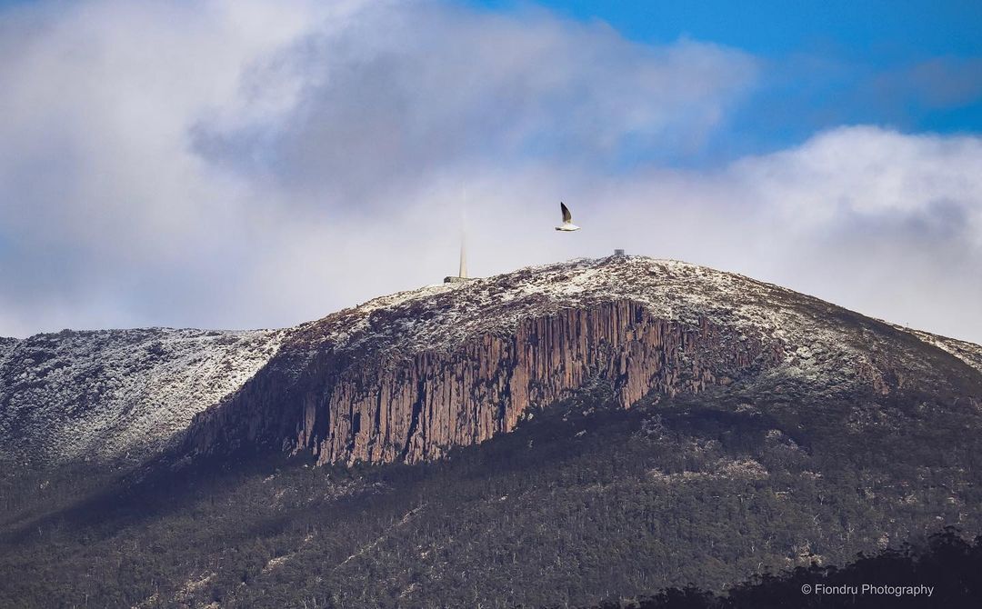
Image: No chips, but there was a bit of flake. Source: @fiondru.photography on Instagram

The cool air down south has replaced the heat which dominated the first part of this week, with cool air moving about halfway up the NSW coast.

In northeast NSW and southeast Qld, it promises to be a scorcher this Thursday, with temps heading for the low-to-mid thirties in all but the most exposed coastal areas like Cape Byron.

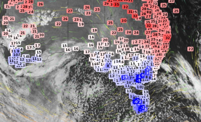
Back down south, that cold air is set in for a couple of days. A speckled Southern Ocean airmass is always a sign of cold air down south, and max temps won’t return to the twenties in Melbourne or Hobart until Sunday.

Canberra should even see frost over the next few mornings with minimum temps around the freezing mark. For more information on our maximum and minimum temperature forecasts, extreme temperatures and heatwaves to snow, please contact us at apac.sales@dtn.com.

Latest news

Satisfy your weather obsession with these news headlines from around the nation, and the world.

How does DTN help businesses monitor bushfire induced pyrocumulonimbus thunderstorms that ignite more fires?

Intense heat from bushfires during elevated fire danger days can trigger fire-induced pyrocumulonimbus thunderstorms that ignite additional fires. In early January 2026, an extreme heatwave sweeping over southeastern Australia brought catastrophic fire danger to Victoria. Intensely hot bush and grass fires spread erratically and quickly in hot, dry and gusty winds, with pyrocumulonimbus generating lightning, […]

Active seas to the north and east of Australia disrupting port and maritime operations

Seas to the north and east of Australia are experiencing periods of increased activity this week, leading to disruptions to port, maritime and offshore operations. Intense and hazardous Tasman Sea Ocean conditions across NSW’s South Coast rapidly deteriorated last Friday as a deep feed of easterly winds whipped up large and dangerous seas. The Batemans […]

Transport, emergency and energy industries flooded across Greater Sydney with weekend deluges

Transport, emergency, energy and port industries in eastern NSW and Sydney were impacted by significant flash flooding with intense and heavy rainfall this weekend. Rainfall rates between 80 and 140mm in one to three hours were registered across parts of Sydney’s Northern Beaches and Central Coast on Saturday afternoon and evening. In some areas, these […]

DTN Dangerous Thunderstorm Alerts in action with severe thunderstorms disrupting Perth industries

Severe thunderstorms impacted southwest WA and the Perth region on Sunday, December 14, 2025, triggering Dangerous Thunderstorm Alerts (DTA) by DTN for industries and businesses in the region. DTN operates Dangerous Thunderstorm Alerts (DTA) which alert businesses and industries to thunderstorms based on intensity and movement. These alerts provide advanced notice of thunderstorms moving into […]