The hot air mass that helped create large fires in Victoria and Tasmania on Thursday will shift its focus to NSW on Friday, causing temperatures to spike in Sydney.
Thursday was a dangerous day of heat and fire danger in southeastern Australia as a mass of hot air combined with strong and dry winds ahead of an approaching cold front.
This combination of hot, dry and windy weather allowed large fires to develop in central Vic and central Tas on Thursday. These fires were so large their smoke plumes stretched for hundreds of kilometres and could be seen clearly in satellite images captured from about 36,000 km above Earth’s surface.

Image: Satellite images showing large smoke plumes in Vic on Thursday.
The fire located near Beaufort to the west of Ballarat has continued to burn through Thursday night and into Friday morning, despite much cooler air in the wake of a cool change that arrived on Thursday. According to reports, this fire has claimed some homes and as of 10am AEDT, emergency warnings were still in place.
VISIT THE VIC EMERGENCY WEBSITE FOR THE LATEST INFORMATION ON FIRES IN VICTORIA.
In Tasmania, several fires were still burning on Friday morning, with three watch and act advisories in place as of 10 am AEDT.
VISIT THE TAS ALERT WEBSITE FOR THE LATEST INFORMATION ON FIRES IN TASMANIA.

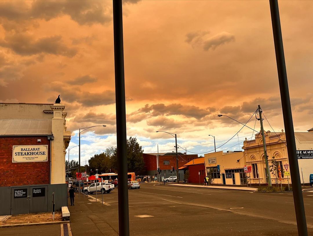
Images: Smoke seen over Ballarat, Vic on Thursday, February 23, 2024. Source: @peterlawrencecarr (top) and @jacquijallen (bottom) / Instagram
The heat that saw temperatures reach 35.9ºC in Melbourne and 35.5ºC in Hobart on Thursday has now moved further north and is focusing on NSW.
Shortly after 10am AEDT on Friday, temperatures were already up to 32ºC in Maitland and Gosford over 30ºC in parts of Western Sydney. Temperatures are predicted to reach the mid to high thirties across most of the Sydney Basin on Friday, while some western parts of the state will nudge 40ºC in the afternoon.
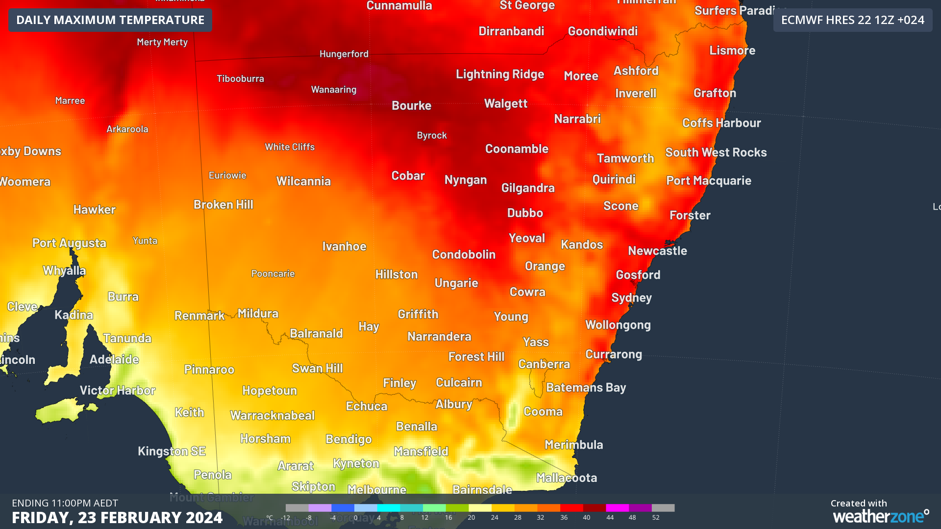
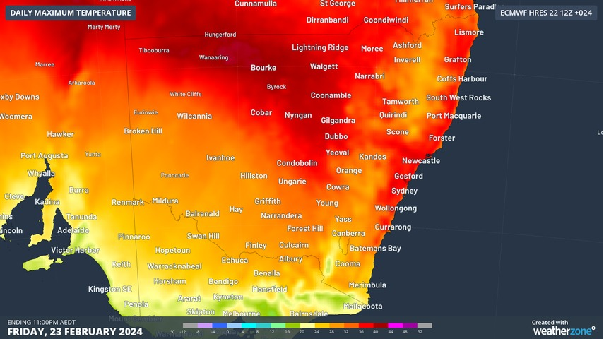
Image: Forecast maximum temperature in NSW on Friday, according to the ECMWF-HRES model
Fortunately, without the strong winds that accompanied the heat in Vic on Thursday, Friday’s fire danger ratings in NSW are not expected to reach Extreme levels. However, parts of NSW, Vic, Tas and SA could see high fire danger on Friday.
Another effect of today’s heat in NSW will be an increased risk of thunderstorms as the warm air rises into an unstable atmosphere.
Thunderstorms are possible over all but the far west of NSW on Friday, with the greatest risk over the eastern half of the state, including the ACT. Some of Friday’s thunderstorms may become severe and a few supercells could develop in the state’s east during the afternoon or early evening.
Anyone in Sydney or other areas of eastern NSW on Friday should keep a close eye on the latest severe thunderstorm warnings.
A cool southerly change will move through southern and central districts of NSW on Friday, reaching Sydney in the evening. For more information on Weatherzone’s fire and energy forecasts, please contact us at apac.sales@dtn.com.


