Prosper in a dynamic world
Search

Extreme heatwave intensifying in southern Australia

Parts of southern Australia, including Adelaide, are in the grip of the worst February heatwave in years, with temperatures set to get even hotter over the coming days.

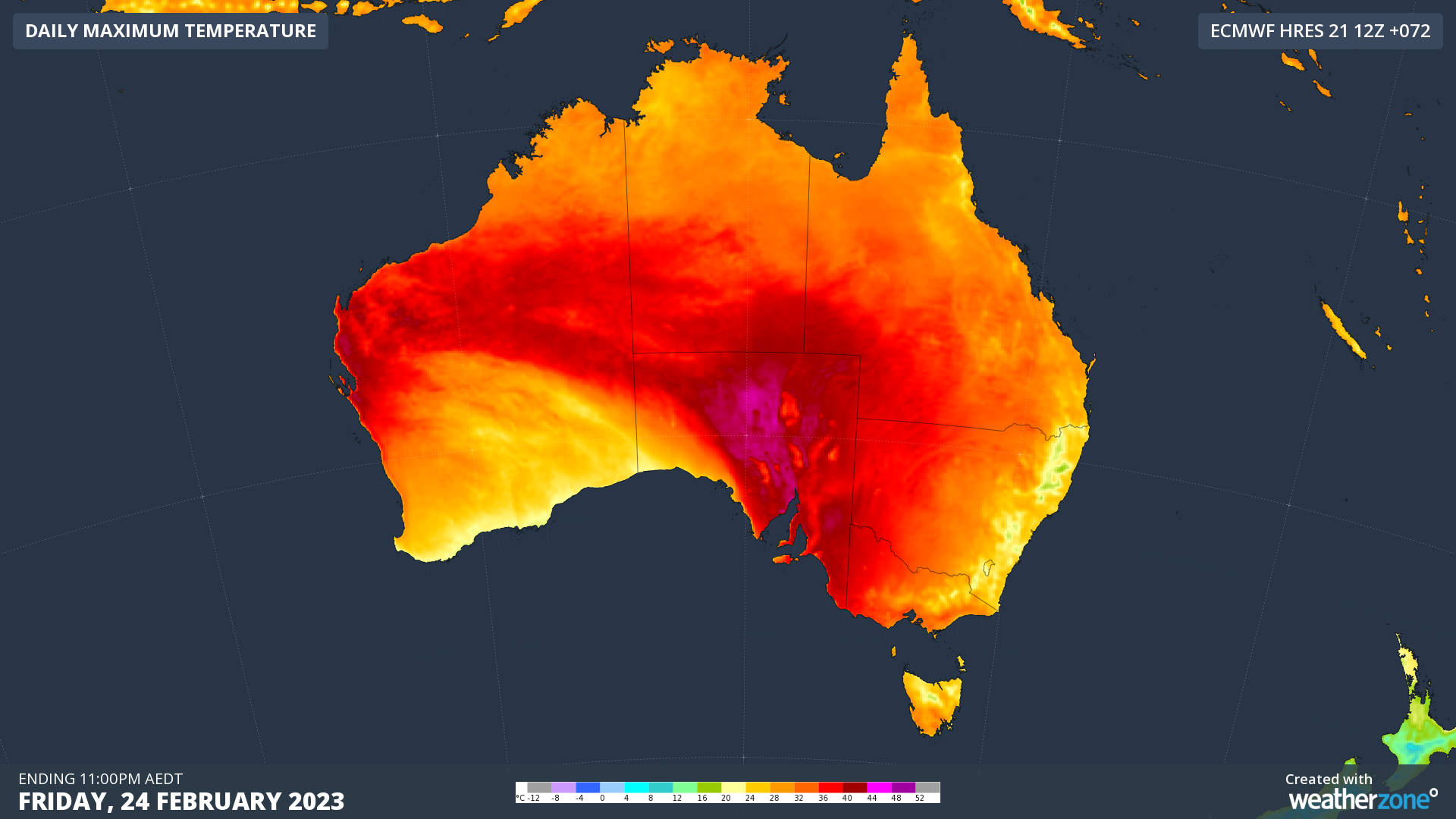
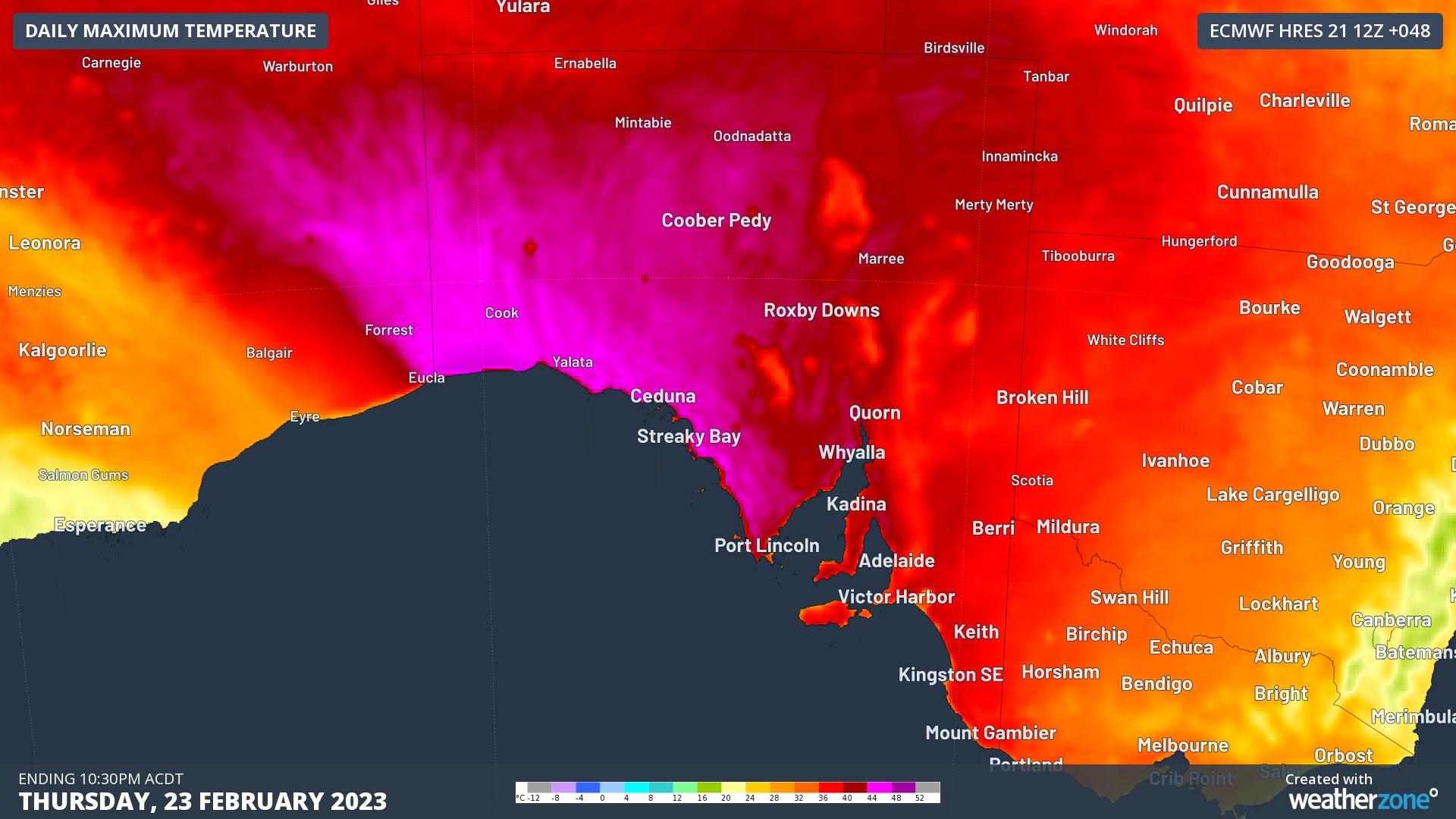
A hot air mass that built up over northwestern Australia in the past week is now spilling into southern Australia ahead of a cold front and associated low pressure trough. This heat can be clearly seen on the three maps below, which show the eastward progression of hot air across southern Australia during the next three days.
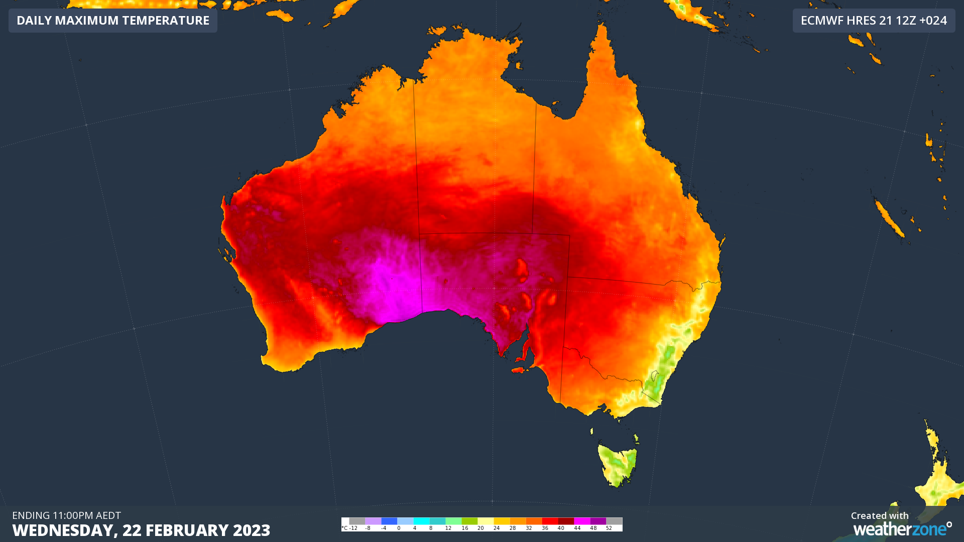
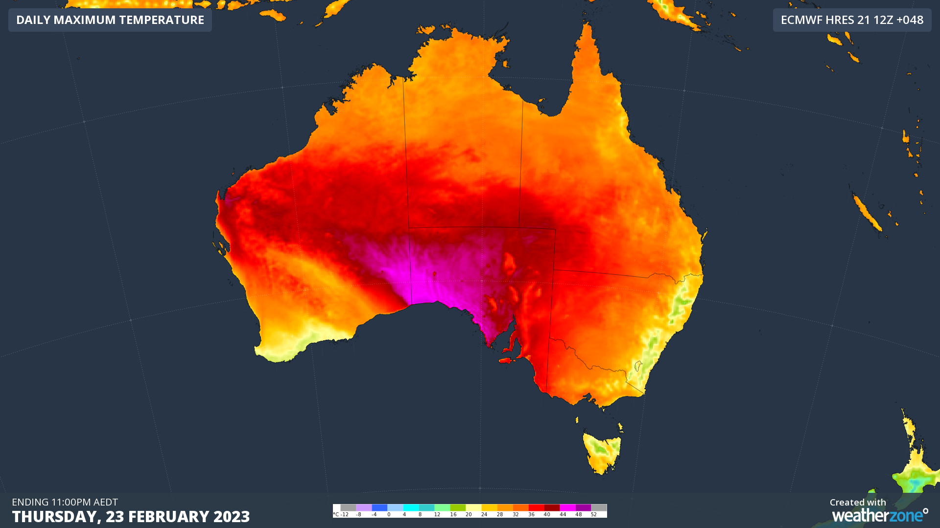
Image: Forecast daily maximum temperatures on Wednesday (top), Thursday (middle) and Friday (bottom), according to the ECMWF-HRES model.

On Wednesday, temperatures soared to 46.8ºC at Eucla in the far southeast corner of WA, which is an incredible 20ºC above average for this time of year. This was the equal highest February temperature observed anywhere in Australia for four years, and Eucla’s hottest February day since 2015.

Across the border in SA, Nullarbor hit 44.9ºC, also its hottest February day in eight years, while Adelaide rose to 38.7ºC, a five-year high for the month.

Temperatures will remain at hazardous levels in and around SA during the next two days and nights, qualifying for a Severe to Extreme heatwave on the Bureau of Meteorology’s scale.
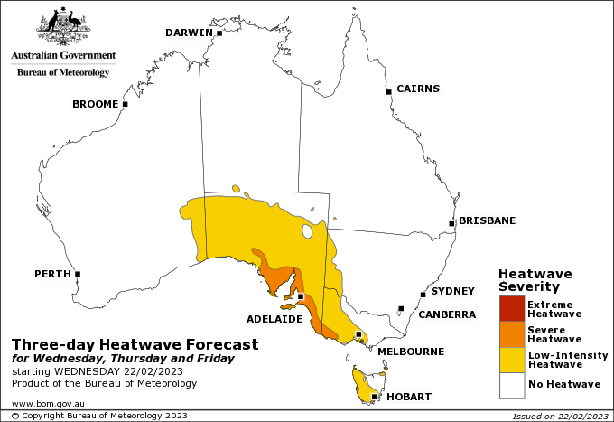
Image: Heatwave forecast for the three-day period from Wednesday to Friday this week. Source: Bureau of Meteorology

In Adelaide, minimum temperatures should be up around 26 to 27ºC on Thursday and Friday mornings, while daytime temperatures should rise to about 39 to 40ºC as well. This would be Adelaide’s hottest run of February days in about five years.

This week’s heatwave will also spread into parts of Vic and Tas during the second half of this week.

You can check which areas of Australia are likely to be impacted by this heatwave here, and the latest heatwave warnings are available here.

To find out about Weatherzones temperature and heatwave forecasts, visit our website or email us at apac.sales@dtn.com.

Latest news

Satisfy your weather obsession with these news headlines from around the nation, and the world.

Active seas to the north and east of Australia disrupting port and maritime operations

Seas to the north and east of Australia are experiencing periods of increased activity this week, leading to disruptions to port, maritime and offshore operations. Intense and hazardous Tasman Sea Ocean conditions across NSW’s South Coast rapidly deteriorated last Friday as a deep feed of easterly winds whipped up large and dangerous seas. The Batemans […]

Transport, emergency and energy industries flooded across Greater Sydney with weekend deluges

Transport, emergency, energy and port industries in eastern NSW and Sydney were impacted by significant flash flooding with intense and heavy rainfall this weekend. Rainfall rates between 80 and 140mm in one to three hours were registered across parts of Sydney’s Northern Beaches and Central Coast on Saturday afternoon and evening. In some areas, these […]

DTN Dangerous Thunderstorm Alerts in action with severe thunderstorms disrupting Perth industries

Severe thunderstorms impacted southwest WA and the Perth region on Sunday, December 14, 2025, triggering Dangerous Thunderstorm Alerts (DTA) by DTN for industries and businesses in the region. DTN operates Dangerous Thunderstorm Alerts (DTA) which alert businesses and industries to thunderstorms based on intensity and movement. These alerts provide advanced notice of thunderstorms moving into […]

How Australian East Coast port and maritime operations could be disrupted by tropical cyclones over the next two weeks

Port and maritime operations across Australia’s East Coast could be disrupted by increased tropical cyclone activity in the Coral Sea and southwest Pacific Ocean over the next two weeks. Meteorologists reference a large selection of Numerical Weather Prediction (NWP) models to forecast weather. A number of these NWP models are forecasting the development of tropical […]