
Western Australia is set to sizzle during the next few days, bringing extreme heat and fire danger to some parts of the state.
A high pressure system in the Bight is directing hot, dry easterly winds over WA over the next few days, causing temperatures to soar across much of the state.
The temperature in Perth has already hit the mid 30’s in some areas, with Perth recording 33.1°C. At 9am WST on Friday.
Perth is expected to have a pair of days over 40°C on Friday and Saturday, with nighttime temperatures on Friday night failing to drop below 25°C.
This heatwave and the one we saw at the beginning of February will bring the total number of days above 40°C to four so far this month, which equals the February record from 2016, 1985, and 1933.
The map below shows that large areas of western WA are expecting temperatures to reach the low to mid 40’s on Friday and Saturday.
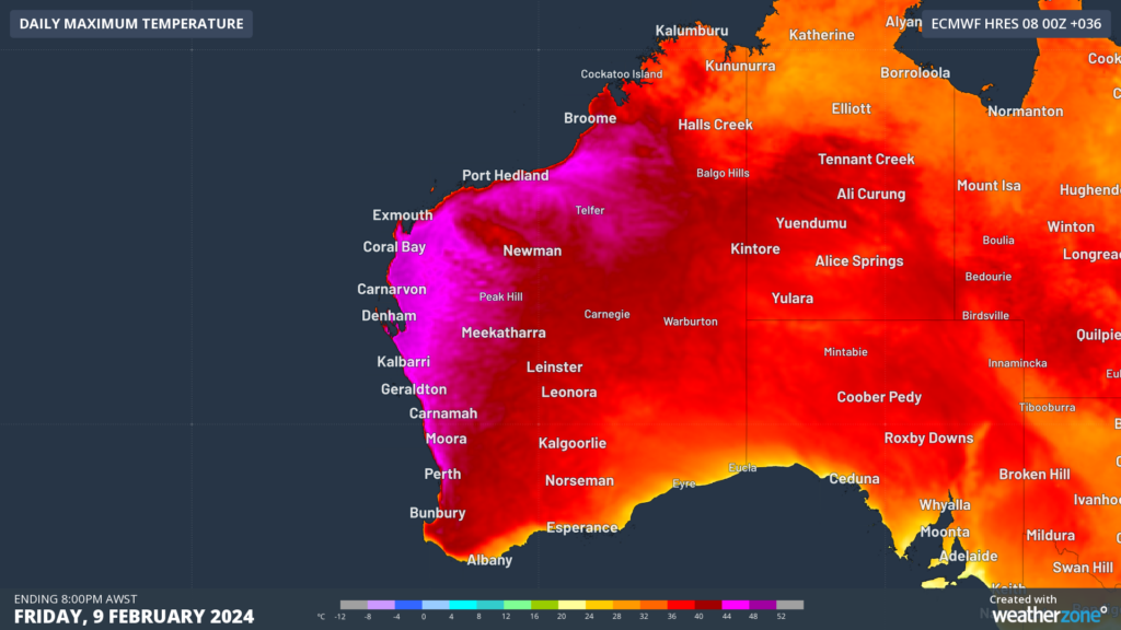
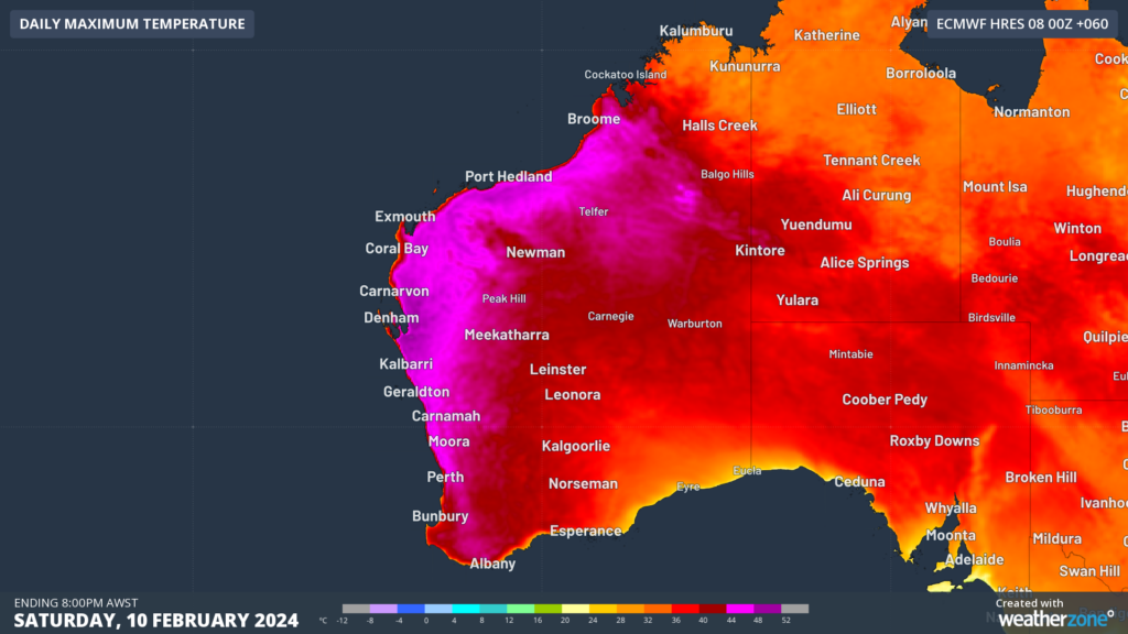
Image: Maximum temperature forecast for Friday, February 9 (top) and Saturday, February 10 (bottom)
The map below shows that severe heatwave conditions are forecast for the next three days in parts of the state’s north and west.
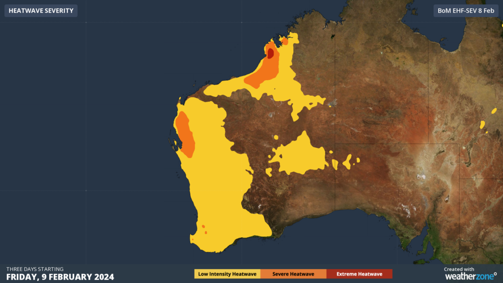
Image: Heatwave severity for the three days from Friday, February 9.
Amid this heatwave, several fires are burning across the state, with the largest blazes currently located near Albany and to the northeast of Perth.
Extreme fire danger is forecast across southwestern WA, including Albany and Perth on Friday and Saturday, as temperatures soar into the low 40’s.
The hot temperatures combining with dry and gusty easterly winds, along with strong afternoon seabreezes, will elevate the fire risk in these areas in the coming days.
Looking ahead, temperatures in the Perth region will cool slightly to the high 30’s on Sunday before dropping to the low to mid 30’s on Monday. However, extreme heat will linger into the start of next week over the northwest of WA.
Another burst of heat may also be on the horizon for Peth, with the city forecast to see temperatures bounce back into the high 30’s mid to late next week. For more information on our extreme heat and energy forecasts, please contact us at apac.sales@dtn.com.


