
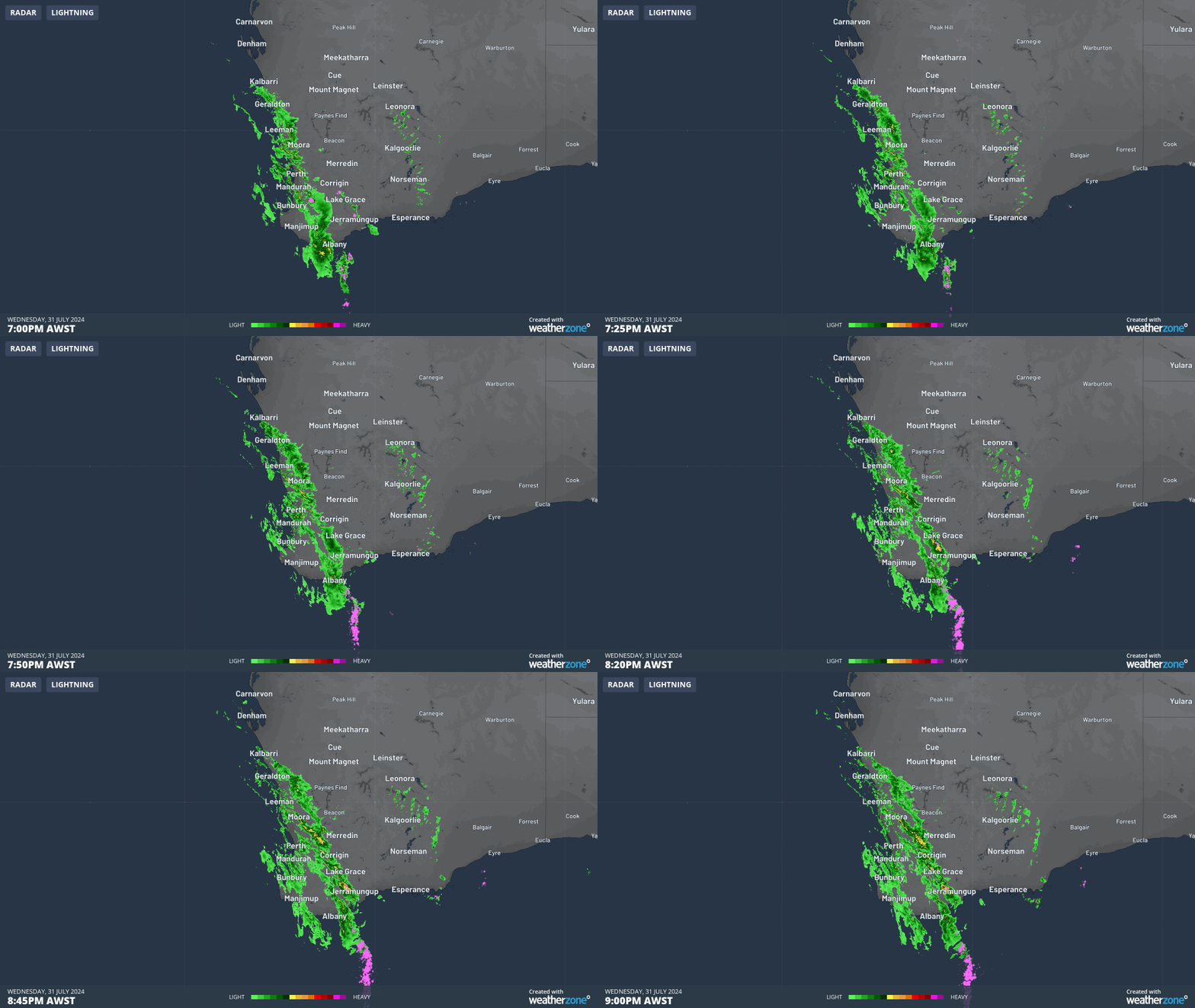
Rain, and plenty of it, has again soaked the southwest corner of Western Australia, with solid falls of around 10 to 30 mm from Geraldton, down through the wheatbelt, all the way to the South Coastal and Great Southern forecast districts.
The heaviest falls came with a pronounced rainband that crossed the coastline early on Wednesday evening ahead of a cold front. You can see the rainband on the loop below, accompanied by multiple flashes of lightning.
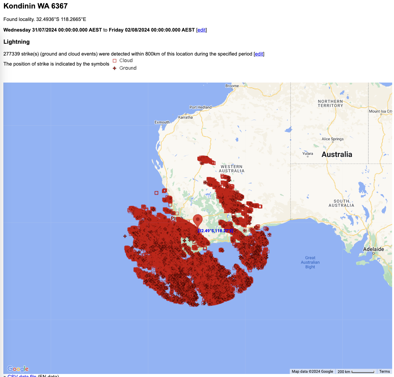
Weatherzone’s Total Lightning Network detected more than a quarter of a million lightning strikes over southwest WA and nearby parts of the ocean as the system moved through.
This is a high number for winter, and the lightning outbreak included some extremely powerful strikes – with a strongest strike of +275.5 kA (kiloamperes are the units by which electric current is measured. The average lightning strike is about 30 kA).
“All up, these were very active and powerful storms for winter,” Weatherzone meteorologist Joel Pippard said.
“There was positive lightning coming from the top of the clouds, rather than the lower-middle part where most comes from – and the cloud tops were reaching the troposphere, about 9 to 10 km up.”
The cold front has now crossed the southwest corner of the state, dropping temps dramatically. Perth reached a very balmy 23.1°C on Wednesday (it was Perth’s second-warmest July on record), but you can shave a good seven degrees off that figure for Thursday’s expected high, and the city won’t see 20°C again till next week.
Meanwhile with August now upon us, it’s worth reflecting on the rainfall in the first two months of winter 2024 for the southwest, which was average or above-average at most locations after a desperately dry spell from early spring through to late autumn.
There’s no place that better illustrate the turnaround than Geraldton – the city of 40,000 which is technically in the Central West forecast district but which is part of WA’s broader South West Land Division.
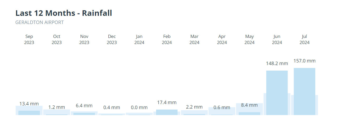
The graph above says it all. And that graph doesn’t include the 12.2 mm that fell overnight, which will go down as August 1 rainfall even if most of it fell before midnight (Australian weather days are officially the 24-hour period from 9 am to 9am).
The rain taps have well and truly turned back on in southwest WA, and while the week ahead looks relatively dry, the current negative Southern Annular Mode (SAM) increases the likelihood of Southern Ocean cold fronts that bring the region’s most consistent rainfall events.
Stormtracker is our Global Information System (GIS) tracking tool, providing multiple weather layers and zoom controls overlaid on a map of your location and infrastructure. You can choose a snapshot or full screen view, depending on your requirements. The maps allow you to monitor all weather, and specifically any systems likely to cause risk for your business. You also have the capacity to observe:
- real time lightning and thunderstorm alerts
- localised lightning strike frequency
- official warnings for storm, cyclone, wind, flood and fire
- sentinel hotspot fires and fire agency current incidents
Stormtracker’s radar imagery updates every 10 minutes, so you are always able to respond rapidly to changing conditions. You can customise alerting to notify you when your staff or infrastructure are under threat. With increased situational awareness, your ability to make informed decisions quickly is optimised.
DTN APAC’ experience and intelligence gives you a clear path through complex situations. Let us assist you, offering actionable insight when extreme weather poses risk to your business. To find out more, please visit our contact page or email us at apac.sales@dtn.com.




