Ferocious winds with gusts equivalent to a category two tropical cyclone have caused widespread damage across Victoria in the last 24 hours, along with huge waves and flooding along the coast.
A powerful cold front embedded in an unusually strong pressure gradient caused a burst of damaging to destructive winds in Victoria on Sunday night into Monday morning. Wind gusts reached 100 to 150 km/h across a broad area of the state, stretching from Portland in the west to Gabo Island in the east and Eildon and Falls Creek in the north. Some of the strongest gusts included:
- 146 km/h at Wilsons Promontory
- 141 km/h at Mount Hotham
- 141 km/h at Fawkner Beacon
- 133 km/h at Mount Gellibrand
- 132 km/h at Falls Creek
- 124 km/h at South Channel Island
- 120 km/h at Portland Airport
- 115 km/h at Gabo Island
- 113 km/h at St Kilda Harbour
- 113 km/h at Cape Otway
- 113 km/h at Aireys Inlet
- 109 km/h at Port Fairy
- 106 km/h at Port Wilson
- 104 km/h at Eildon Fire Tower
- 102 km/h at Essendon
These winds caused widespread power outages as trees and branches fell onto power poles, wires and other infrastructure. Powercor reported more than 34,000 customers without power in western Vic on Monday morning, while more than 90,000 customers were without power in the state’s east, according to AusNet. More customers were affected in areas serviced by other electricity providers as well.
If you see a fallen powerline, stay more than 10 metres away and report it to your energy provider immediately.
The damaging winds also kept emergency services busy, with the Vic SES receiving more than 2,800 requests for assistance on Sunday night into Monday morning.
Video: The Vic SES responding to tree damage at Clarinda in Melbourne. Source: @thelucentcomic / X
This system’s powerful winds were even stronger over open water, with gusts reaching 150 km/h at Hogan Island early on Monday. This caused huge waves to surge through Bass Strait, forcing tides to reach abnormally high levels along the Vic coastline.
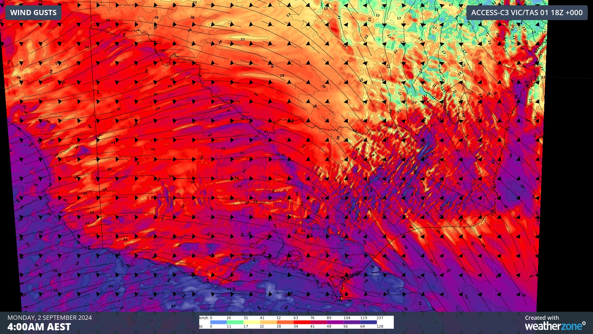
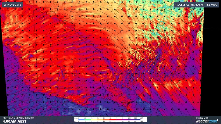
Image: Wind gusts at 4am AEST on Monday, according to the ACCESS-C model.
Significant wave heights of 8.4 m were recorded at Cape Bridgewater early on Monday, while data from Gippsland Ports reveals that tides rose close to one metre higher than the expected levels at Lakes Entrance and Port Welshpool Wharf on Monday morning.
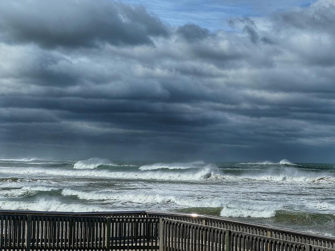
Image: Rough seas at Ocean Grove on Sunday, September 1, 2024. Source: @aviva2.0 / Instagram
While the strongest winds have now passed, a brisk stream of west to southwesterly winds will linger over Vic into Monday afternoon in the wake of last night’s cold front. As of 1pm AEST, a severe weather warning was still in place for damaging winds gusts across some of the state’s southern, central and eastern districts, including Melbourne. A Coastal Hazard warning was also in place for abnormally high tides and damaging surf along parts of the coast.
Conditions should ease on Tuesday as a high pressure ridge builds across the state, giving the SES and energy providers a good window of calmer weather to clean up and reconnect power across the state.
DTN APAC, a DTN company, offers precise weather intelligence and alerting to protect your utilities network when severe weather, floods and fires threaten.
Over 80% of Australian transmission and distribution networks already rely on our proven nowcasting and forecasting out to 15 days. You can rest assured yours is protected by market-leading analysis. With this foresight you can gain lead time to prepare for possible outages, reduce risk and protect your people and profits.
You will never be left in the dark when conditions suddenly worsen. We deliver reliable, up-to-the-minute weather forecasts and analytical tools that give you the power to enhance your operational management and response to weather risk. Our Total Lightning Network is a globally proven solution that accurately identifies and alerts you to lightning strikes within your defined thresholds, supporting the safety of your team.
Your customisable interface has GIS mapping, showing multiple weather layers over your utilities network and offering full situational awareness. You can quickly recognise any threat to your assets in real-time. 24-hour asset monitoring allows you to track lightning, bushfires and other severe weather systems that approach your service territory.
Advanced and actionable analytics allow you to act decisively and improve your planning and outage response strategy. For more information, please visit our website or email us at apac.sales@dtn.com.


