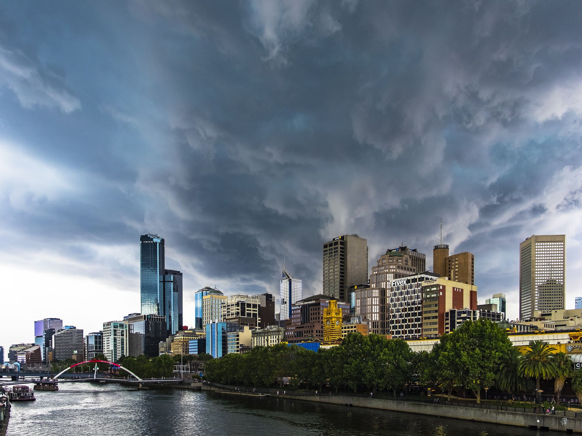
It is going to be a wild day for parts of southeastern Australia, with severe heat, catastrophic fire danger, severe thunderstorms, blustery winds and a welcome cool change all on the forecast.
This dangerous mix of weather is being generated by a strong cold front, which will sweep across the region on Tuesday.
A severe thunderstorm warning has already been issued on Tuesday morning for damaging winds for parts of the Central, Southwest and Wimmera districts.
Mount William and Mount Gellibrand recorded 98km/h and 130km/h wind gust respectively on Tuesday morning. The lighting associated with these thunderstorms may have ignited some new fires in the region this morning.
The image below shows these severe thunderstorms forming along a pre-frontal trough sitting through western Vic on Tuesday morning.
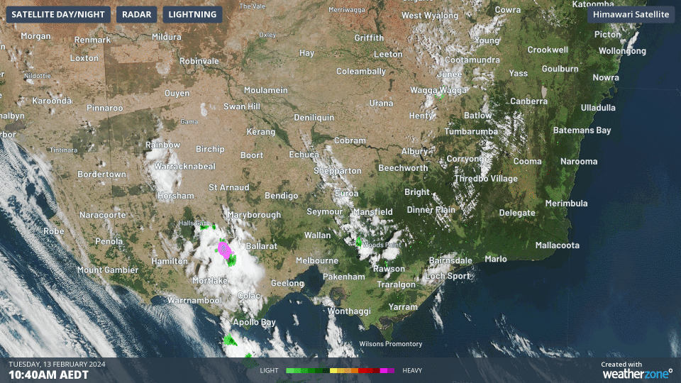
Image: Himawari-9 satellite image at 11:10am AEDT on Tuesday, February 13.
Severe thunderstorms are expected to continue over parts of Vic, Tas and the far southern ranges and slopes in NSW on Tuesday. Damaging winds are the most likely risk with these storms, although heavy rainfall and large hail are possible, particularly through central and eastern Vic.
The thunderstorms will spread further north into NSW and the ACT on Wednesday, as the hot and unstable airmass shifts to the northeast.
Severe thunderstorm activity will focus on the state’s central ranges and coastline, including Sydney, Wollongong, the Blue Mountains and Newcastle on Wednesday.
Outside of these thunderstorm cells, the map below shows the strong northwesterly wind gusts impacting Vic and Tas on Tuesday afternoon.
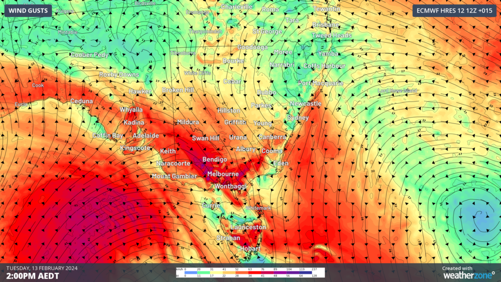
Image: Wind gust forecast at 2pm AEDT on Tuesday, February 13, according to the ECMWF model
These hot and dry northerly winds are dragging a hot airmass into Vic, NSW, ACT and Tas ahead of the strong cold front.
Melbourne’s morning began hot with the mercury reaching the 30’s by 9:30am, with the city’s temperatures set to peak this afternoon with 37°C forecast.
Hobart’s temperature has also risen early with the city reaching 25.6°C at 11am, with a maximum temperature of 30°C forecast, nearly 8°C above average.
Both Hobart and Melbourne’s daytime temperature today could be hotter than Darwin’s, which is particularly unusual.
The hot, dry and windy conditions are bringing severe fire danger to parts of Vic and SA on Tuesday, with catastrophic fire danger forecast for the Wimmera region in Vic for the first time in 14 years.
The map below shows the severe to catastrophic fire danger impacting the southeast, with high fire danger forecast for parts of Tas and southwestern NSW.
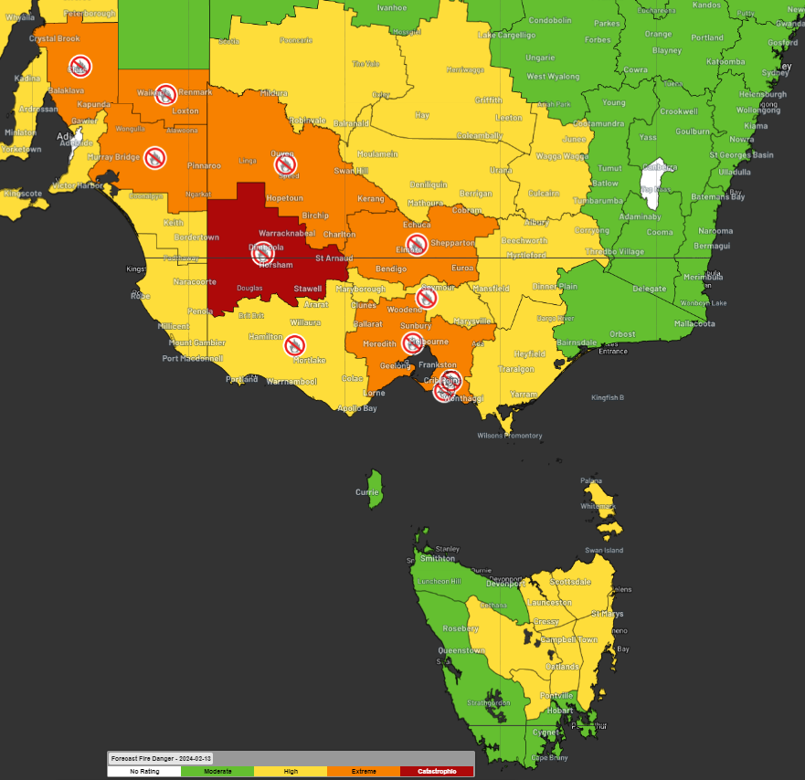
Image: Fire danger forecast showing catastrophic (red) and severe (orange) fire danger forecast on Tuesday, February 13.
The heat and fire danger will ease as a cool southerly change arrives behind this strong cold front sweeping across the southeast on Tuesday and Wednesday.
This change should arrive in Melbourne between 4:30 and 6:30pm local time on Tuesday, dropping the temperature significantly in several hours. Both Melbourne and Adelaide’s temperatures on Wednesday will be around 4-5°C below average.
The image below shows the stark temperature contrast in airmasses ahead and behind the cold front early Wednesday morning.
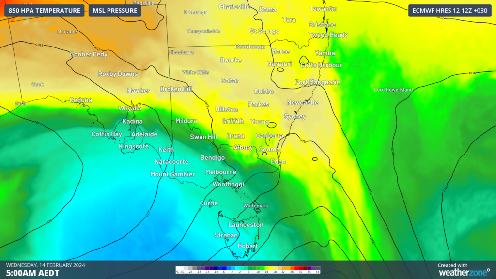
Image: 850hpa temperature forecast at 5am AEDT on Wednesday, February 14.
Sydney’s temperature will remain in the 30’s on Wednesday, before the cool change arrives in the afternoon providing some relief.
As the next few days unfold, please keep an eye out for the latest warnings.
Stormtracker is our Global Information System (GIS) tracking tool, providing multiple weather layers and zoom controls overlaid on a map of your location and infrastructure. You can choose a snapshot or full screen view, depending on your requirements. The maps allow you to monitor all weather, and specifically any systems likely to cause risk for your business. You also have the capacity to observe:
- real time lightning and thunderstorm alerts
- localised lightning strike frequency
- official warnings for storm, cyclone, wind, flood and fire
- sentinel hotspot fires and fire agency current incidents
Stormtracker’s radar imagery updates every 10 minutes, so you are always able to respond rapidly to changing conditions. You can customise alerting to notify you when your staff or infrastructure are under threat. With increased situational awareness, your ability to make informed decisions quickly is optimised.
DTN APAC’ experience and intelligence gives you a clear path through complex situations. Let us assist you, offering actionable insight when extreme weather poses risk to your business. For more information, please contact us at apac.sales@dtn.com.


