Fierce winds are moving across parts of WA, SA, Vic, NSW and the ACT on Friday as two intense cold fronts sweep across southern Australia.
The satellite image below shows the first cold front moving over SA and the other following closely behind in the Bight.
Image: Himawari-9 satellite images at around 6:40am on Friday, July 19
The strongest gusts across these states in the last 24 hours were;
- Cape Naturaliste and Cape Leeuwin in WA, with a 98km/h and 109 km/h wind gusts respectively on Thursday night between 8 and 10pm AWST.
- Esperance in WA, saw its strongest gust in nearly four years with 85.2km/h recorded early Friday morning. While Rottnest recorded a 100km/h wind gust late Thursday night.
- Kadina in SA recorded its strongest gust in two years, observing a 74.1kmh gust on Friday morning.
These fierce winds are set to continue to impact several states and territories Friday and in some cases into Saturday.
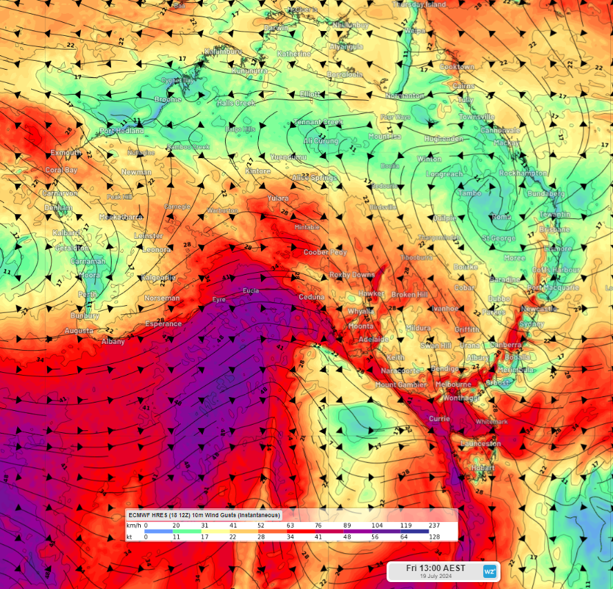
The image below shows the wind gusts forecast on Friday and Saturday afternoon, showing strong winds across much of southern Australia.

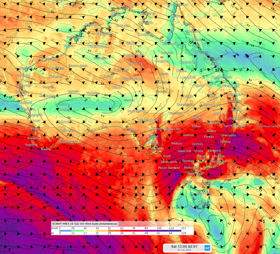
Image: Instantaneous wind gust forecast at 1pm on Friday, July 19 (top) and Saturday (bottom), according to ECMWF
Starting to the west of Australia, damaging wind gusts of around 100km/h are possible about the southeast coast of WA on Friday morning , easing later in the morning.
In SA, damaging winds are forecast to impact the Mount Lofty Ranges from early Friday morning before impacting coastal districts later in the day, including Adelaide in the evening. Winds are forecast to average around 60 to 70km/h with gusts around 90-100 km/h. These winds will most likely continue into Saturday across parts of SA.
Similar strength winds will also impact parts of Vic on Friday, including the Grampians and the northeast alpine region on Friday afternoon through to Saturday afternoon. These winds are likely to cause blizzards in the alpine regions. The damaging wind warning may extend to parts of southern Vic on Saturday, possibly including Melbourne.
In NSW and Vic, damaging winds will develop on Friday evening about the Snowy Mountains, the ACT and South West Slopes district before easing Saturday evening. This warning area could extend to other parts of the NSW ranges and slopes on Saturday, with very strong winds forecast to impact Sydney, the Illawarra and Newcastle.
As this event unfolds, please check the latest forecasts and warnings. To find out more, please visit our contact page or email us at apac.sales@dtn.com.


