Parts of Australia’s southeast just shivered through the coolest June morning in at least 20 years.
Dry air on the western flank of the low over the Tasman Sea producing frosty nights across south east Australia. pic.twitter.com/OfKGEP5TVB
— Andrew Miskelly (@andrewmiskelly) June 18, 2024
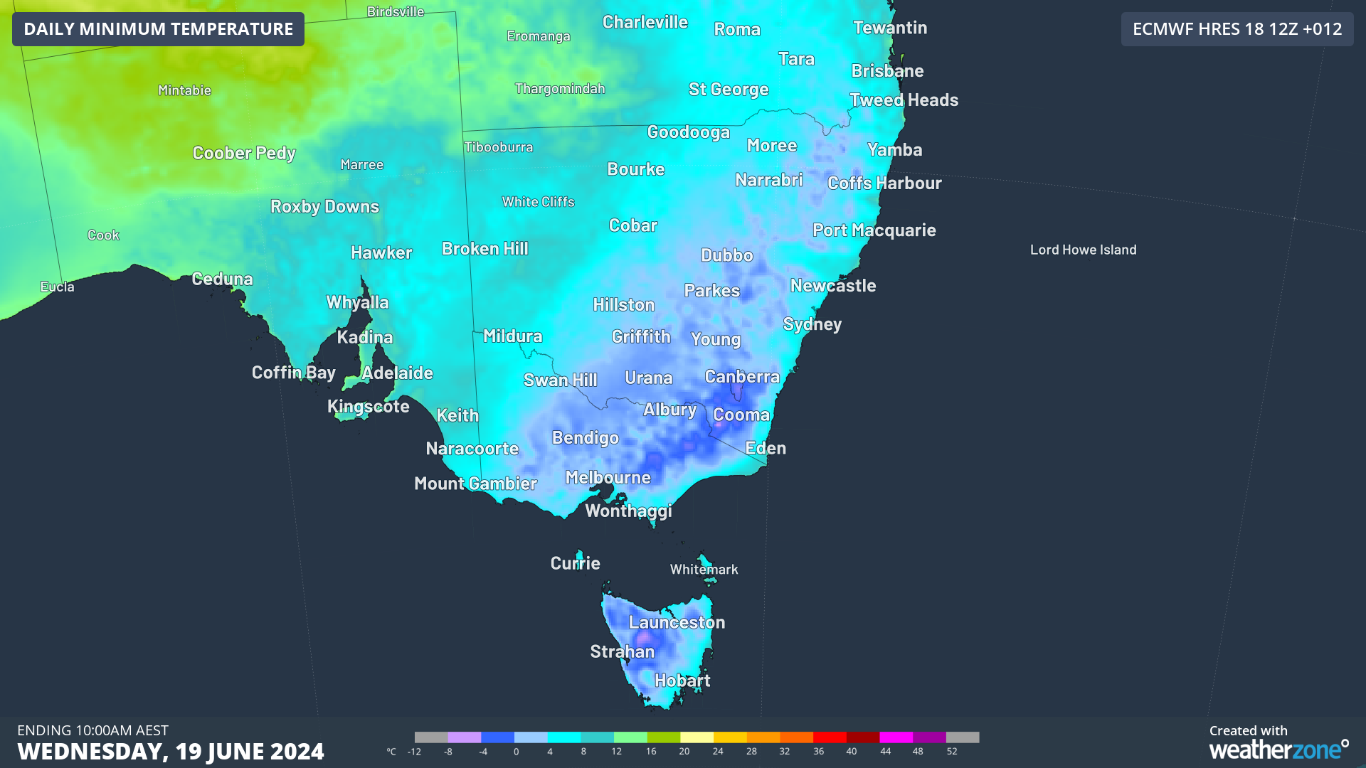
A Tasman Low has directed icy southerly winds over eastern Australia for several days and a high-pressure system has moved in behind it causing temperatures to plummet overnight with clear skies.
The images below show the low in the Tasman and mostly clear skies over the southeast, with some lingering fog on the ranges on Wednesday morning.
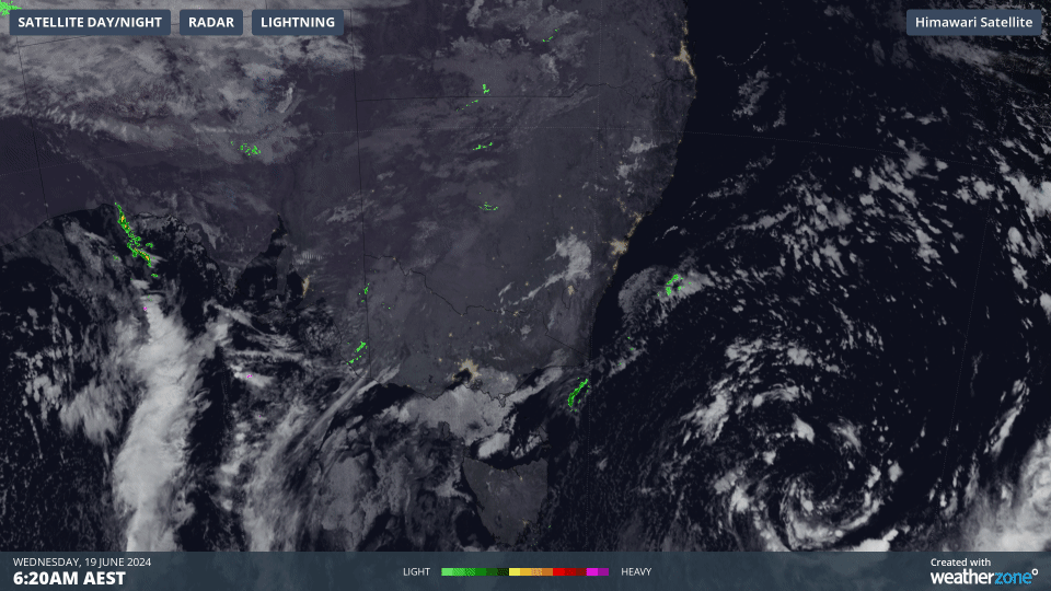
Image: Himawari-9 satellite image for the three hours leading up to 9:20am on Wednesday, June 19.
This set-up caused the coolest morning in decades in the southeast:
Tasmania
- Smithton recorded its lowest temperature in records dating back to 1996, with a minimum temperature of –4.5°C.
- King Island saw the coolest temperature since July 2020, with a minimum of –0.1°C
Victoria
- Westmere’s overnight temperature dropped to –5.7°C, the coolest morning in records dating back to 2006
- Sheoks observed the coolest June morning in 29 years, with a minimum of –2C.
- Omeo, saw its coolest June morning since 1995, with the temperature dropping to –6.4°C
- Melbourne recorded its coolest morning in nearly two years, with a minimum of 1.4°C
- Melbourne airport recorded the equal coldest June morning since 1996, with a minimum of 0.2°C
- Mortlake racecourse’s temperature plummeted to –3.5°C, the coolest June morning in 28 years and in any month for nearly 18 years
- Bendigo’s minimum temperature plummeted to –3.9°C, the coolest morning since August 2013
New South Wales
- Griffith airport’s temperature dropped to –4°C, the coolest morning since August 2018
- Sydney Observatory Hill’s minimum was 6.5°C, the coolest morning in a year.
The wind chill across the southeast has made these temperatures feel 4 to 6 degrees cooler than the actual temperature.
While the temperature at Sydney Observatory Hill was 6.5°C at 7:30am Wednesday, June 19, the apparent temperature was 1°C due to this wind chill.
At the same time in Melbourne, the apparent temperature was –2.3°C, with the actual sitting at 1.4°C.
The cool start to the morning will mean that Wednesday’s daytime temperatures will struggle to reach above 16 °C in Sydney, Hobart and Melbourne.
Unfortunately, this means that Thursday morning will be another cool one for the southeast, before the east is reprieved on Friday ahead of a cold front. However, the southern capitals’ minimums will remain cool through the weekend into next week.
Weatherzone Business has grown to become the outright leader within the Australian energy market, serving wind, solar, hydro, trading, utilities and network companies.
You can’t control the weather, but you can gain precision insights to optimise your response. What lights us up is providing your energy business with tailored weather information to reduce your risk and keep you moving ahead of the curve.
Our services cover all aspects – from wind and solar generation to demand forecasts, wholesale markets to retail so, no matter where your company sits, we have solutions for you. We have worked closely with market participants to create products that meet the evolving needs of the sector, aiming to increase safety and profitability for our customers.
Benefit from the timely delivery of accurate weather information, allowing informed and effective decision-making. For more information please contact us at apac.sales@dtn.com.


