
As the temperature drops and Victorians begin to turn on their gas heating, many in the National Electricity Market (NEM) are wondering what the gas demands this winter will be?
Cool blasts and high gas demand are primarily brought about by Antarctic southerly winds behind cold fronts that sweep across southern Australia.
So, can we predict the number of cold fronts or cool spells that will hit southern Australia this winter?
Not exactly, climate drivers such as La Nina may indicate fewer cold fronts than average over the months. However, La Nina has finished and is not expected to impact our winter. There are no major indications of cooler or warmer winter this year, due to the lack of climate drivers influencing our weather. Most models are showing a normal to slightly above normal temperatures this winter across the NEM.
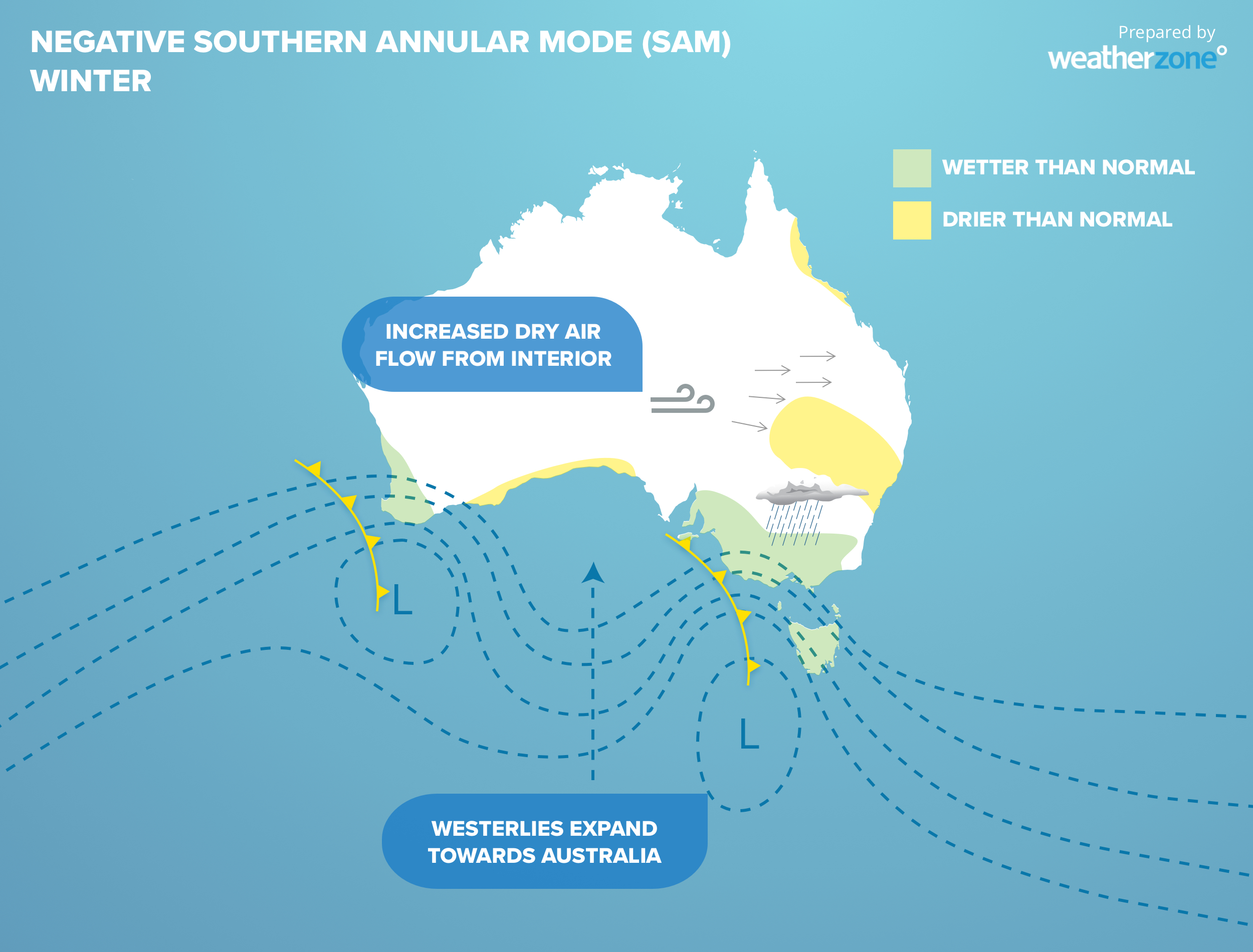
However, the Southern Annular Mode (SAM) is a great indication of above or below normal temperatures and wind power in the next 14 days. The SAM refers to the north or south movement of the westerly wind belt or cold fronts that move across southern Australia. SAM three phases, neutral, positive, and negative, each event lasts for one to two weeks, however it oscillates randomly, and longer periods can occur.
Positive SAM means cold fronts pass further south than normal, with high pressure systems dominating our weather. This promotes lighter winds, warmer daytime temperatures, and stable weather. However, under the influence of high pressure, skies are clearer, which brings cooler overnight temperatures.
Negative SAM is the phase to watch this winter in terms of gas demand, as it shifts cold fronts further north than normal. An increase in the number of cold fronts hitting southern Australia this winter will bring cooler daytime temperatures, high wind power and increased cloud cover and precipitation.
The SAM is forecast to be neutral during the next two weeks, with cold fronts passing through southern Australia at the usual position.
During this winter, SAM is expected to oscillate between each phase. There are some indications that negative SAM may dominate some of August, bringing increased wind power and cooler temperatures overall for the month.
How many very cool days can we expect this winter in Melbourne?

Our models here at Weatherzone are forecasting around 11 very cool days (Maximum temperature below 12C) this winter in Melbourne, which is one day below average. While this year’s cool days forecast is near normal, we are forecasting more cool days (Max temperature below 12C) than the previous 3 winters, which may come as a shock to Victorians.
The previous three winters were all affected by climate drivers with El Nino conditions observed in 2018, a positive Indian Ocean Dipole in 2019 and the beginning of La Nina last year, 2020.
Weatherzone’s model OptiCast can predict temperatures, including the risk of cool spells up to 2 weeks out. In addition to this, long term seasonal forecasting can indicate temperature, pressure, wind, cloud, rain, and snowfall trends up to 6 months out. For more information, please contact us at apac.sales@dtn.com.


