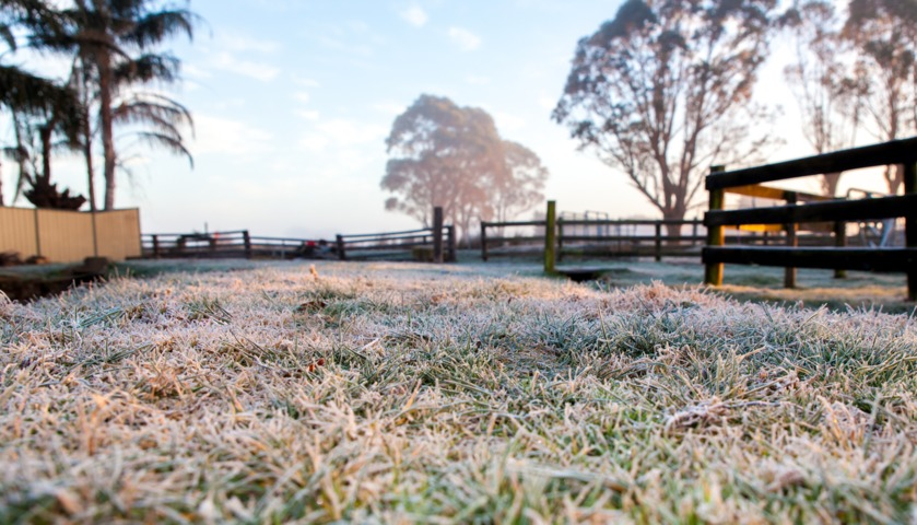
Queenslanders had the chance to thaw out this Tuesday under skies which were sunny across virtually the entire state, after Tuesday morning brought the Sunshine State’s coldest temps to date in 2024, with widespread inland frosts.
Some of the sites which experienced their coldest night of the year to date included:
- –5.7°C at Toowoomba’s Wellcamp Airport, about 15 km west of the Darling Downs city, which as mentioned was the coldest temp anywhere in Queensland so far this year.
- -5.4°C at Oakey Aero, about 30 km northwest of Toowoomba, the coldest July morning there in six years.
- -4.5°C at Warwick.
- -4.4°C at Dalby Airport.
- -4.3°C at Applethorpe.
- –0.8°C at the University of Queensland’s Gatton campus, its coldest morning of any month in six years.
- 1.6°C at Hervey Bay, its coldest morning of any month in six years.
- 7.5°C at the town of Seventeen Seventy near Gladstone, its coldest July morning in 34 years. Gladstone itself had its coldest July morning in 13 years, with a minimum of 7.9°C.
Brisbane shivered through a low of 6.7°C on Tuesday morning, after its coldest temp of the year to date with 6.3°C early on Monday.
While the mercury touched 20.9°C in Brisbane just before 3 pm today, the “feels like” temps stayed well below 20°C all day.
With the Paris Olympics currently underway, it’s worth briefly dwelling on Brisbane’s weather in the context of the Olympics which will be held in that city from July 23 to August 8, 2032.
As we wrote in 2021 when Brisbane was named host city of the 2032 Olympic Games:
- Brisbane’s average July max is 22.1°C with an average min of 10.4°C.
- In August, Brisbane’s average max and mins rise slightly to 23.4ºC and 10.8°C.
In short, both the temperatures and typically dry midwinter conditions will be perfect for most sports at Brisbane 2032, but spectators will want to bring a cardigan – and not just because cardigans are always timeless fashion garments that are never uncool.
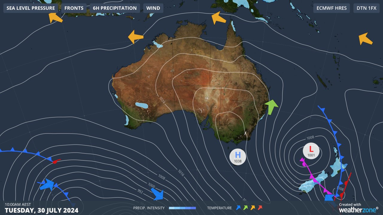
You don’t have to dig too much deeper than Tuesday’s synoptic chart to understand why Queensland nights are so cold this week.
Air is circulating anti-clockwise around that high centred over Tasmania, funnelling frigid air northwards. Meanwhile the low in the Tasman Sea that ushered in the cold air is too far east to push moist onshore winds toward Queensland.
Both daytime and overnight temps will rise slightly in most places as the week progresses, but not by much. Dry conditions will also persist in most Qld forecast districts, with the exception of the North Tropical Coast and Tablelands where showers are expected.
Weatherzone Business has grown to become the outright leader within the Australian energy market, serving wind, solar, hydro, trading, utilities and network companies.
You can’t control the weather, but you can gain precision insights to optimise your response. What lights us up is providing your energy business with tailored weather information to reduce your risk and keep you moving ahead of the curve.
Our services cover all aspects – from wind and solar generation to demand forecasts, wholesale markets to retail so, no matter where your company sits, we have solutions for you. We have worked closely with market participants to create products that meet the evolving needs of the sector, aiming to increase safety and profitability for our customers.
Benefit from the timely delivery of accurate weather information, allowing informed and effective decision-making. To find out more, please visit our contact page or email us at apac.sales@dtn.com.


