Prosper in a dynamic world
Search

First cool bite of Autumn

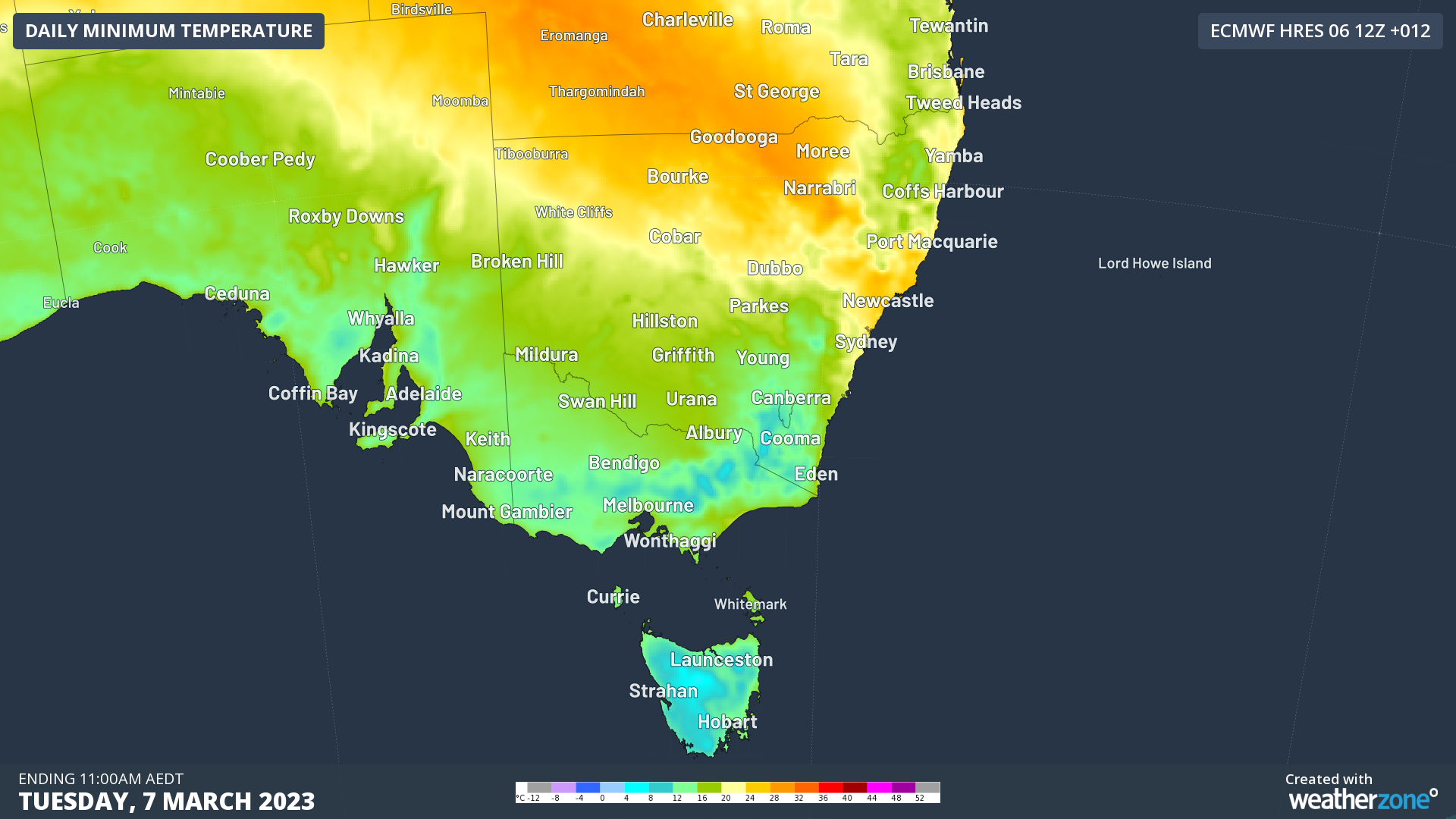
The first gentle bite of autumn is making its mark across southeastern Australia, with Tasmania and most of SA and Victoria already having a coolish day.

While parts of NSW are enduring the third day of a low intensity heatwave – with most Sydney suburbs having reached 30°C by midday on Tuesday in the remnant hot air which was pushed eastwards heads of a cold front – it’s a very different story down south.

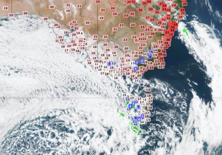
That front is well and truly working its magic in three states, with the whole of Tasmania experiencing temps in the teens or lower at midday on Tuesday.

You can see the contrasting temps on the satellite image below taken just before midday Tuesday. It also shows the speckled cloudmass typically associated with Southern Ocean cold fronts surging northwards towards southeastern Australia.

Looking ahead to tonight and Wednesday, snow is expected down to 700 metres in Tasmania overnight, so be sure to check in here on Weatherzone on Wednesday morning, as we’ll have our snow scouts out and about finding the best images.

  • For Melbourne, a top of just 18°C is expected on Wednesday, with similarly cool conditions expected across the state. Only the Mallee in the state’s far northwest can expect top temps over 20°C.
  • Adelaide and Canberra are both looking at tops around 20°C on Wednesday, while Hobart is looking at a max of 15°C, which would be five degrees below the monthly average.

Cool conditions will persist into Wednesday, with milder temps tracking as far north as the NSW Central Tablelands. Nights will also be cooler, with light frosts likely in the high country of NSW and Victoria.

Despite the burst of autumnal cool, this is a mostly dry front for the mainland. While showers are lashing Tasmania on Tuesday, only a light drop or two can be expected along the coasts of SA and Vic, as well as NSW and Vic mountain districts.

To find out about Weatherzones temperature, visit our website or email us at apac.sales@dtn.com.

Latest news

Satisfy your weather obsession with these news headlines from around the nation, and the world.

Madden-Julian Oscillation increasing tropical cyclone potential for northern Australia industries

Sea surface temperatures exceeding 31°C off the coast of northern Australia and an active phase of the Madden-Julian Oscillation (MJO) are increasing the likelihood of early-season tropical cyclone activity, with hints of the season’s first tropical cyclone coming as early as next week. Tropical cyclones require sea surface temperature of 26.5°C or warmer to develop, […]

Tropical cyclone season begins with warm oceans surrounding northern Australia

The 2025-26 tropical cyclone season has begun with abnormally warm oceans surrounding northern Australia, signalling an increased risk for severe tropical cyclones in the coming months. The Australian tropical cyclone season runs from November 1 to April 30. During this six-month period, there are usually about 9 to 10 tropical cyclones in the Australian region, […]

7.8 million lightning pulses detected by DTN’s Total Lightning Network over Australia in one week

A barrage of thunderstorms battered large areas of eastern and northern Australia over the past week, producing close to 8 million lightning pulses across the country and more than 4 million over Queensland alone. DTN’s Total Lightning Network (TLN) detected around 7.79 million lightning pulses above Australia last week. This lightning was observed over every […]

Warmest October on record for Sydney, Brisbane

Sydney and Brisbane just had their warmest October on record, despite a relatively cool end to the month. A surge of cold air caused temperatures to plummet in eastern Australia earlier this week. In Brisbane, the temperature only reached 22.2°C on Tuesday, while Sydney’s maximums remained below 18°C on both Tuesday and Wednesday. These chilly […]