Heavy rainfall, severe thunderstorms and damaging winds will hit parts of WA this weekend as another strong cold front sweeps over the state.
Earlier this week, a cold front and northwest cloud band provided some much-needed rainfall to some drought-stricken parts of WA, with 50 to 100mm of rain falling in parts of the southwest and Kimberley regions.
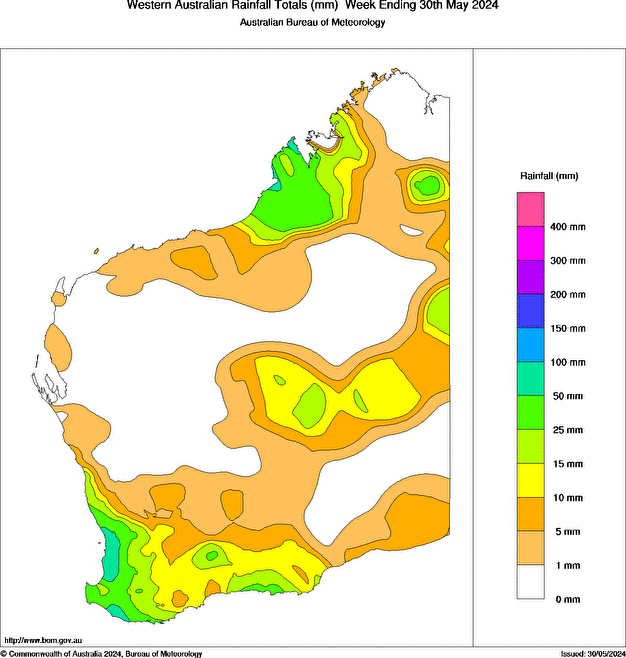
Image: Rainfall observations for the week ending on Thursday, May 30. Source: Bureau of Meteorology.
Merely days after the skies cleared over the state from the last system, another strong cold front has set its sights on WA.
This front will arrive late Saturday night and cross the state swiftly on Sunday, linking up with tropical moisture and producing another bout of wet weather as it passes.
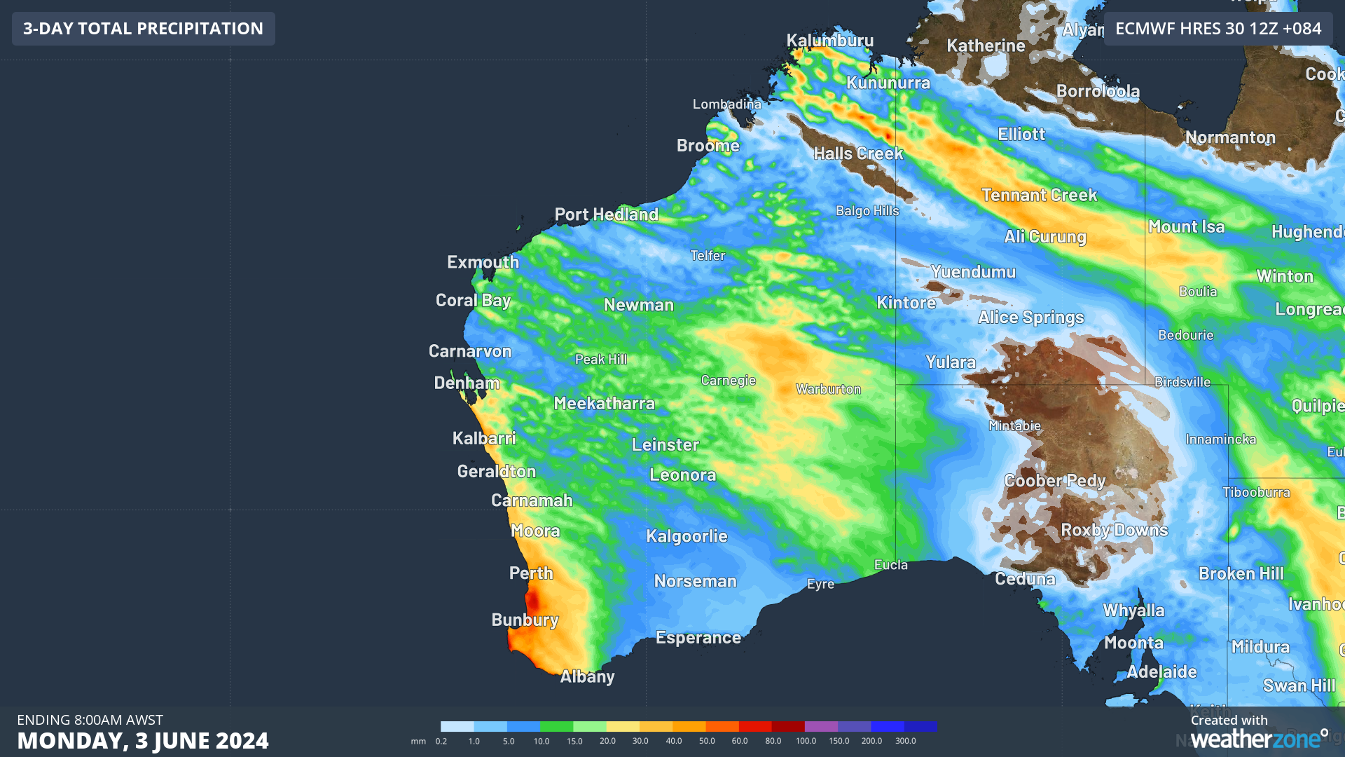
The map below shows one computer models rainfall forecast for the next three days. Widespread falls of 20 to 50mm are forecast along the west coast between Denham and Albany, and the interior and far north, with isolated falls of 50-80mm possible.

Image: Accumulated 3-day rainfall forecast up to 8am AWST on Monday, June 3, according to ECMWF.
Severe thunderstorms are also possible over large areas of WA this weekend, including Perth late Saturday into Sunday. These storms could produce heavy rainfall leading to flash flooding, and damaging winds. Some models suggest that Perth could see 30-60mm on Sunday.
The cold front could also produce damaging winds across the southwest of the state. Please keep an eye out for the latest warnings as this event unfolds.
Stormtracker is a severe weather solution that can assist you in observing, in real-time, any storm or event that has the potential to impact your business.
Embedded in DTN APAC’ industry interfaces, the system gives you a time advantage when monitoring conditions developing over your infrastructure and location.
Stormtracker is our Global Information System (GIS) tracking tool, providing multiple weather layers and zoom controls overlaid on a map of your location and infrastructure. You can choose a snapshot or full screen view, depending on your requirements. The maps allow you to monitor all weather, and specifically any systems likely to cause risk for your business. You also have the capacity to observe:
- real time lightning and thunderstorm alerts
- localised lightning strike frequency
- official warnings for storm, cyclone, wind, flood and fire
- sentinel hotspot fires and fire agency current incidents
Stormtracker’s radar imagery updates every 10 minutes, so you are always able to respond rapidly to changing conditions. You can customise alerting to notify you when your staff or infrastructure are under threat. With increased situational awareness, your ability to make informed decisions quickly is optimised.
DTN APAC’ experience and intelligence gives you a clear path through complex situations. Let us assist you, offering actionable insight when extreme weather poses risk to your business. To find out more, please contact us.


