May could be Adelaide’s driest in 185 years of records, with the clear skies causing chilly nights and driving energy demand across the city and the rest of SA.
The paltry 0.6 mm that fell on Sunday night is Adelaide’s total rain for May 2024 to date and snapped a 29-day dry spell which came on the back of extremely dry months in March and April and a totally rain-free February.
- May is usually one of Adelaide’s wettest months with an average of 67.9 mm at the city’s West Terrace/ngayirdapira site in records stretching back to 1839 – a significant period of data considering the city was only founded in 1836.
- Adelaide’s lowest May rainfall on record was 2.6 mm in 1934 at West Terrace/ngayirdapira, and 8.2 mm in 2005 at the Kent Town weather station, which served as the city’s official weather station for 40 years from 1977 to 2017.
The remarkably dry weather has meant that the first 21 days of May have been great for solar, with Adelaide recording 8 hours of sunshine on average. This is well above the sunshine we saw in May 2023, which averaged nearly 5 hours. At this stage, it is looking like this could be the cities sunniest May on record, with the current record held by May 2008 with an average of 6.7 hours of sunshine.
The clear skies have caused overnight temperatures to plummet, with Edinburgh in Adelaide’s north recording the coolest morning its seen in more than 51 years early Wednesday morning, May 22. This cool evening elevated demand across SA, with it peaking at 2009 MW at 7pm on Tuesday, May 21. While this was the coolest night this season, the nightime temperatures in May so far have been below average, under the influence of stubborn high pressure systems and clear skies.
Looking ahead, the minimums during the next 7 days are set to remain cool, before warming slightly from mid next week.
So will it rain before June?
Almost certainly not in the week from this Wednesday to next Wednesday, no.
Beyond that period, there’s a glimmer of hope towards the end of the month. The BoM’s ACCESS-G model shows moisture associated with a cold front flicking the southeast of SA with the chance of thunderstorms. But this is a very marginal system that could slide too far south to impact Adelaide.
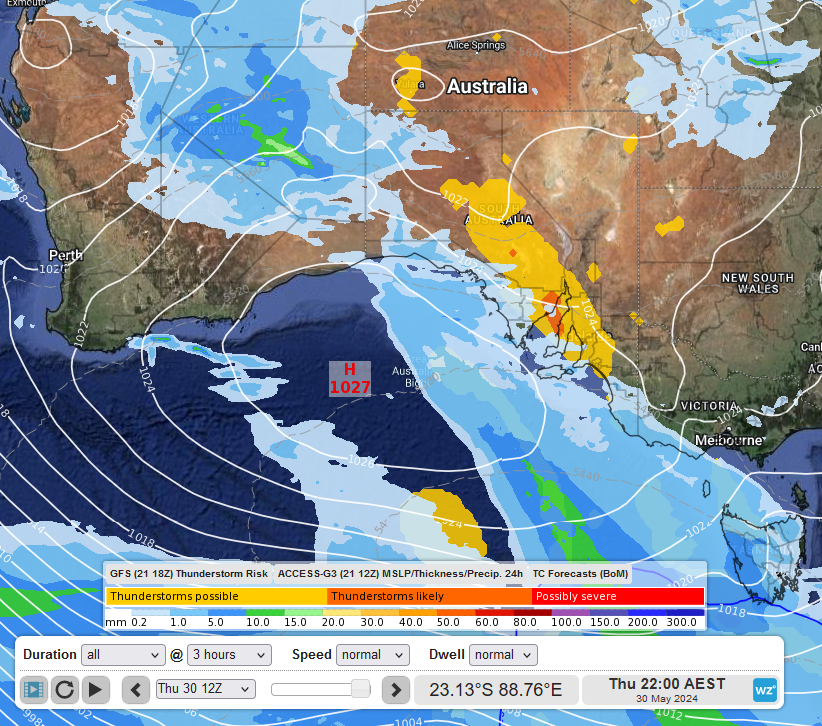
Image: The charts suggest some hope of rain, but it definitely wouldn’t hurt to touch some wood, cross your fingers or do a rain dance.
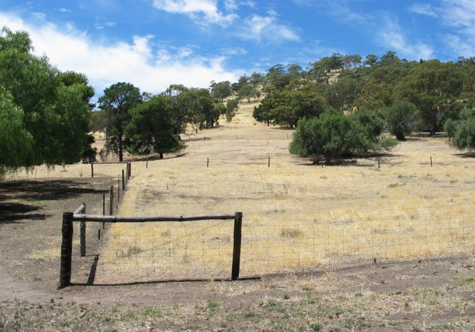
Meanwhile as dry lawns crackle underfoot in the suburbs, the combined capacity of Adelaide’s water storages is at 45%, compared to 56% on this day last year.
It’s relatively normal for dams to be low at this time of year after the traditionally dry summer and early autumn period, but South Australians will have their fingers and toes crossed for substantial rains in the coming winter months.
Weatherzone Business and Solcast are a market-leading partnership delivering highly specialised solar data to the Australian renewable energy industry. For more information, please contact us at apac.sales@dtn.com.


