
The Bureau of Meteorology has today declared the end of the persistent positive Indian Ocean Dipole (IOD) event, which contributed to the driest three-month period on record in 2023.
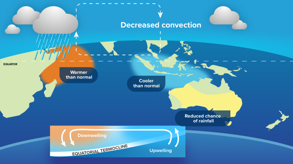
The IOD is an index that measures the difference in sea surface temperature anomalies between the western and eastern sides of the tropical Indian Oceans.
The IOD index is positive when cooler-than-average water lies off the coast of Indonesia and warmer than average water sits near the Horn of Africa.
Positive IOD events typically cause below average rain and above average daytime temperatures over large areas of Australia during winter and spring, particularly over central and southern parts of the country.
This positive IOD event was the second strongest on record peaking at +1.92°C in October 2023, falling short of the 2019 event which reached as high as +2.15°C.
Both the positive IOD and El Niño were declared in September 2023, which led to the driest three-month period on record during the middle of 2023.
The map below shows the exceptionally dry period between August and October 2023, particularly in southeast Qld, parts of NSW and the NT, WA and SA.
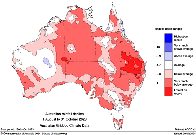
Image: Australian rainfall deciles for the three months leading up to November 2023
While these climate drivers had a noticeable influence in winter and early spring, their influence has waned in summer for much of Australia.
The map below shows that above average rainfall fell across central and eastern Australia between November and February, while the WA coast saw below average rainfall.
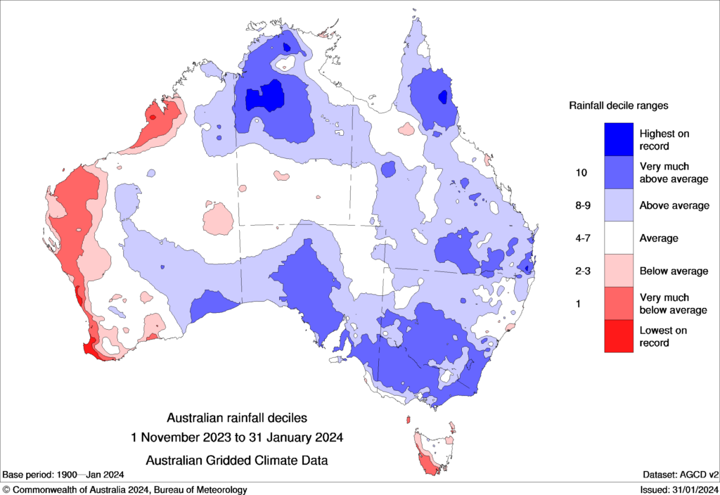
Image: Australian rainfall deciles for the three months leading up to February 2024.
However, the positive IOD has contributed to several impacts this summer:
- Reduced number of early season cyclones, lows and cyclones across the Western Region.
- Extreme heat in WA and parts of the NT during late December and early January.
- Lack of northwest cloud bands which stretch from the northwest of Australia to the southeast, reducing cloud cover, thunderstorms and rain in these areas at times.
This year’s event was also unusually long, lingering into February thanks to the late arrival of the monsoon trough and the strength of the event.
The monsoon trough was around a month late under the influence of El Nino arriving on Thursday 11th January. However, it was not the latest arrival on record, which was on the 25th January 1973.
The warming of the oceans near Jakarta and the arrival of the monsoon in Australia has caused the positive IOD to lose strength during the last few weeks.
The latest weekly value to February 4 was +0.3°C, which is below the positive threshold of +0.4 °C for the second consecutive week.
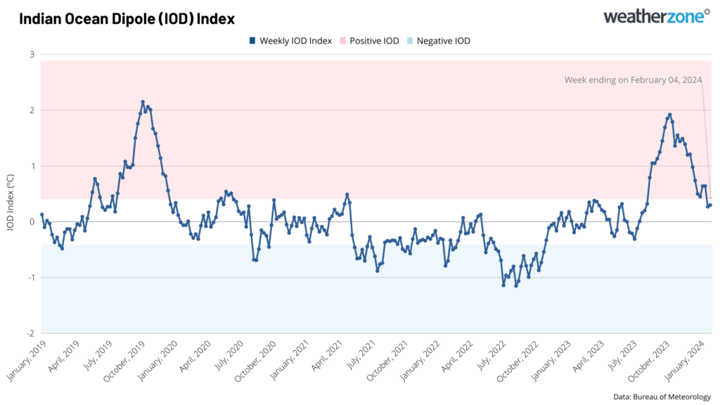
Image: Weekly IOD index since the beginning of 2019, showing the IOD is now neutral.
While the positive IOD has lost its grip on Australia, El Niño is continuing in the Pacific Ocean, but it has passed it peak. For more information on our climate forecasts and briefings, please contact us at apac.sales@dtn.com.


