
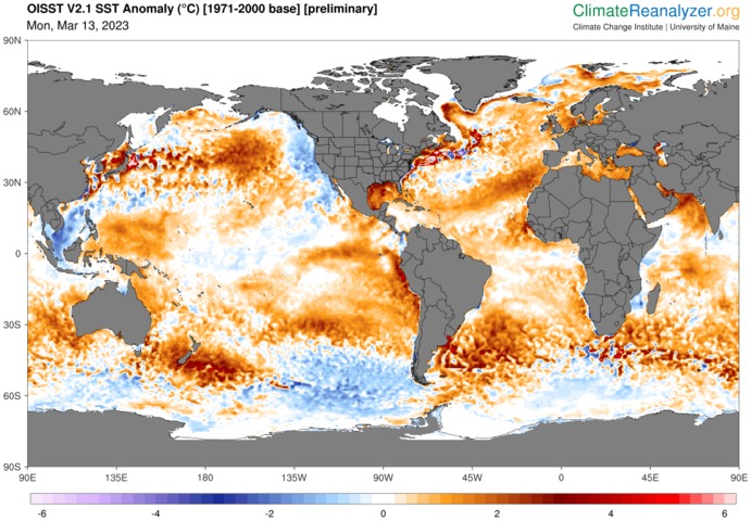
Global ocean temperatures have rebounded to record-challenging high levels this week as our planet shakes off the cooling influence of La Niña.
Earth’s ocean temperatures have been rising in recent decades due to the ongoing warming influence of climate change. According to data from the U.S. National Oceanic and Atmospheric Administration (NOAA), the global ocean temperature has increased by around 1ºC since 1900 and about 0.6ºC since 1970.
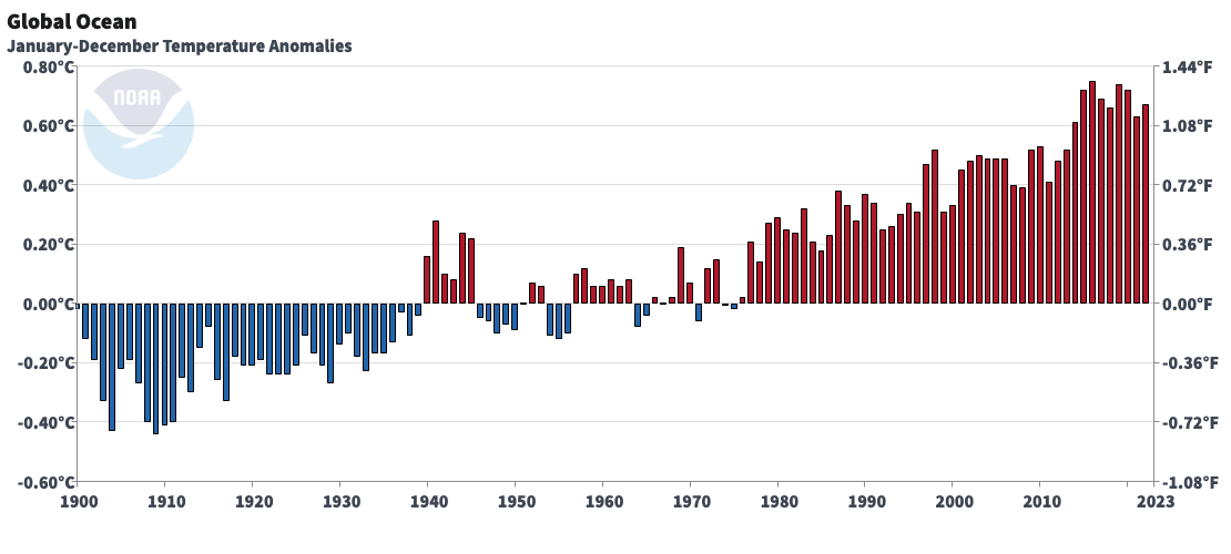
Image: Global annual sea surface temperature anomaly between 1900 and 2022. Source: NOAA/NCEI
This background oceanic warming has been masked during the last two-to-three years by to the cooling influence of La Niña. The last two bars on the graph above show the recent dip in global ocean temperatures, which coincide with the cold water associated with La Niña (images below).
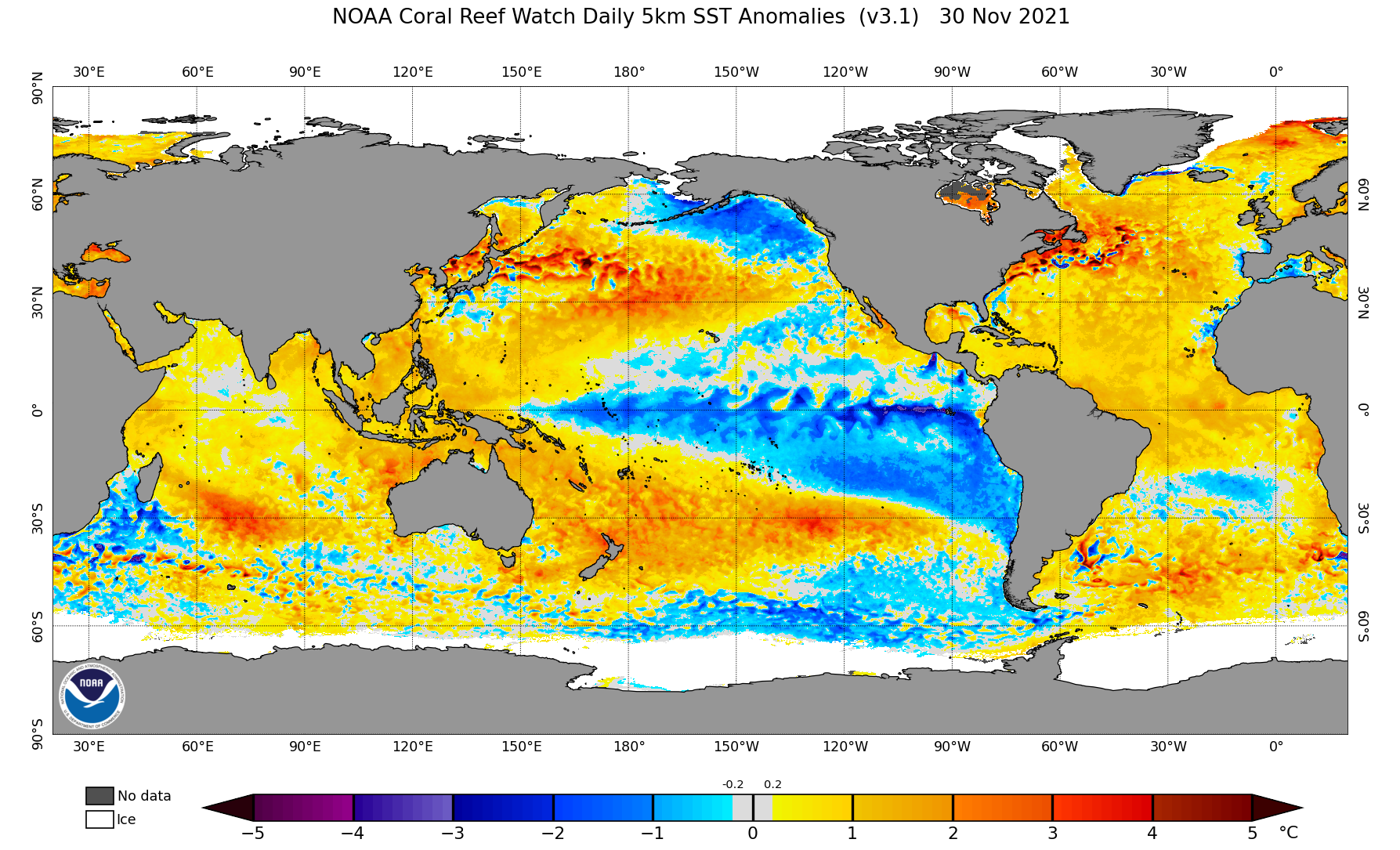
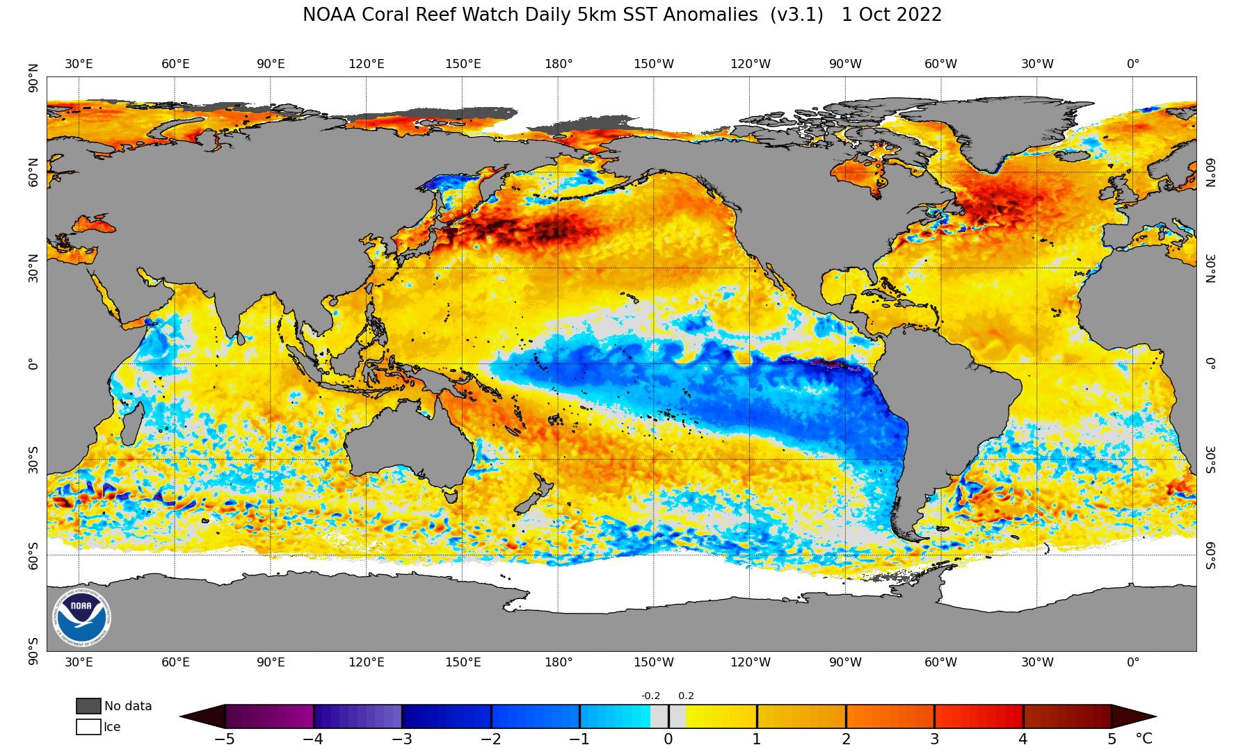
Images: Sea surface temperature anomalies in November 2021 (top) and October 2022 (bottom), showing distinct La Niña patterns with a large pool of abnormally cold water in the central and eastern tropical Pacific Ocean. These pools of cold water helped suppress global sea surface temperatures in 2021 and 2022. Source: NOAA
However, La Niña is now over and our planet’s average ocean temperature has started to increase at an alarming rate.
The graph below shows daily global sea surface temperatures between 1981 and 2023. This graph uses data from NOAA’s Daily Optimum Interpolation Sea Surface Temperature (OISST) record, which incorporates observations from satellites, ships, buoys and Argo floats across the world’s oceans.
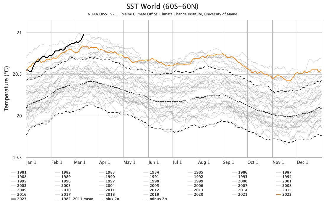
Image: Daily global sea surface temperature, showing 2023 (dark solid black line) and 2022 (orange line) compared to all other years since 1981 (light grey lines). Source: ClimateReanalyzer.org
The black line on the graph above reveals that global sea surface temperatures are currently at their warmest level on record for this time of year. The only other year that is on par with the current warmth was 2016, which was Earth’s warmest year in record for ocean temperatures. However, it is important to note that 2016 was an El Niño year and El Niño is known to enhance global ocean temperatures.
This year has already been able to rival the oceanic warmth of 2016, despite being under the cooling influence of a waning La Niña. With some forecast models suggesting that El Niño may develop later in the year, this might not be the last record-challenging warmth in out planet’s oceans during 2023.
DTN APAC can provide tailored climate briefings to your business to alert you of the most likely weather conditions and hazards to look out for during the upcoming season. Now is a good time to get a good look at the forecast for autumn and winter. To find out more or to book a presentation, please email apac.sales@dtn.com.




