A positive Indian Ocean Dipole (IOD) event is gaining strength to the northwest of Australia, increasing the risk of hot and dry weather and fires in the coming months.
What is the IOD?
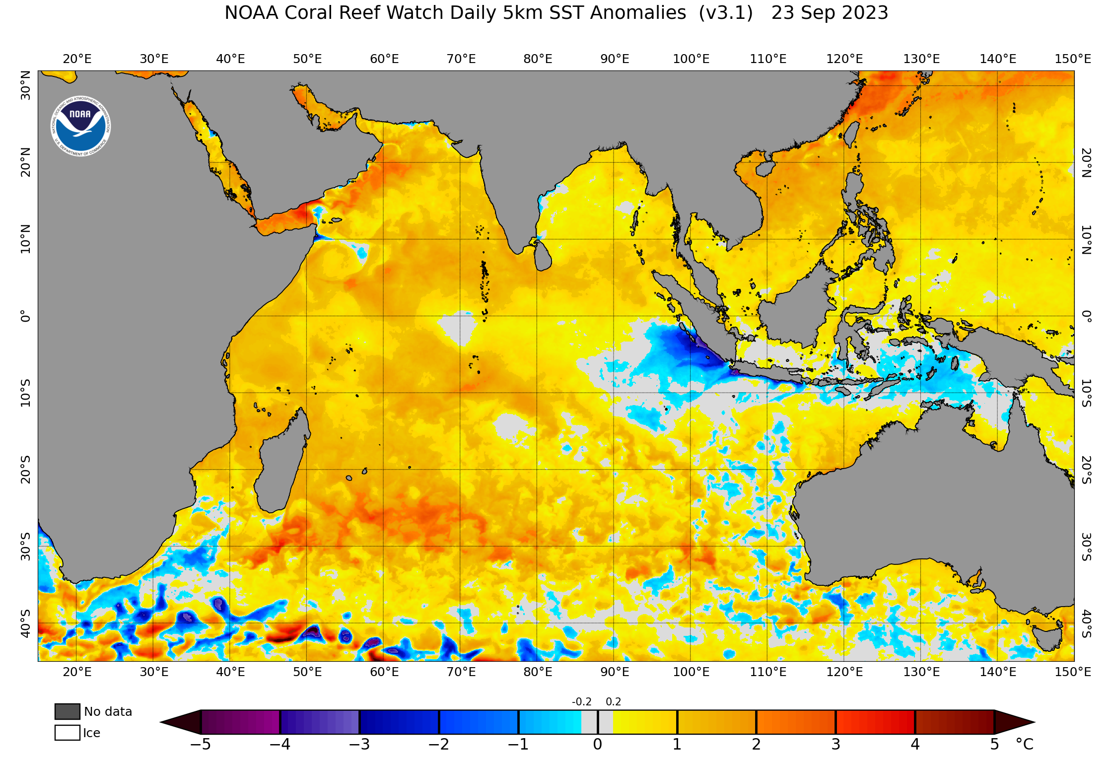
The IOD is an index that measures the difference in sea surface temperature anomalies between the western and eastern sides of the tropical Indian Oceans.
The IOD index gets positive when cooler-than-average water lies off the coast of Indonesia and warmer than average water sits near the Horn of Africa.
How does a positive IOD affect Australia?
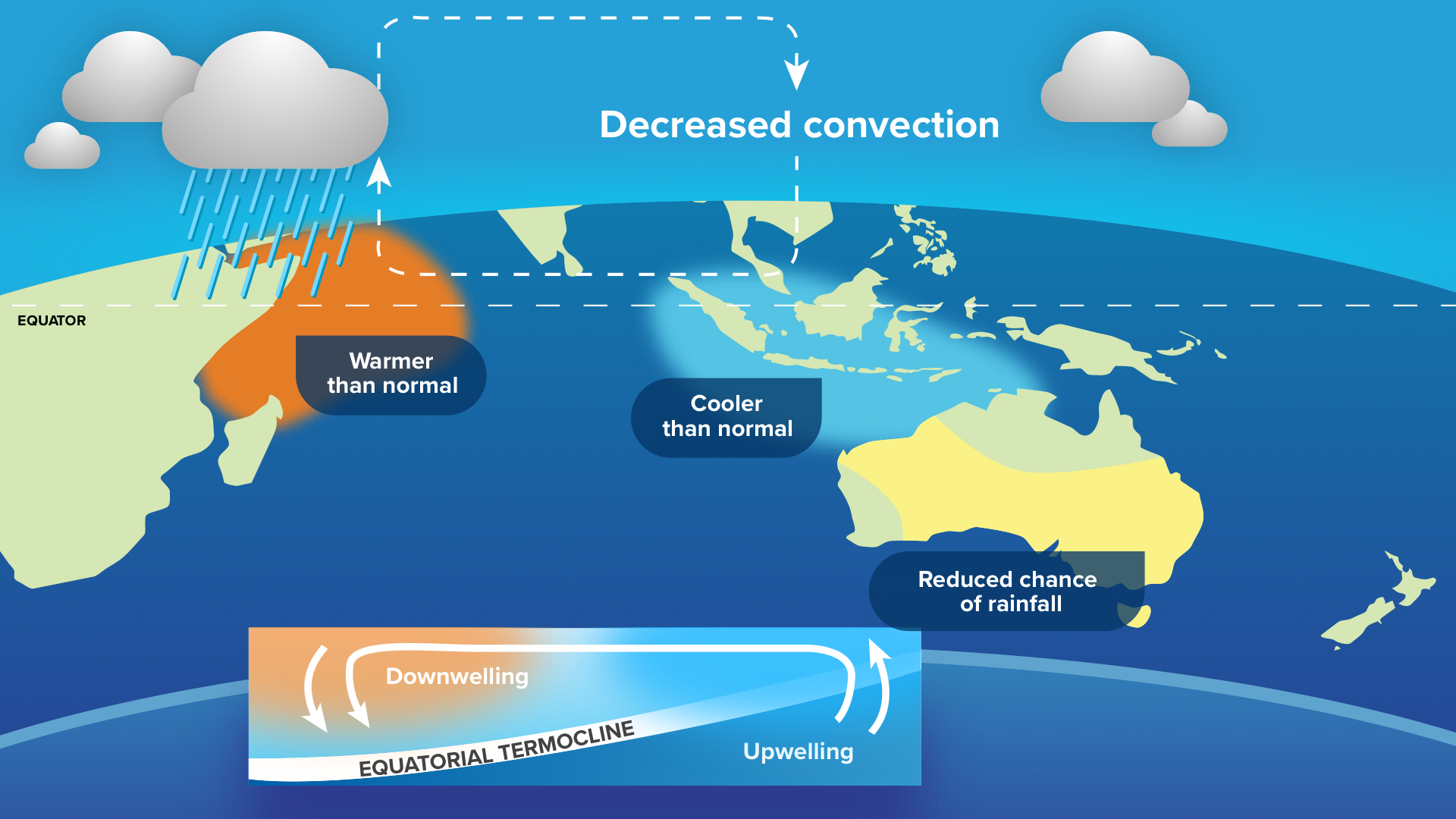
Positive Indian Ocean Dipole (IOD) events reduce the amount of moisture flowing towards Australia from the northwest. This suppressed atmospheric moisture increases the likelihood of above average daytime temperatures and below average rain over large areas of Australia in winter and spring.
The warming and drying influence of a positive IOD can also precondition the landscape for above average fire activity during the following summer, particularly in southeastern Australia.
The maps below show how rainfall and maximum temperatures have been influenced by positive IOD events in the past. The yellow, red and orange shading highlights areas that were drier and warmer than average during winter and spring due to a positive IOD influence.
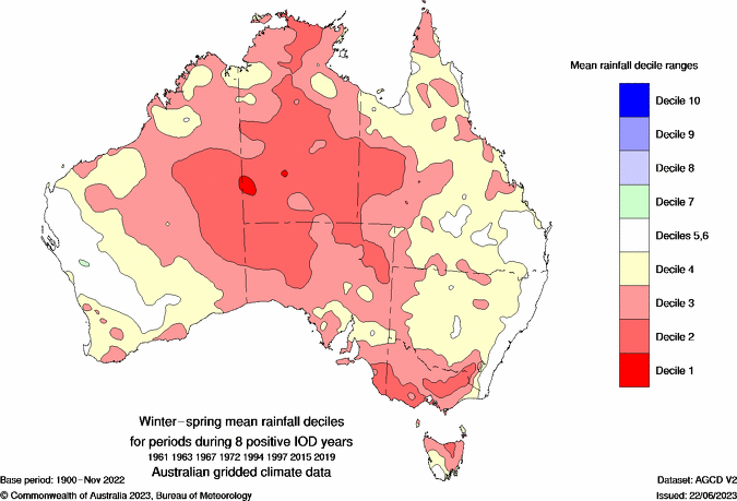
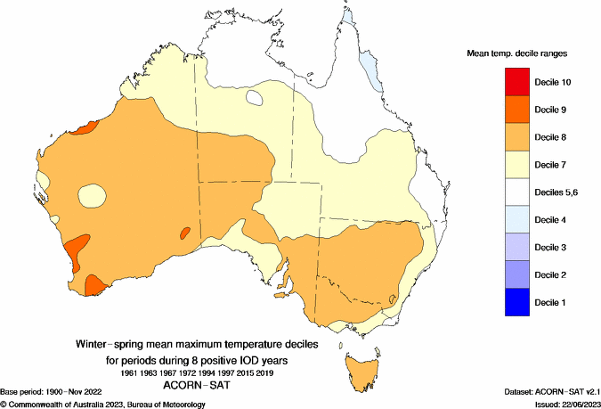
Images: Mean winter-spring rainfall (top) and maximum temperature (bottom) deciles from 8 positive IOD events between 1961 and 2019. Source: Bureau of Meteorology
What’s the IOD doing now?
A positive IOD event started to emerge in the Indian Ocean in August and was officially declared by the Bureau of Meteorology in mid-September. This positive IOD signal has been gaining strength during the last few weeks, with the weekly IOD index hitting +1.45ºC on September 24. This is well above the positive IOD threshold of +0.4ºC and the highest value recorded since November 2019.
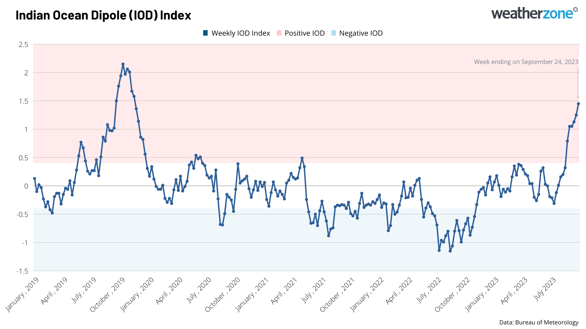
Forecast models suggest that the IOD will continue to strengthen in October and peak during spring, before weakening later in the year. Based on current forecasts, the IOD could last into the beginning of summer.
What does this mean for Australia?
The strengthening positive IOD, in conjunction with a strengthening El Niño in the Pacific Ocean, significantly increased the likelihood that large areas of Australia will be warmer and drier than average for the rest of spring and into at least the start of summer.
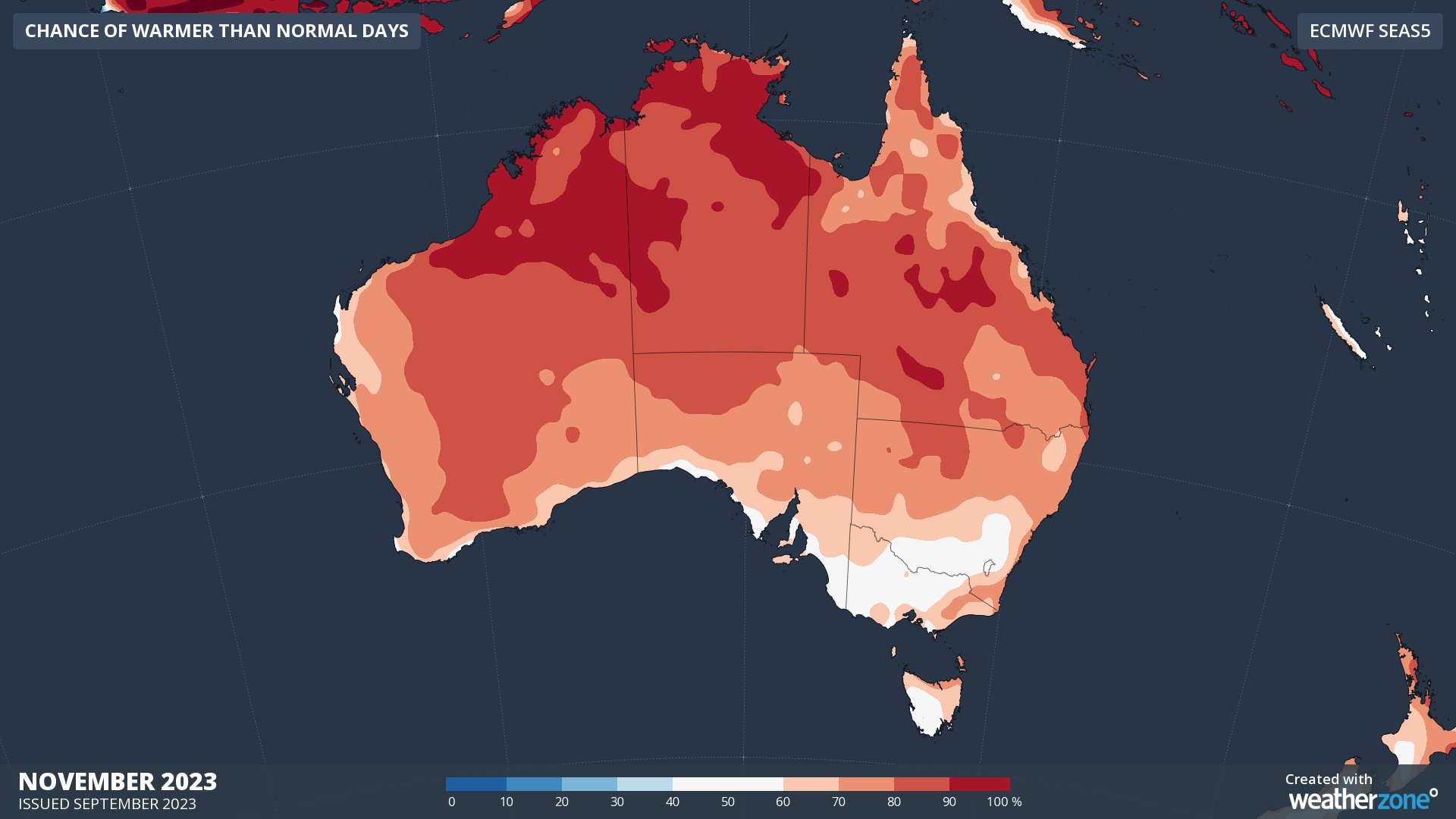
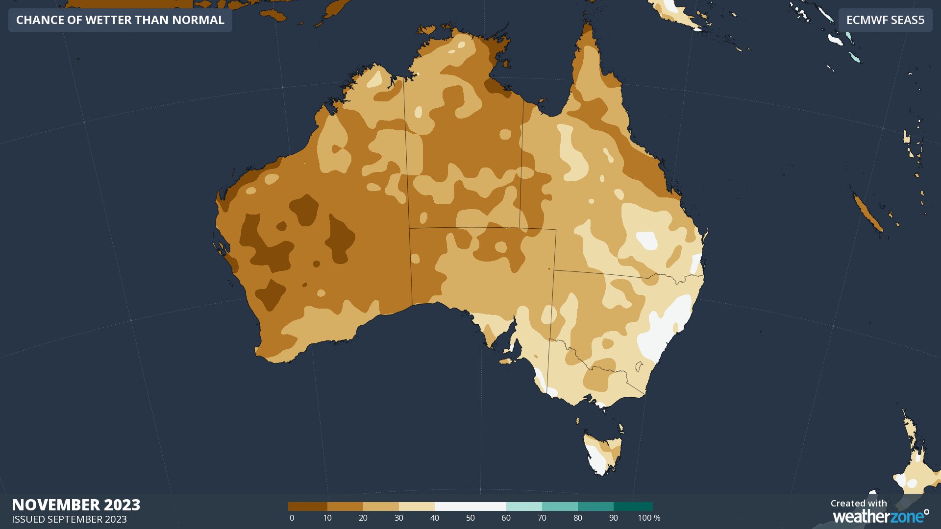
Images: Chance of being warmer than average (top) and wetter than average (bottom) in November.
The increased likelihood of warm and dry weather in the coming months also means there will be a heightened risk of fires in spring and summer.
Positive IOD events are a known precursor to some of Victoria’s largest fire seasons, including Black Saturday and Ash Wednesday. This doesn’t mean that a positive IOD guarantees a significant bushfire season in Victoria, but it does make it more likely. One study found that of 16 positive IOD events between 1950 and 2009, 11 were followed by significant fire seasons in Victoria.
It’s also worth noting that the 2019 Black Summer fires came after one of the strongest positive IOD events in record. That IOD peaked at +2.15ºC, which is 0.7ºC above the current value of +1.45ºC. This will be worth watching closely if the IOD index does continue to climb into October.
For detailed climate updates, please contact us at apac.sales@dtn.com


