

Here at Weatherzone, a DTN company, we are celebrating our 25-year anniversary. It’s been a quarter of a century well spent – delivering invaluable weather intelligence to support the everyday safety and decision-making of individuals, communities, and businesses. We’re definitely not feeling creaky in the knees; moving from strength to strength as we focus […]
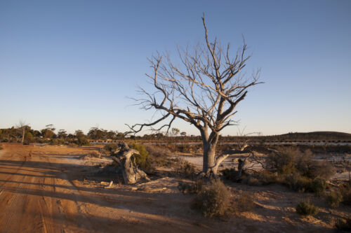
This year’s positive Indian Ocean Dipole is gaining strength so quickly that it’s getting close to the record-challenging 2019 event that underpinned Australia’s warmest and driest year on record. While the Pacific Ocean’s El Niño has been getting a lot of attention in recent months, its lesser-known cousin – the Indian Ocean Dipole (IOD) – […]

The wild weather which has lashed southeastern Australia is moving out into the Tasman Sea, leaving in its wake dangerously swollen rivers, wind damage, and even a decent dusting of spring snow. Overnight, winds howled their way around a low pressure system centred over the eastern part of Bass Strait. Winds were strong across virtually […]

A powerful northeasterly surf will build off NSW on Wednesday, followed almost immediately by a strong southerly swell, as an unusually strong transient low develops over the state. A cold front and trough crossing western NSW on Tuesday afternoon will stall overnight as a low pressure spins up (likely centred near Wagga Wagga) and starts […]

It’s set to be a huge few days of wild spring weather across southeastern Australia, and Victoria is already copping it this Tuesday morning. After Melbourne registered its driest September in 168 years of records with just 10.8 mm of rain, an extremely active loop of rain and storms sweeping across the state in a […]
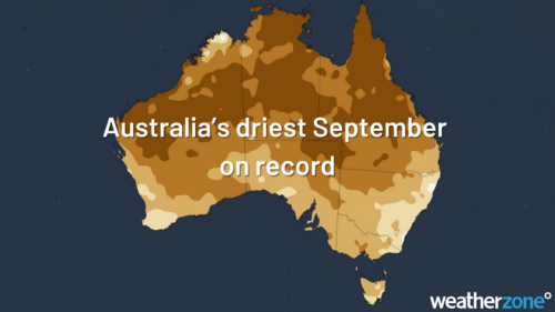
Australia has had its driest September on record, led by huge rainfall deficiencies in the Murray-Darling Basin. Most of the country was well above average for maximums too, with NSW, Victoria and WA setting new records. Rainfall Australia as a whole averaged a measly 4.8mm of rain during September, the lowest on record for September […]
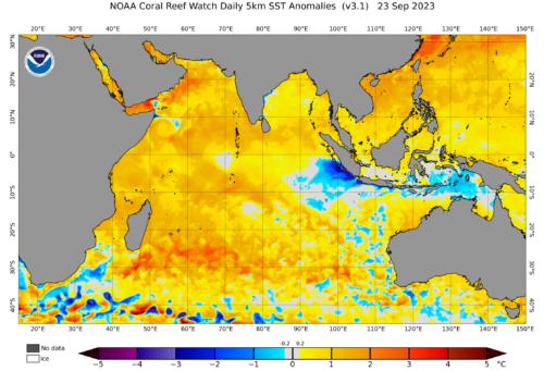
A positive Indian Ocean Dipole (IOD) event is gaining strength to the northwest of Australia, increasing the risk of hot and dry weather and fires in the coming months. What is the IOD? The IOD is an index that measures the difference in sea surface temperature anomalies between the western and eastern sides of the […]

The Bureau of Meteorology has today declared the arrival of El Niño and a positive Indian Ocean Dipole (IOD), a climate driver double-up that significantly increases the likelihood of unusually warm and dry weather across large areas of Australia in the second half of 2023. The Bureau made the El Niño and positive IOD declarations […]
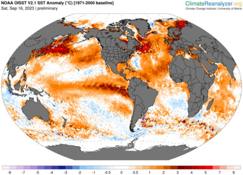
Scientists are developing a new way to classify El Niño in a warming climate as rising ocean temperatures make existing methods less effective. This research, led by a team of international scientists, may even shed light on why the atmosphere has struggled to respond to this year’s developing El Niño. Warm, warm water in […]

Australia’s tropical cyclone season is officially underway, but we may not see much activity for few months yet. The season runs from November to April, and for mining operators and businesses across northern Australia, 2026-27 is shaping up to be a season where the headline numbers and the real risk may not line up. On […]

A positive Indian Ocean Dipole is underway, but this one is unlikely to deliver the textbook dry spring and summer that businesses have come to expect from the pattern. The Bureau of Meteorology officially declared a positive IOD on Tuesday, October 27, which typically like El Niño can cause drier and warmer conditions over parts of […]

Waters off Indonesia have cooled in recent weeks, an indication that a positive Indian Ocean Dipole (IOD) event could be developing. It’s an important climate driver for Australia, and it could shape rainfall and temperatures heading into summer, with flow-on effects for farmers, energy and other industries. What is the Indian Ocean Dipole? The IOD […]

Leonora, WA, had its wettest September day on record earlier this month. Three weeks later, more than 1.3 million lightning pulses were detected within 800 km of the town in 48 hours. Why is a stalled trough delivering storms to mining country, and what it could mean for operations? The DTN Total Lightning Network detected […]
