
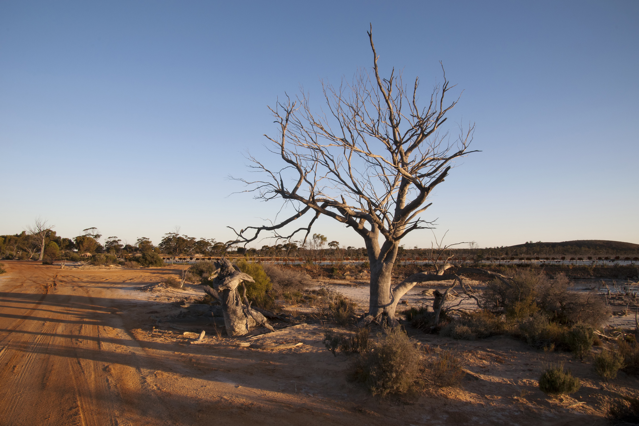
This year’s positive Indian Ocean Dipole is gaining strength so quickly that it’s getting close to the record-challenging 2019 event that underpinned Australia’s warmest and driest year on record.
While the Pacific Ocean’s El Niño has been getting a lot of attention in recent months, its lesser-known cousin – the Indian Ocean Dipole (IOD) – has been quickly gaining strength on the other side of Australia.
What is the IOD?
The IOD refers to an index that measures the difference in sea surface temperature anomalies on either side of the tropical Indian Ocean.
The IOD index gets positive when warmer than average water sits on the western side of the tropical Indian Ocean, near the Horn of Africa, and abnormally cool water lies on the eastern side of the Indian Ocean, near Indonesia. The map below shows that this distinctive positive IOD pattern is currently in place.
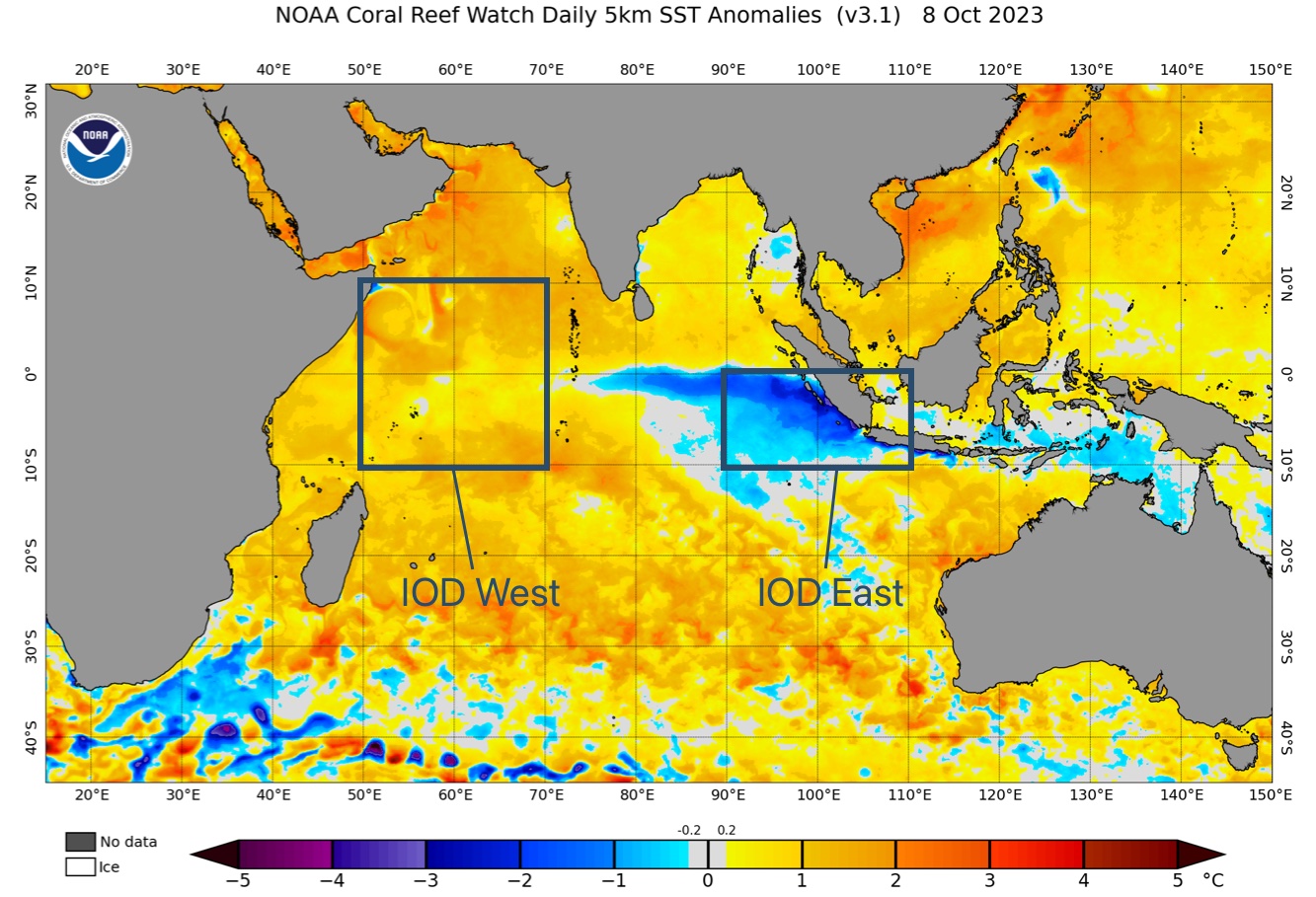
Image: Sea surface temperature anomalies in the Indian Ocean on October 8, 2023. Boxes highlight the two regions used to measure the IOD.
Positive IOD events typically cause below average rain and above average daytime temperatures over large areas of Australia during winter and spring, particularly over central and southern parts of the country. Most IOD events typically start in winter, peak in spring and end in late spring or early summer.
The Bureau of Meteorology considers sustained IOD index values above +0.4°C as typical of a positive IOD event. The index started to exceed this positive IOD thresholds in August and a positive IOD event was officially declared by the Bureau in September.
The positive IOD has quickly gained strength over the last two months, with the index reaching +1.85°C in the week ending on October 8, according to the Bureau of Meteorology. It is rare to see the IOD index get this high, with the current value nearing the peak of the 2019 positive IOD event, which reached as high as +2.15°C.
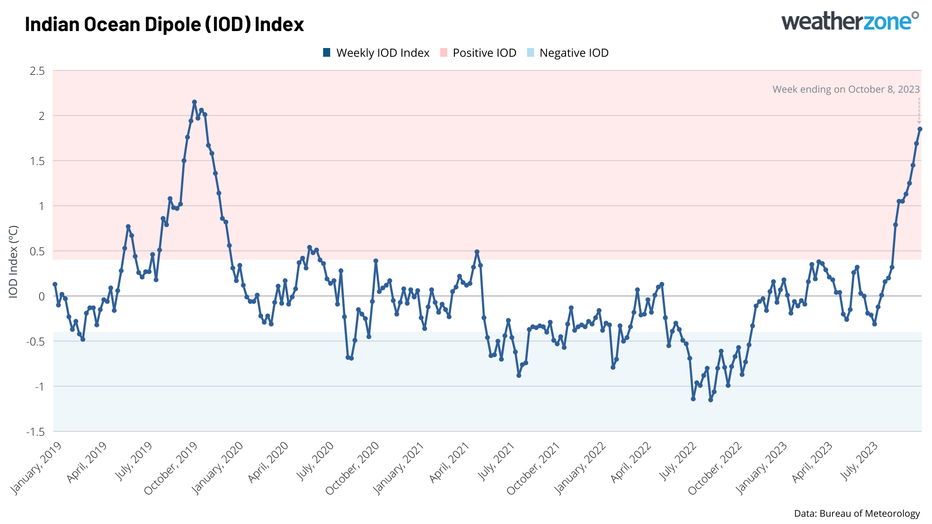
Image: Weekly IOD index since the beginning of 2019, showing similarities between the 2019 and 2023 positive IOD events.
According to monthly IOD data from the Bureau of Meteorology, 2019 was the strongest positive IOD on record. However, some other datasets suggest that it may have been rivalled by 2017. Either way, the fact that this year’s IOD is getting close to the 2019 event is cause of attention, as the IOD played a big role in making 2019 Australia’s warmest and driest year on record.
One important distinction to make between this year’s positive IOD and the 2019 event is that the antecedent conditions are very different. The 2019 positive IOD occurred at the tail end of a multi-year drought in Australia. By contrast, large areas of Australia saw abnormally wet weather in the last few years thanks to La Niña and negative IOD events.
Parts of 2019 were also influenced by prolonged negative Southern Annular Mode episodes, which further suppressed rainfall in some parts of the country. This is not happening in 2023.
So, while this year’s positive IOD bears some similarities to the 2019 event, it is not the only factor influencing Australia’s weather and climate this year.
What will the last few months of 2023 look like?
Most forecast models suggest the current IOD event will peak in October or November, before breaking down in early summer. The presence of this strong positive IOD increases the likelihood that large areas of Australia will see abnormally dry and warm weather during the second half of spring and possibly into early summer. This warm and dry influence will also be enhanced by El Niño in the coming months.
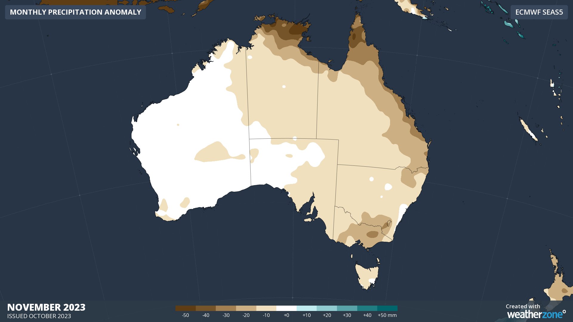
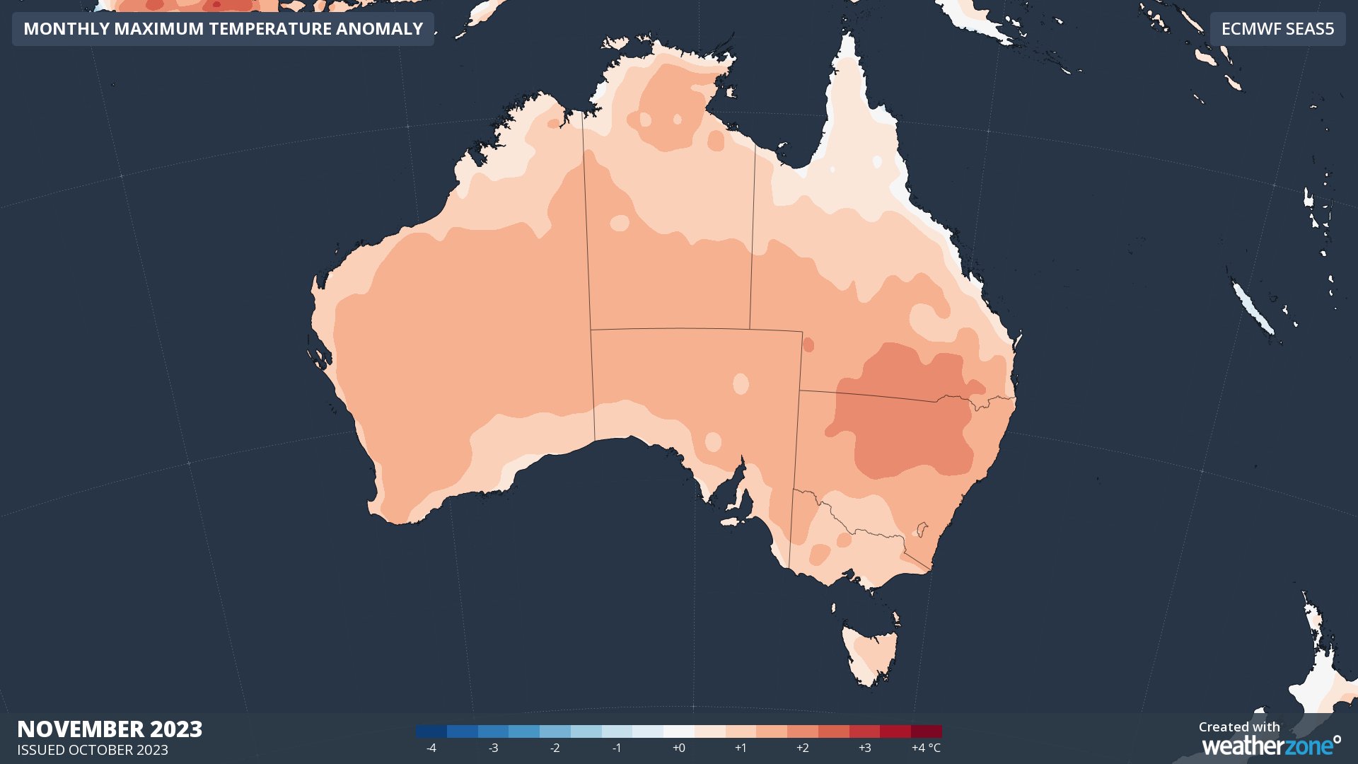
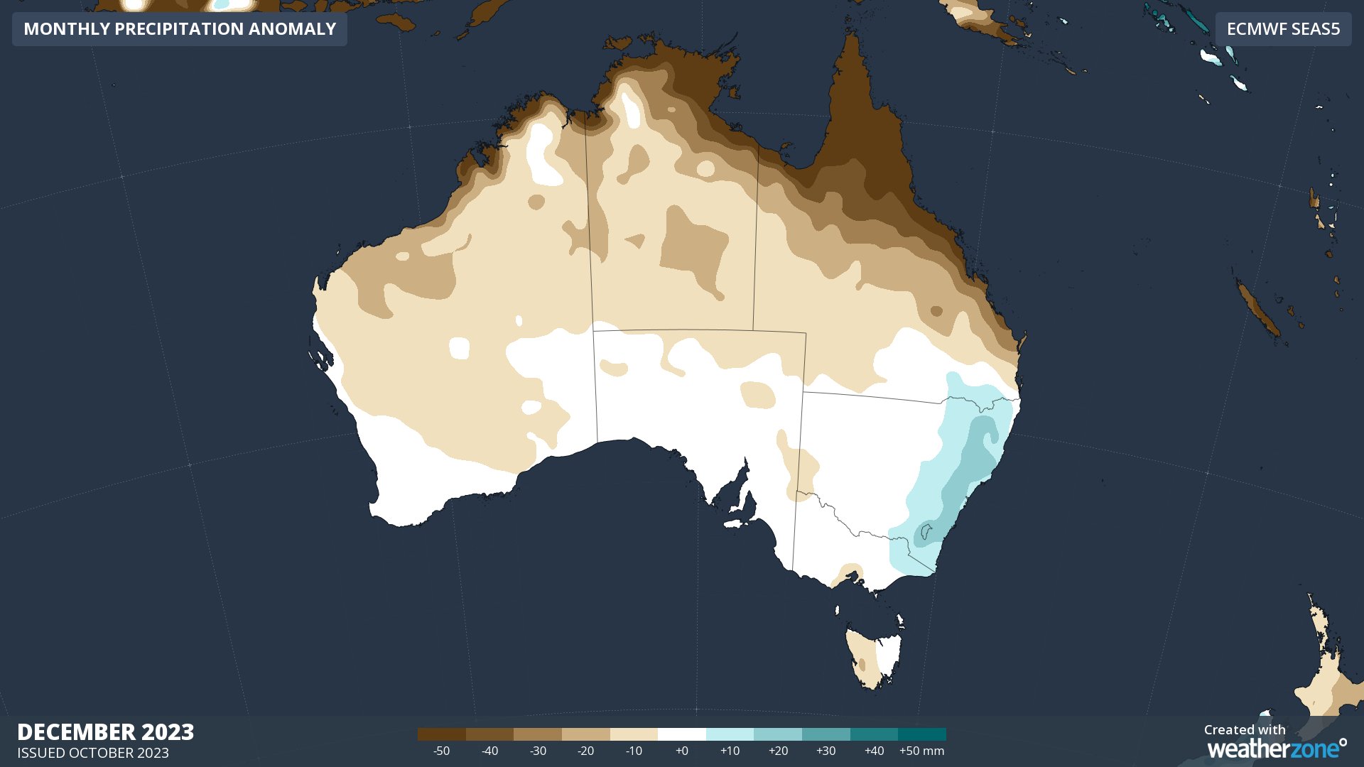
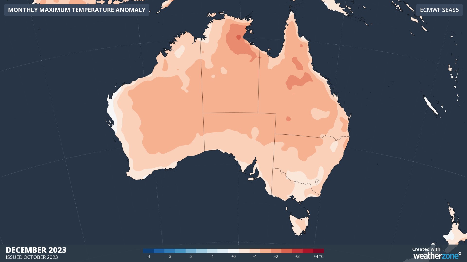
Images: Forecast rainfall and maximum temperature anomalies in Australia during November and December 2023.
If this warm and dry weather does eventuate, fire danger will also be increased across most states and territories as spring rolls into summer.
DTN APAC can provide tailored climate briefings to your business to alert you of the most likely weather conditions and hazards to look out for during the upcoming season. Now is a good time to get a good look at the forecast for summer and a look into 2024. To find out more or to book a presentation, please email apac.sales@dtn.com.




