
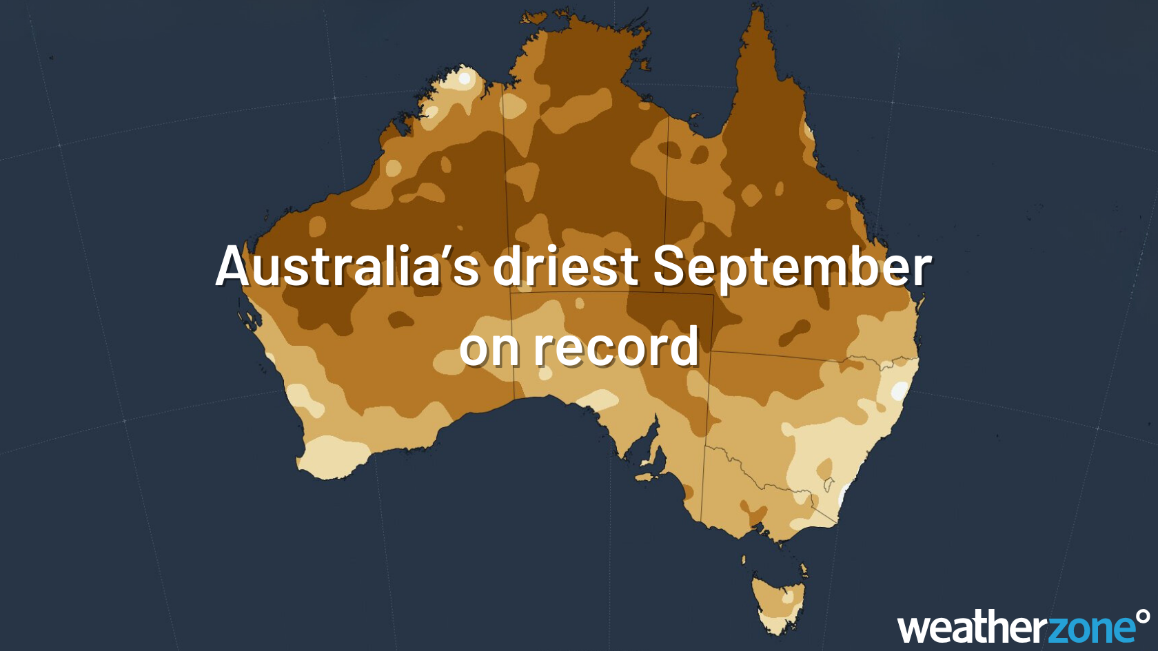
Australia has had its driest September on record, led by huge rainfall deficiencies in the Murray-Darling Basin. Most of the country was well above average for maximums too, with NSW, Victoria and WA setting new records.
Rainfall
Australia as a whole averaged a measly 4.8mm of rain during September, the lowest on record for September and one of the lowest monthly totals for any month, with records going back to 1900.
Victoria and the broader Murray-Darling Basin have missed the rain the most, with both regions recording their driest Septembers on record. Across the Murray-Darling Basin, rainfall averaged 5.6mm, just 16% of what would normally fall during the month.
Melbourne exemplified this, having its driest September in 168 years of rainfall records. Only 10.8mm fell in the gauge, just under the previous record of 12.0mm from 2008.
Elsewhere, NSW experienced its 2nd driest September on record, with much of the inland not seeing any rain at all, while both South Australia and the Northern Territory having their 7th driest Septembers.
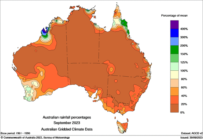
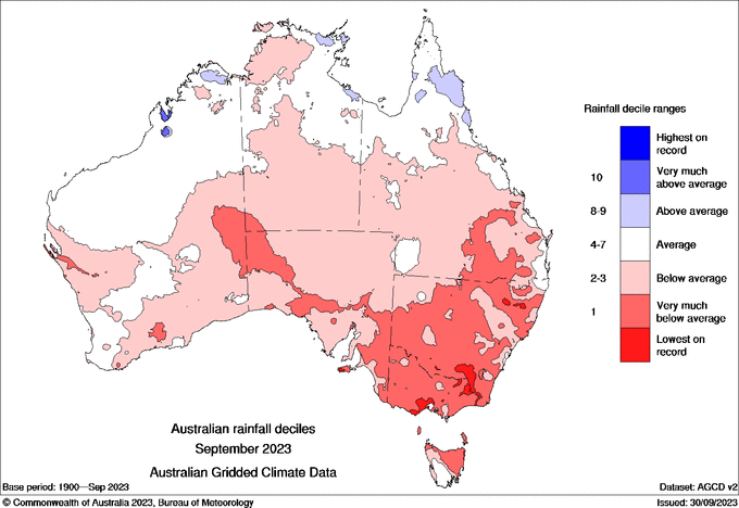
Image: Rainfall percentages (left) and rainfall deciles (right). Rainfall was well below average across Australia, with many locations through the inland seeing no rain at all.
Temperatures
Australia as a whole was 2.43°C above average for mean temperature (combines minimum and maximum temperatures), making it the 3rd highest on record, behind 2005 (+2.66°C) and 2013 (+2.86°C). Maximum temperatures were the 2nd warmest on record, while minimums were the 8th warmest.
Records were absolutely destroyed in Victoria, with maximums 3.77°C above average, nearly a full degree hotter than the previous hottest September of +2.78°C in 1944. Western Australia similarly smashed their record, with average daytime temperatures 3.54C above average, 0.75°C above the previous record from 2019. This was paired with WA’s hottest September for both minimums and mean temperatures on record.
NSW also had their hottest September on record, an insane +5.07°C hotter than average, beating the previous record of +4.73°C from 2013. Tasmania (+2.02°C) and South Australia (+4.76°C) had their 2nd hottest September maximums on record.
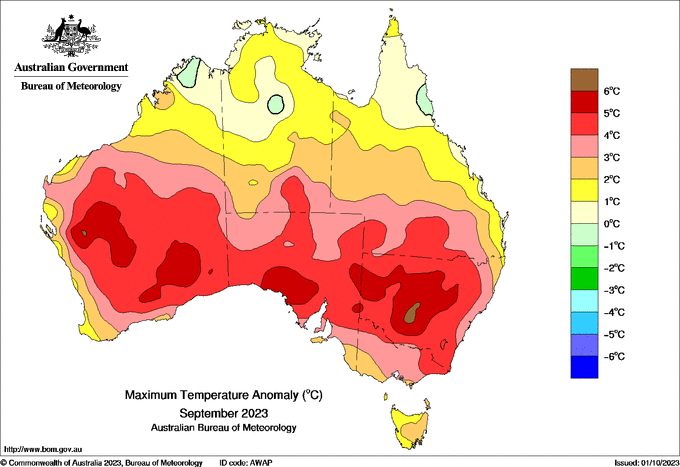
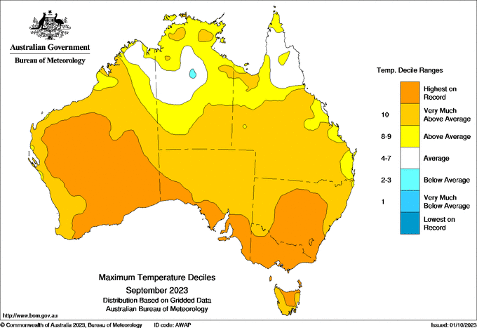
Image: Maximum temperature anomalies (left) and deciles (right) across Australia. Areas in red and dark orange respectively were over 4 degrees warmer than the climate average, and the hottest on record.
Most of the capital cities either broke or came near to breaking a monthly temperature record this month. It was the:
- Hottest September for maximum temperatures on record for Melbourne (20.1°C) and Canberra (20.9°C)
- Hottest September for mean temperature on record for Perth (17.2°C)
- 2nd hottest September maximum temperatures on record for Sydney (23.7°C), Hobart (17.5°C), and Adelaide (22.1°C)
Why was September so hot and dry?
Both El Niño and a positive Indian Ocean Dipole were declared last month. Both of these climate drivers increase the chances of hotter temperatures and drier than average rainfall. The positive IOD in particular has been rapidly gaining strength since August and could become one of the strongest events on record (2019 was the strongest).
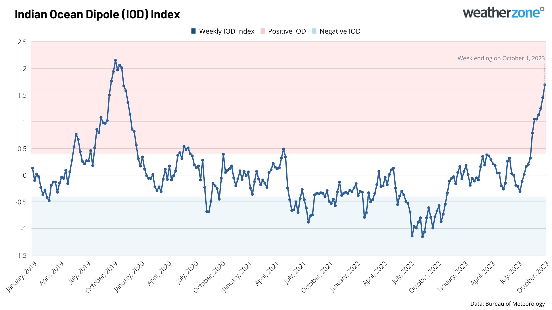
Image: IOD index values over the last few years. This positive IOD is starting to rival the strength of the strongest event on record in 2019. This was likely the most important driver for Australia’s dry and very warm September.
The Southern Annular Mode (SAM) also went through a very strong negative phase during the middle of the month, increasing westerly winds across the country. This regularly drew in hot, desert air over central and eastern states, leading to a record-breaking heatwave in the middle of the month.
Finally, Australia has continued the overall global trend of record-breaking hot temperatures occurring in 2023. This past month was likely the hottest September on record for the entire globe, as well as the hottest surface ocean temperatures on record for September. El Niño and climate change are the main culprits for this most recent trend.
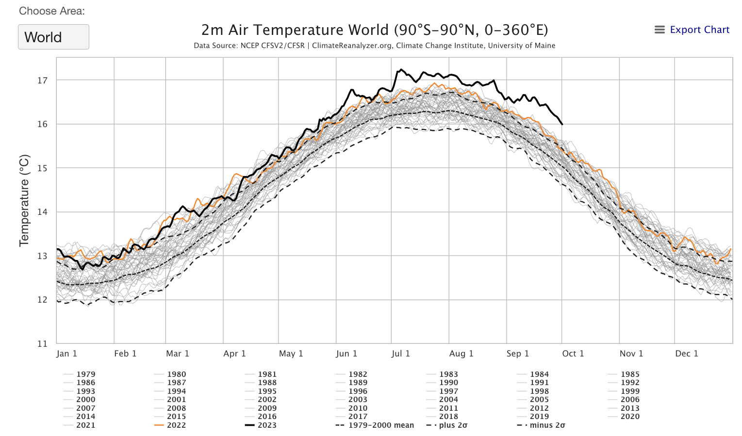
Image: Globally averaged 2m air temperatures, with 2023 in the dark black line, and 2022 in orange. Values have been above record levels consistently since June 2023, in line with the building El Niño. Source: University of Maine
What’s ahead?
With El Niño and a positive IOD now established, there will continue to be an overall trend of hotter and drier than average conditions for at least the rest of year. However, as seen from the forecast in the next few days, rain will fall over parts of the country as we enter the build-up season.
DTN APAC can provide tailored climate briefings to your business to alert you of the most likely weather conditions and hazards to look out for during the upcoming season. Now is a good time to get a good look at the forecast for summer and a look into 2024. To find out more or to book a presentation, please email apac.sales@dtn.com.




