
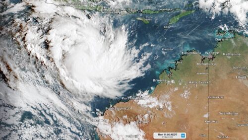
Tropical cyclone Charlotte developed to the northwest of Australia on Monday morning, becoming our eighth named cyclone so far this season. The satellite image below shows Charlotte sitting around 900km to the northwest of Port Hedland at 8am WST on Monday, March 21. The system is moving slowly to the southwest away from mainland […]
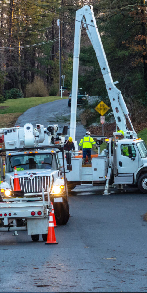
Recent weather events, such as tropical cyclones and record-breaking flooding, have once again brought into focus the resiliency of utilities. Even though utility companies are continually evaluating their grid systems and investing in resilience measures, weather events can cause power outages that last days, even weeks, across the country. For example, severe thunderstorms can […]

Parts of northern Australia could see a wet end to March as the Madden-Julian Oscillation (MJO) moves through the Australian region. The MJO is a pulse of increased cloudiness and rainfall that travels around the world near the equator every 30-60 days. The MJO has been weak and indiscernible in recent weeks, meaning it has […]

A highly regarded international long-range forecast model is hinting at the possibility of a third consecutive La Niña event later this year. But before getting too worried about the prospect of a triple-dip La Niña, there are a few reasons why this outlook should be taken with a grain of salt for now. First up, what […]

A satellite sitting 36,000 km above the ground has captured mesmerising images of the historic rain and flooding event that unfolded across eastern Australia during the last fortnight. The Himawari-8 satellite is a geostationary satellite that captures images of the atmosphere over Australia, every 10 minutes, throughout the day and night. This satellite, which […]

During the past week, heavy rainfall, gale force winds and flooding across eastern NSW caused significant disruptions across many rail networks. Flooding, landslides and trees on tracks all contributed to the delays or cancellations this week. Now, the NSW rail network have the challenging task of repairing track damage and clearing debris quickly so services […]

Perth is struggling to shake off the shackles of its record-breaking summer with the city enduring another bout of extreme heat this week. A West Coast Trough is drawing air from the interior towards Australia’s west coast this week, causing temperatures to soar in Perth. The city is expected to reach around 37ºC on […]

A powerful blast of gale force winds moved up the southern and central NSW coastline on Tuesday night and early Wednesday, impacting NSW port operations. The wild weather during the last 48 hours has been driven by an East Coast Low which has brought heavy rainfall, flooding, gale force winds and damaging surf to […]

It has been a challenging week across NSW airports with heavy rain, thunderstorms, strong winds and low cloud all impacting the aviation industry. This week’s heavy rainfall has been caused by another East Coast Low which developed in the early hours of Tuesday morning. This system caused heavy rainfall and flooding across Sydney’s […]

Australia’s tropical cyclone season is officially underway, but we may not see much activity for few months yet. The season runs from November to April, and for mining operators and businesses across northern Australia, 2026-27 is shaping up to be a season where the headline numbers and the real risk may not line up. On […]

A positive Indian Ocean Dipole is underway, but this one is unlikely to deliver the textbook dry spring and summer that businesses have come to expect from the pattern. The Bureau of Meteorology officially declared a positive IOD on Tuesday, October 27, which typically like El Niño can cause drier and warmer conditions over parts of […]

Waters off Indonesia have cooled in recent weeks, an indication that a positive Indian Ocean Dipole (IOD) event could be developing. It’s an important climate driver for Australia, and it could shape rainfall and temperatures heading into summer, with flow-on effects for farmers, energy and other industries. What is the Indian Ocean Dipole? The IOD […]

Leonora, WA, had its wettest September day on record earlier this month. Three weeks later, more than 1.3 million lightning pulses were detected within 800 km of the town in 48 hours. Why is a stalled trough delivering storms to mining country, and what it could mean for operations? The DTN Total Lightning Network detected […]
