
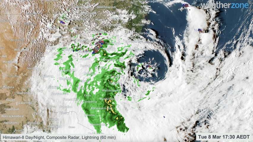
A satellite sitting 36,000 km above the ground has captured mesmerising images of the historic rain and flooding event that unfolded across eastern Australia during the last fortnight.
The Himawari-8 satellite is a geostationary satellite that captures images of the atmosphere over Australia, every 10 minutes, throughout the day and night.
This satellite, which is operated by the Japan Meteorological Agency, has the best seat in the house when it comes to watching weather events unfolding across the Australian region.
Fortunately, we can see this show as well by stitching the Himiwari-8 satellite images together after a weather event.
The animation below shows a sequence of combined visible (day) and infrared (night) satellite images over the eight-day period between Tuesday, February 22 and Tuesday March 1.
The clip above shows the development of the first phase in the past fortnight’s rain and flooding event, which involved an upper-level low passing over eastern Australia as an atmospheric river drove thick clouds and heavy rain into southeast QLD and eastern NSW.
The video below shows enhanced water vapour images over the same period as the previous clip.
Water vapour satellite imagery helps revel where moisture is locatd in the atmosphere. In the animation above, the blue, white and pink colours show regions of the atmosphere that have higher concentrations of water vapour in the atmosphere, while black and brown/orange colours indicate drier air.
The clip below shows the second phase of this weather event, which involved a second upper-level low helping to drive more heavy rain into eastern NSW.
This second phase of the event caused major flooding near Sydney and more flooding and landslides up and down the state’s east coast and ranges.
The videos featured in this article have documented a record-breaking weather event. But while the clouds looked spectacular from above, the severe weather they caused on the ground had a devastating impact. For more information, please contact us at apac.sales@dtn.com.




