

A burst of late-season heat in NSW today could see Sydney reach 38ºC for the first time in more than 800 days, while hot and dry winds fan dozens of fires across the state. A low pressure trough passing over NSW on Monday is causing hot and dry northwesterly winds to flow across central and […]

Two tropical cyclones spinning off Australia’s east coast are about to play an epic game of follow-the-leader that could last for several days and cover a distance of close to 5000 km. The satellite animation below shows tropical cyclones Judy and Kevin located over the Soutwest Pacific Ocean on Thursday morning, just over 1500 km […]

Parts of Australia could be at risk of a flash drought in 2023, with growing signs that El Niño may develop in the Pacific Ocean later this year. The current La Niña event, which underpinned record-breaking rain and flooding in eastern Australia last year, is about to end. This can be said with confidence […]

Large areas of Australia could be in for an unusually dry and warm autumn as La Niña loses its grip on our weather. The latest seasonal outlook from the Bureau of Meteorology shows significant potential for below average rain and above average daytime temperatures for most of Australia this autumn. Images: Chance of exceeding the […]

Eastern NSW is in for plenty of severe thunderstorms on Monday afternoon as warmth, humidity and instability all collide along the ranges. Heat is being drawn ahead of a southerly change that is making its way up the coast. Temperatures are expected to peak in the mid-to-high 30’s for the northern half of the […]

Tropical Cyclone Freddy has made landfall near Vilankulos, Mozambique. Although the system is weakening it will continue to cause heavy rainfall leading to flooding for parts of Mozambique and Zimbabwe. Image: Infrared satellite imagery at 00:40 UTC February 25th. Source: EUMETSAT. Wind gusts exceeding 90km/h should continue for the next 24 hours but weaken beyond […]

An abundance of drying vegetation off the back of three consecutive La Niña events could fuel record-challenging grass fires across Australia later this year, warns a former Commissioner of Fire and Rescue NSW. Unprecedented rain and flooding in recent years, fuelled by three back-to-back La Niña events, has created a boom in vegetation growth across […]
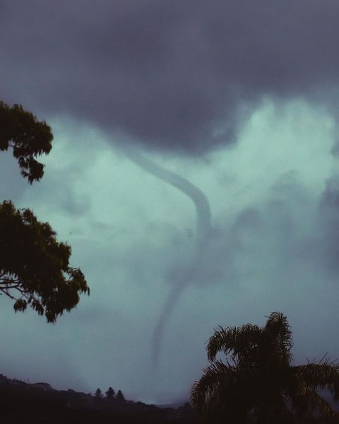
A barrage of rain and intense thunderstorms swept over Sydney and surrounding areas of central eastern NSW on Tuesday night, triggering flash flooding, damaging winds and even a waterspout. Heavy rain and storms developed near a southerly change that swept up the NSW coast on Tuesday, forced warm and humid air to rise into the […]

A roll cloud has been spotted following the East Australia Current (EAC) down the NSW coast this morning, making use of near–record high ocean temperatures. The EAC is one of the world’s major warm water ocean currents that transports water from the equator to the Southern Ocean. Made famous by the movie “Finding Nemo”, […]

Australia’s tropical cyclone season is officially underway, but we may not see much activity for few months yet. The season runs from November to April, and for mining operators and businesses across northern Australia, 2026-27 is shaping up to be a season where the headline numbers and the real risk may not line up. On […]

A positive Indian Ocean Dipole is underway, but this one is unlikely to deliver the textbook dry spring and summer that businesses have come to expect from the pattern. The Bureau of Meteorology officially declared a positive IOD on Tuesday, October 27, which typically like El Niño can cause drier and warmer conditions over parts of […]

Waters off Indonesia have cooled in recent weeks, an indication that a positive Indian Ocean Dipole (IOD) event could be developing. It’s an important climate driver for Australia, and it could shape rainfall and temperatures heading into summer, with flow-on effects for farmers, energy and other industries. What is the Indian Ocean Dipole? The IOD […]

Leonora, WA, had its wettest September day on record earlier this month. Three weeks later, more than 1.3 million lightning pulses were detected within 800 km of the town in 48 hours. Why is a stalled trough delivering storms to mining country, and what it could mean for operations? The DTN Total Lightning Network detected […]
