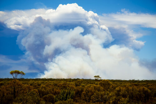
Single lightning strike sparked bushfire near Perth
A lone lightning strike from a tiny storm on Friday was all it took to start an intense blaze near Serpentine on Friday, serving as a reminder as to the danger thunderstorms can pose. Image: A single cloud-to-ground lightning strike (circled in red) recorded on Friday afternoon near Serpentine Main Dam from the Total Lightning […]
Western Australia’s driest October on record
It was dry across Australia in October, but Western Australia did it tougher than the rest, with its driest October on record. Nationally, it was Australia’s 5th-driest October since national records began to be kept in 1900. It was also the 5th-driest October in South Australia, the 6th-driest in the Northern Territory, and the […]
‘Australia’s hottest place’ almost 6 degrees above average in October
Onslow, a coastal town in Western Australia’s Pilbara region with a population of around 900, holds half of a significant Australian heat record – equalling Australia’s highest recorded temperature when the mercury reached a searing 50.7°C in January 2022. On average, Onslow is not quite as hot as several other WA towns such as Marble […]
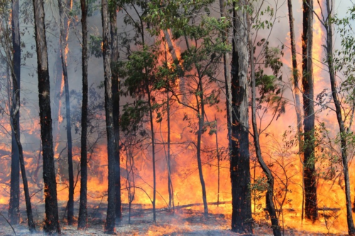
Extreme fire danger returns to NSW, Qld
Firefighters in Qld and NSW will continue to face challenging conditions over the next two days amid another burst of hot, dry and windy weather. A cold front crossing southeastern Australia on Monday and Tuesday will cause a tongue of hot and dry air to sweep across NSW and Qld. This heat will be […]
An extremely dry season, even by Darwin standards
We all know that Darwin experiences an extended dry season through the middle months of the year, but the 2023 dry season was a lot drier than most. Indeed, Darwin received a grand total of no rainfall in this year’s dry season, which officially runs from May through September according to the BoM. Darwin […]
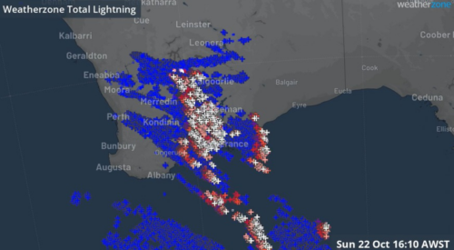
WA skies sizzle with quarter of a million lightning strikes
There were “striking” scenes in the skies above the southwest of Western Australia on Sunday afternoon, as a quarter of a million lightning strikes sparked a spectacular sky show. The awesome natural fireworks display was caused by a trough moving through the area, with significantly cooler air behind the warm airmass east of the […]
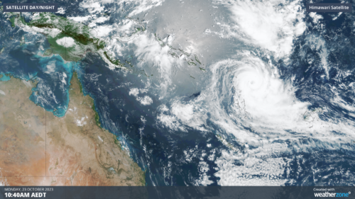
Tropical Cyclone Lola gaining strength near Vanuatu
The first tropical cyclone to form near the Australian region this season is about to unleash a burst of severe weather in Vanuatu. Tropical Cyclone Lola formed to the northeast of Vanuatu on Sunday. As it developed outside the eastern boundary of Australia’s area of responsibility, Lola was named by the Fiji Meteorological Service. Lola […]
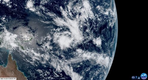
High chance of a tropical cyclone next week
The first tropical cyclone of the season is likely to form early next week near the Solomon Islands and could move into Australian waters. A tropical low-pressure system developed to the east of the Solomon Islands on Friday morning and has been named Tropical Low 01U by the Bureau of Meteorology. The […]
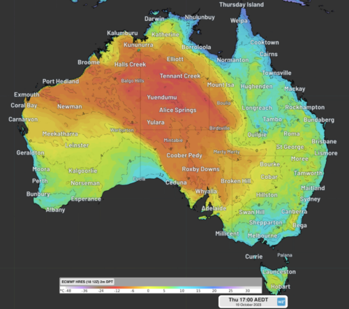
Bone dry air to increase fire danger in the east
A remarkably dry airmass over central Australia will move east over the next 72 hours, bringing dangerous fire weather to NSW over the weekend. The map below shows the parched air sitting over parts of WA, the NT, SA and Qld on Thursday morning. Image: 2m Dewpoint and 10 metre wind observations at 9:30am […]