
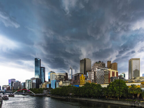
It is going to be a wild day for parts of southeastern Australia, with severe heat, catastrophic fire danger, severe thunderstorms, blustery winds and a welcome cool change all on the forecast. This dangerous mix of weather is being generated by a strong cold front, which will sweep across the region on Tuesday. A […]
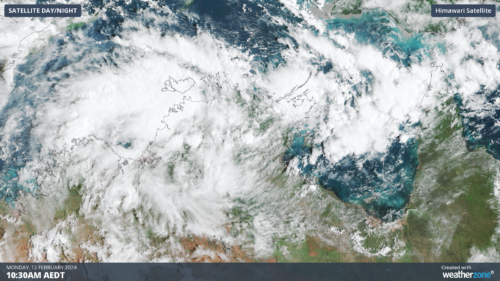
Darwin has had its wettest day in 7 years as a tropical low builds strength in the Top End and could become a tropical cyclone later this week. Over the last 36 hours, a tropical low has been building over the western Top End. Last night, the low strengthened enough to incorporate cross-equatorial winds from […]
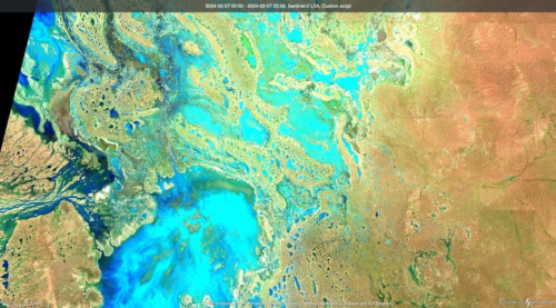
Satellites have captured images of floodwaters filling rivers and lakes in southwest Qld and northwest NSW, following heavy rain from ex-Tropical Cyclone Kirrily. Clouds, rain and thunderstorms have been a persistent feature over Australia’s eastern inland during the last fortnight. This late-summer soaking was caused by the overland journey of ex-Tropical Cyclone Kirrily, which made […]
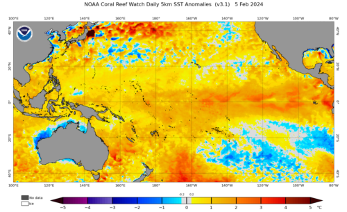
The oceans off the NSW and Qld coast are extremely warm and theoretically could provide enough energy to bring a tropical cyclone into NSW waters. The map below shows that the temperatures off the Coffs Coast and north are currently above 26.5 °C, which is 2-3°C above average for this time of year. […]
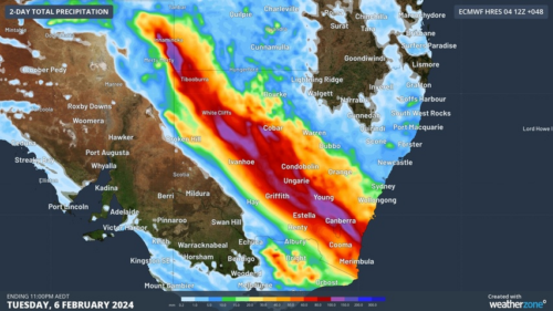
The low pressure system formerly known as Tropical Cyclone Kirrily continues to cause heavy rain, thunderstorms and flooding over Australia’s eastern outback, more than 10 days after it made landfall. Tropical Cyclone Kirrily crossed Qld’s North Tropical Coast on the night of Thursday, January 25, making landfall as a category two system just north of […]
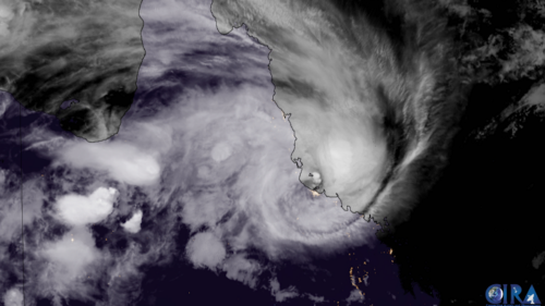
Some weather models are hinting at the possibility of yet another tropical cyclone, after Jasper and Kirrily, to develop in the Coral Sea and make landfall over the Queensland coast. But how likely is this to happen at this stage? Thumbnail image: Severe Tropical Cyclone Kirrily at landfall. Source: Cooperative Institute for Research in the Atmosphere […]

A weather balloon has uncovered the record water vapour levels over Brisbane, as heavy rain pours over southeast Qld. The balloon was released on Monday night, measuring the atmospheric pressure, temperature, humidity and wind speed at different heights in the atmosphere. It found that the column above Brisbane airport contained 73.5mm of precipitable water, […]

Heavy and intense rainfall is forecast across southeast Qld in the next 72 hours, bringing hundreds of millimetres to the region. The satellite image below shows thick cloud over Qld and northeast NSW on Monday afternoon. Image: Himawarri-9 satellite image at 1pm AEST on Monday, January 29. A coastal trough is expected to […]
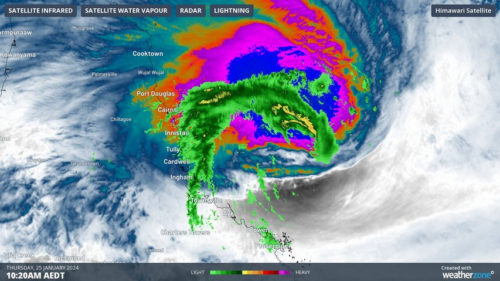
Tropical Cyclone Kirrily was declared on Wednesday evening and will cross the Queensland coast on Thursday evening. The most likely time of landfall is around 8 pm AEST, although it could occur anytime between about 6 pm and midnight. The most likely location for landfall is just north of Townsville around Magnetic Island although the […]

Australia’s tropical cyclone season is officially underway, but we may not see much activity for few months yet. The season runs from November to April, and for mining operators and businesses across northern Australia, 2026-27 is shaping up to be a season where the headline numbers and the real risk may not line up. On […]

A positive Indian Ocean Dipole is underway, but this one is unlikely to deliver the textbook dry spring and summer that businesses have come to expect from the pattern. The Bureau of Meteorology officially declared a positive IOD on Tuesday, October 27, which typically like El Niño can cause drier and warmer conditions over parts of […]

Waters off Indonesia have cooled in recent weeks, an indication that a positive Indian Ocean Dipole (IOD) event could be developing. It’s an important climate driver for Australia, and it could shape rainfall and temperatures heading into summer, with flow-on effects for farmers, energy and other industries. What is the Indian Ocean Dipole? The IOD […]

Leonora, WA, had its wettest September day on record earlier this month. Three weeks later, more than 1.3 million lightning pulses were detected within 800 km of the town in 48 hours. Why is a stalled trough delivering storms to mining country, and what it could mean for operations? The DTN Total Lightning Network detected […]
