
Some weather models are hinting at the possibility of yet another tropical cyclone, after Jasper and Kirrily, to develop in the Coral Sea and make landfall over the Queensland coast. But how likely is this to happen at this stage?
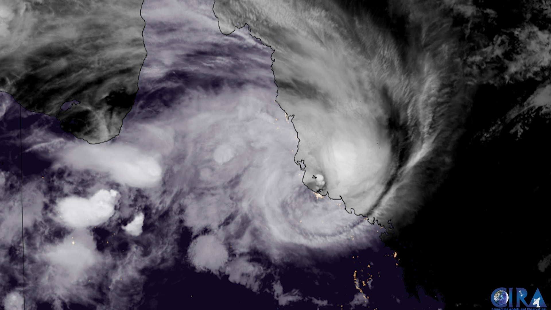
Thumbnail image: Severe Tropical Cyclone Kirrily at landfall. Source: Cooperative Institute for Research in the Atmosphere at Colorado State University
Queensland has borne the brunt of two tropical cyclones over the last two months:
- Tropical Cyclone Jasper in mid-December delivered record-breaking rainfall and flooding to Far North Queensland, including 2252mm over 7 days at Baird.
- Severe Tropical Cyclone Kirrily brought wind gusts of 142km/h, cut the power to about 50,000 residents in and around Townsville, and is still delivering heavy rain to northwestern Queensland.
The next low pressure system to look out formed yesterday near K’gari (formerly Fraser Island) from the coastal trough that dumped intense rainfall over southeast Queensland. However, this low is not like the typical tropical low we look out for cyclogenesis. Because it formed so far south, it is classified as a sub-tropical low, so it has some extra work to do before it can become a tropical cyclone.
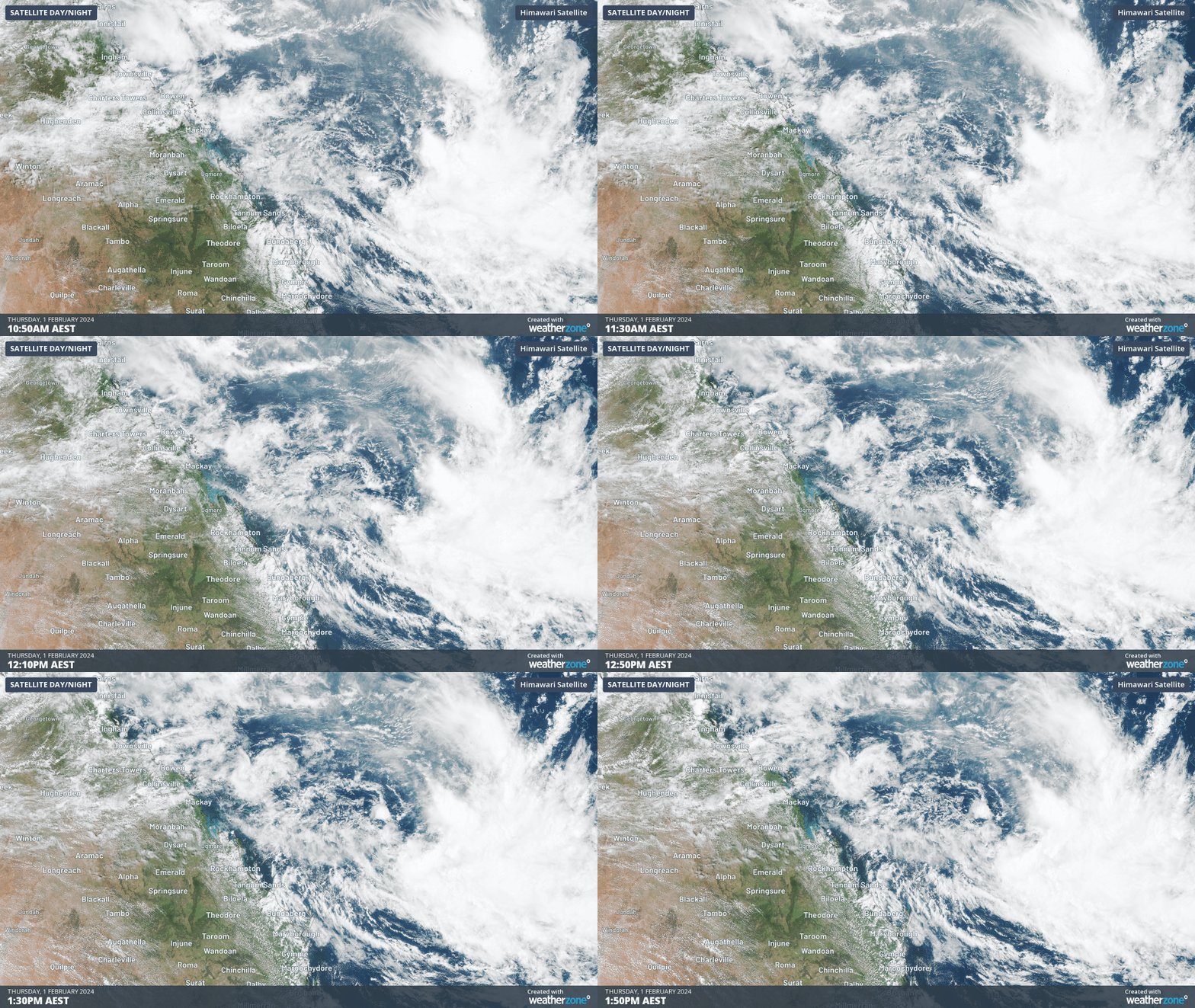
Image: Satellite of the sub-tropical low off the Queensland coast. This system is tracking to the north and will likely linger in the Coral Sea for several days.
A sub-tropical low has characteristics of both a tropical low and an extratropical low (the typical low pressure system with a cold and warm front). Some of the big transitions this system will have to have happen if it is to become a tropical cyclone are:
- Warm core centre: the centre of a tropical cyclone is warmer than the air around it, while in nearly all extratropical lows, the centre is colder. This system has already nearly completed this process, as warmer air is pushed into its centre as it moves north
- Change of primary energy source: Extratropical cyclones are powered by baroclinic instability: the temperature difference between the hot and cold air that make them up (this is what makes the cold and warm fronts). Tropical cyclones on the other hand are powered by hot oceans. This system will need to transition between the two energy source types.
- Flush out cold and dry air: This might be the biggest barrier to becoming a tropical cyclone. At the moment, cooler and dry air is wrapped into the sub-tropical low. A tropical cyclone requires clouds wrapped all the way around the system to support its convection and growth.
- Consolidation of the low: This sub-tropical low is very large, while most tropical cyclones often start their life as much smaller systems. This is because it takes a progressively more energy to spin-up a system the larger it is (see Tropical Cyclone Kirrily struggling to develop over Coral Sea). For this system to develop any further, a smaller region of convection is most likely needed for the system to develop into a tropical cyclone.
All of this is a tall order for a sub-tropical low to do in order to become a tropical cyclone. However, it does have time on its side. Models suggest this system will spend at least a week sitting over warm tropical waters in the northern Coral Sea. Most likely this system will bring direct impacts to New Caledonia and maybe Vanuatu, before it tracks west back towards the Queensland coast.
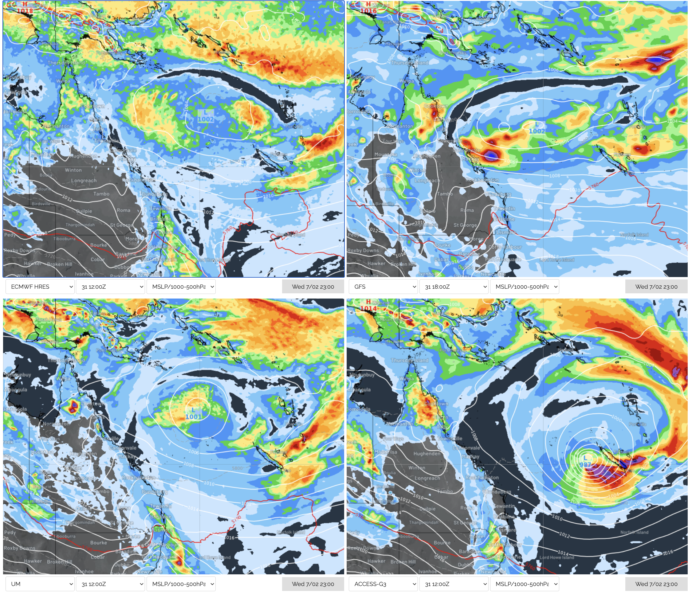
Image: ECMWF (top-left), GFS (top-right), UKMO (bottom-left) and Access-G (bottom-right) forecasts for Wednesday 7th 11pm. Only Access-G has this system at tropical cyclone strength at this timestep.
At this stage, there is enough uncertainty to take the forecast of a tropical cyclone with a large grain of salt. Its best to be aware but not alarmed about this system. If the system does show signs of developing into a tropical cyclone, we keep you updated on the Weatherzone News Feed.
DTN APAC has a suite of tropical cyclones services we provide to deliver our clients with as much forewarning of tropical cyclones as we can. We have 4 levels of forecasts timeframes:
- Tropical cyclone seasonal outlooks
- Weekly tropical update
- Daily 7-day tropical cyclone forecast
- Detailed tropical cyclone impacts (issued every 1-6 hours aligning with offical advisories)
Through these products you can have as much preparation as possible for tropical cyclones and their impacts. To find out more, please visit our website or email us at apac.sales@dtn.com.




