
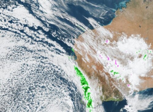
A deep low pressure system and associated front and trough will generate widespread damaging winds and locally destructive wind gusts across parts of southern WA today, with the potential for severe thunderstorms to develop during the afternoon. The cold front crossed the coast earlier this morning causing temperatures to plummet and delivering widespread rainfall totals […]

A negative phase of the Southern Annular Mode (SAM) has developed in the Southern Hemisphere and it’s going to influence weather patterns in the Southern Hemisphere, including the Australian region, in the opening week of October. What is the Southern Annular Mode? The SAM is an index that monitors the position of the westerly winds […]
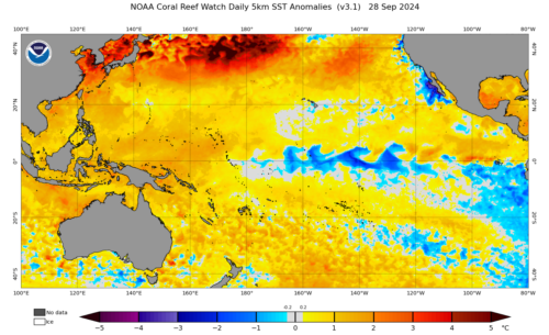
A clear La Niña signal is starting to emerge in the central Pacific Ocean, however the declaration of La Niña depends on a few factors that are still a coin flip chance of occurring. What is La Niña? La Niña is the cool phase of the El Niño Southern Oscillation (ENSO) that occurs when cooler […]
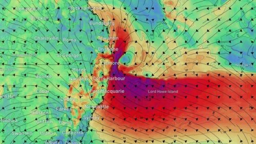
A burst of heavy rain and blustery winds will continue to batter eastern NSW over the next three days, with the state’s northeast coast set to see a particularly dangerous mix of rain, wind and surf on Friday and Saturday. An upper-level trough interacting with a feed of tropical moisture caused rain to spread across […]
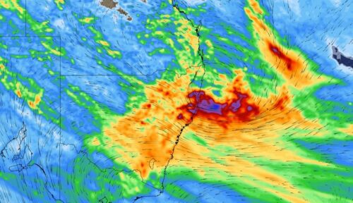
There are growing signs that heavy rain and potentially damaging winds will impact parts of eastern NSW later this week, while some other parts of the state could see unexpected low-level snow on Thursday. An upper-level cut-off low pressure system is expected to drift over NSW from Thursday and linger over eastern Australia for several […]
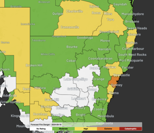
Sydney and the Illawarra will experience an early-season spike in fire danger ratings on Wednesday and Thursday as a burst of warm, dry and windy weather hits eastern NSW. While the start of this week was abnormally cold in Sydney and surrounding areas, temperatures will climb quickly over the next couple of days as warmer […]

This spring is shaping up to be an unusually warm and stormy season for Australia, with some parts of the country also likely to see an increased risk of fires. Australia has entered spring off the back of its warmest August and second warmest winter on record. The end of winter was also very dry […]
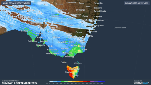
Yet another cold front will bring renewed potential for moderate flooding in Tas and damaging winds, high fire danger and well above average temperatures to southeastern states in the next 48 hours. The satellite image below shows the cold front and associated rain and cloud approaching SA, Vic and Tas on Friday morning. Image: […]
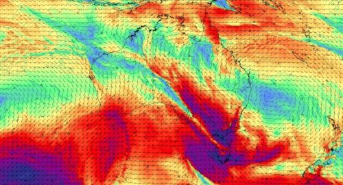
Another surge of powerful winds will spread across Australia’s southeastern states over the next two days, prompting warnings for damaging wind gusts in parts of Victoria, NSW and the ACT. A vigorous northwesterly airstream and embedded cold fronts will cause damaging winds, rain and thunderstorms over southeastern Australia on Thursday and Friday. While this system […]

Australia’s tropical cyclone season is officially underway, but we may not see much activity for few months yet. The season runs from November to April, and for mining operators and businesses across northern Australia, 2026-27 is shaping up to be a season where the headline numbers and the real risk may not line up. On […]

A positive Indian Ocean Dipole is underway, but this one is unlikely to deliver the textbook dry spring and summer that businesses have come to expect from the pattern. The Bureau of Meteorology officially declared a positive IOD on Tuesday, October 27, which typically like El Niño can cause drier and warmer conditions over parts of […]

Waters off Indonesia have cooled in recent weeks, an indication that a positive Indian Ocean Dipole (IOD) event could be developing. It’s an important climate driver for Australia, and it could shape rainfall and temperatures heading into summer, with flow-on effects for farmers, energy and other industries. What is the Indian Ocean Dipole? The IOD […]

Leonora, WA, had its wettest September day on record earlier this month. Three weeks later, more than 1.3 million lightning pulses were detected within 800 km of the town in 48 hours. Why is a stalled trough delivering storms to mining country, and what it could mean for operations? The DTN Total Lightning Network detected […]
