
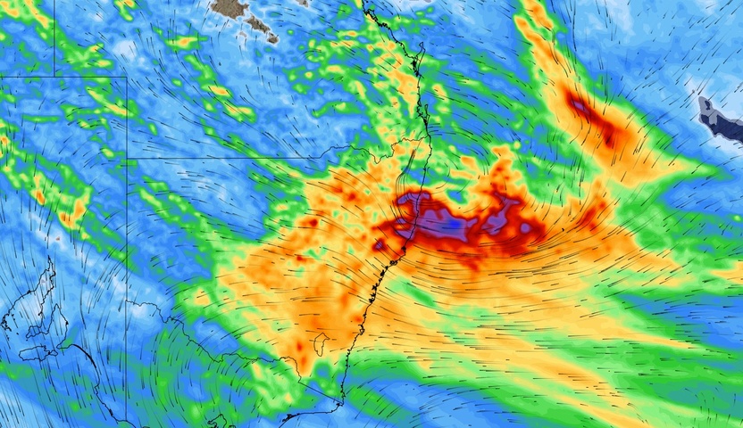
There are growing signs that heavy rain and potentially damaging winds will impact parts of eastern NSW later this week, while some other parts of the state could see unexpected low-level snow on Thursday.
An upper-level cut-off low pressure system is expected to drift over NSW from Thursday and linger over eastern Australia for several days. This slow-moving upper-level feature should cause a low pressure system or trough to develop at the surface near the NSW coast, leading to a 3-day period of increased rain, wind and swell from Thursday to Saturday.
There is some uncertainty regarding the strength and position of the low pressure system later this week, which makes it difficult to accurately predict its impacts. At this stage, there is enough model consensus to suggest that the heaviest rain, strongest winds and largest waves will probably occur along the Mid North Coast and possibly in parts of the Hunter or Northern Rivers districts.
The maps below show how much rain three different computer models are predicting during the next seven days, with most of this rain expected to fall before the end of this week.
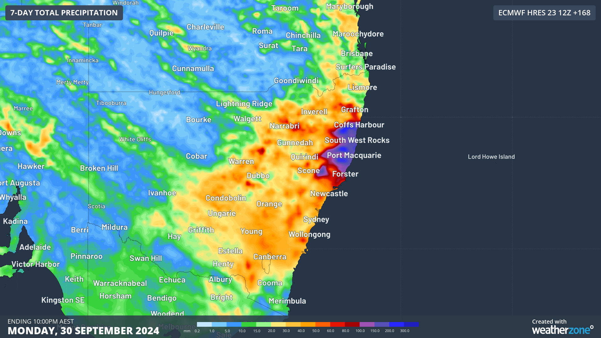
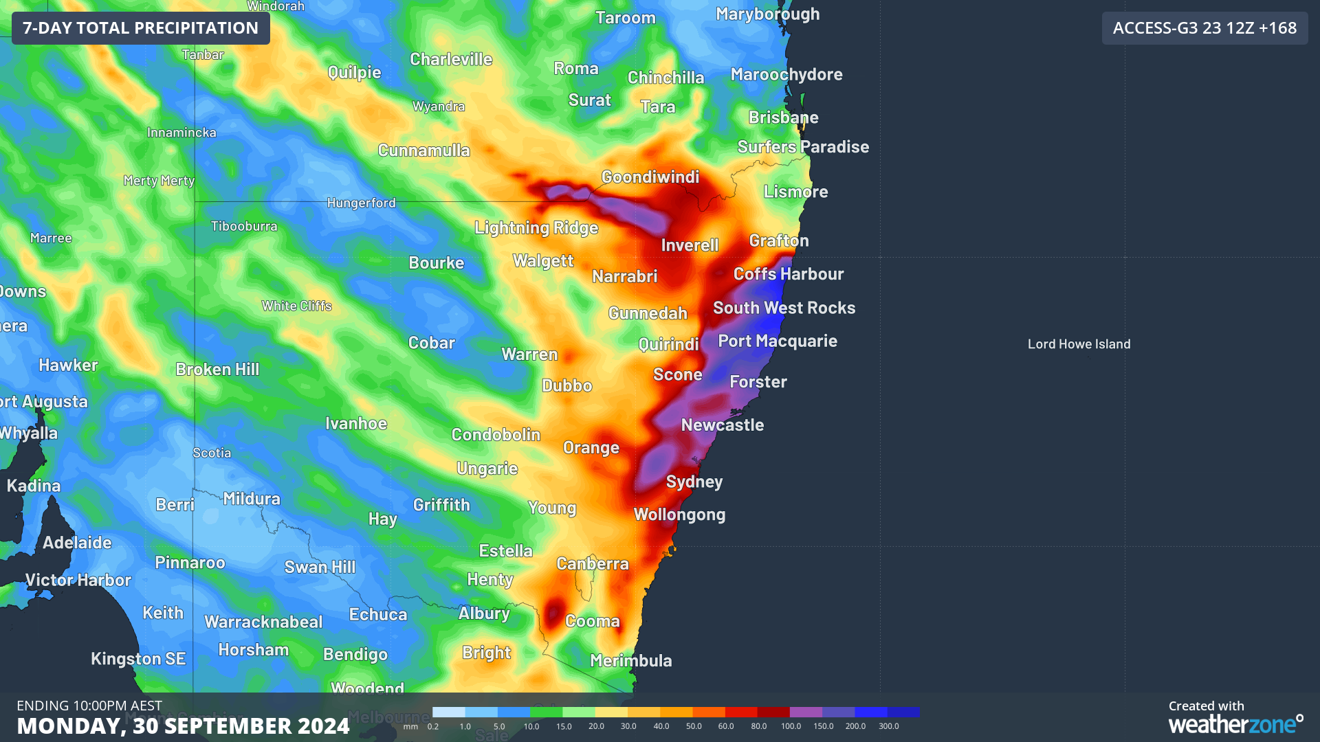
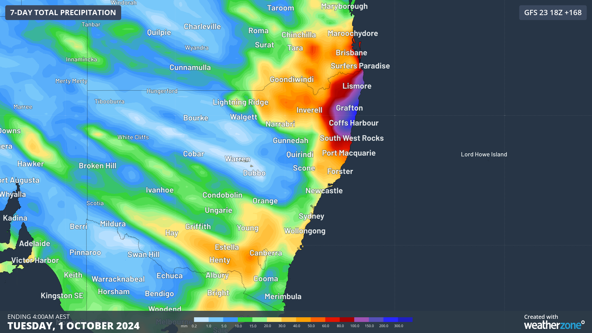
Images: Forecast accumulated rain during the next seven days (starting Tuesday) from three different computer models.
While there is noticeable disagreement in the location of the heaviest rain in the images above, all three models are predicting localised rainfall totals of more than 200 mm from this system. This would be enough rain to cause flash flooding.
Blustery south to southeasterly winds will also batter the NSW coast from Thursday to Saturday, with damaging gusts possible in some areas, particularly near the low pressure system.
Another interesting aspect of this weather system will be the potential for unexpected snow in parts of southern and central NSW. The combination of persistent precipitation, a saturated atmosphere and cold air could allow a phenomenon called the ‘melting effect’ to cause snow to reach low levels in southern NSW on Thursday. There is even a chance of snow in parts of the Central Tablelands if the precipitation is persistent enough on Thursday.
The melting effect occurs when snow falling into a warmer layer of atmosphere melts but doesn’t evaporate. This transition from ice to water extracts heat from the surrounding environment, which cools the air and allows other snowflakes to fall further before melting. If this melting effect is allowed to persist for hours, it can lower the snow level by hundreds of metres.
More reliable forecast information will become available in the coming days and warnings will be issued later in the week where necessary. Stay up to date with the latest forecasts and warnings in your area for the most accurate information on this developing system.
DTN APAC, a DTN company, specialises in building tailored weather monitoring and alerting solutions. These provide heightened visibility, guiding you to plan and respond effectively when adverse weather threatens transport operations. Our weather insights, including flood and fire proximity alerts, warn you of potential and real-time hazardous weather affecting water, rail and road conditions.
Your control interface delivers centralised services, password protected for your personnel. It’s purpose-built to meet your unique specifications, delivering easy-to-visualise critical intelligence that is scalable. Industry-leading lightning detection, GIS storm tracking, nowcasting, forecasting and severe conditions alerting are the foundation of the weather API. You then have the option to layer additional premium solutions to meet your unique requirements.
Leverage our comprehensive weather data to inform your route planning, minimise delays where possible, and mitigate the disruptive effects of severe weather events. For more information, please visit our website or email us at apac.sales@dtn.com.




