
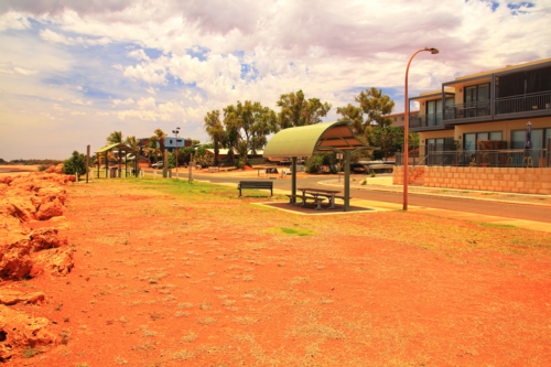
Onslow, a coastal town in Western Australia’s Pilbara region with a population of around 900, holds half of a significant Australian heat record – equalling Australia’s highest recorded temperature when the mercury reached a searing 50.7°C in January 2022. On average, Onslow is not quite as hot as several other WA towns such as Marble […]
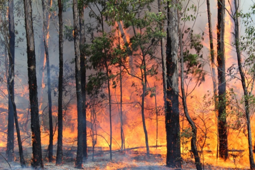
Firefighters in Qld and NSW will continue to face challenging conditions over the next two days amid another burst of hot, dry and windy weather. A cold front crossing southeastern Australia on Monday and Tuesday will cause a tongue of hot and dry air to sweep across NSW and Qld. This heat will be […]

An unseasonably cold blast is sweeping across southeastern Australia, bringing a mixed bag of snow, hail, thunderstorms and rain to the region. The cool air spread through the southeast on Wednesday behind a strong cold front that is now sitting in the Tasman Sea. The image below shows forecast air temperatures around 1.5km above sea […]
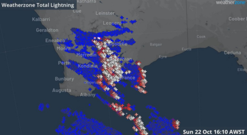
There were “striking” scenes in the skies above the southwest of Western Australia on Sunday afternoon, as a quarter of a million lightning strikes sparked a spectacular sky show. The awesome natural fireworks display was caused by a trough moving through the area, with significantly cooler air behind the warm airmass east of the […]
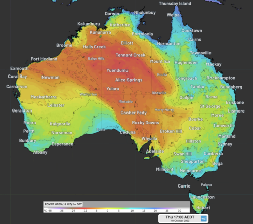
A remarkably dry airmass over central Australia will move east over the next 72 hours, bringing dangerous fire weather to NSW over the weekend. The map below shows the parched air sitting over parts of WA, the NT, SA and Qld on Thursday morning. Image: 2m Dewpoint and 10 metre wind observations at 9:30am […]

A frigid airmass will move across southeastern Australia late this week, dropping temperatures and some snow on the alpine peaks. A strong cold front will sweep across the region on Sunday and Monday, leaving a cool airmass in its wake. The image below shows forecast air temperatures around 1.5km above sea level on […]

Hot, dry and windy weather is elevating bushfires & fire danger across parts of NSW on Thursday, ahead of a cool and fierce southerly change. Maximum temperatures across parts of the state are expected to be 5-10°C above the October average, with temperatures climbing into the mid 30’s. The hot airmass has been dragged […]

A cold front is about to cause damaging winds, showers and thunderstorms in parts of Victoria, NSW and the ACT. The satellite images below show a cold front and associated low pressure system moving over the Great Australian Bight on Wednesday morning. This system will continue to move towards the east over the next 48 […]
This year’s positive Indian Ocean Dipole is gaining strength so quickly that it’s getting close to the record-challenging 2019 event that underpinned Australia’s warmest and driest year on record. While the Pacific Ocean’s El Niño has been getting a lot of attention in recent months, its lesser-known cousin – the Indian Ocean Dipole (IOD) – […]

Australia’s tropical cyclone season is officially underway, but we may not see much activity for few months yet. The season runs from November to April, and for mining operators and businesses across northern Australia, 2026-27 is shaping up to be a season where the headline numbers and the real risk may not line up. On […]

A positive Indian Ocean Dipole is underway, but this one is unlikely to deliver the textbook dry spring and summer that businesses have come to expect from the pattern. The Bureau of Meteorology officially declared a positive IOD on Tuesday, October 27, which typically like El Niño can cause drier and warmer conditions over parts of […]

Waters off Indonesia have cooled in recent weeks, an indication that a positive Indian Ocean Dipole (IOD) event could be developing. It’s an important climate driver for Australia, and it could shape rainfall and temperatures heading into summer, with flow-on effects for farmers, energy and other industries. What is the Indian Ocean Dipole? The IOD […]

Leonora, WA, had its wettest September day on record earlier this month. Three weeks later, more than 1.3 million lightning pulses were detected within 800 km of the town in 48 hours. Why is a stalled trough delivering storms to mining country, and what it could mean for operations? The DTN Total Lightning Network detected […]
