
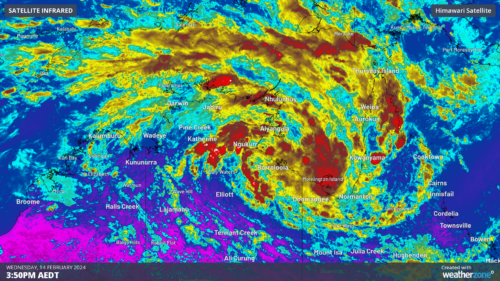
A tropical low (07U) has now formed over the Gulf of Carpentaria, with a moderate chance of becoming a tropical cyclone on Thursday or Friday. The satellite image below shows a broad-scale circulation rotating clockwise around the tropical low on Wednesday morning. Image: Himawari-9 visible (top) shows the system rotating and the water […]
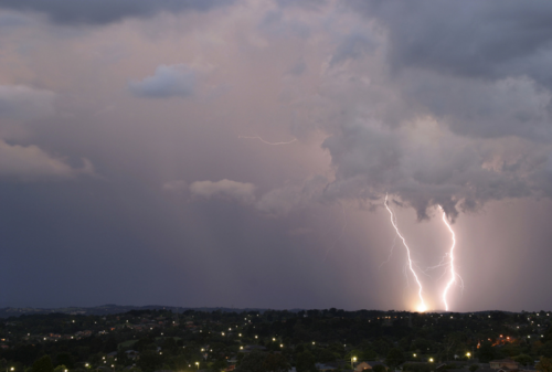
Thunderstorms will develop over parts of NSW on Wednesday, with severe storms possible in the afternoon and evening. The low pressure trough that triggered severe thunderstorms in parts of Vic and southern NSW on Tuesday will move further north across NSW on Wednesday. This system is likely to trigger showers and thunderstorms over a […]

Tuesday’s powerful winds in Vic, resulted in power outages for more than 500,000 customers. According to Victorian Energy Minister Lily D’Ambrosio, this has been one of the largest outage events in the state’s history. The wild weather brought down six transmission towers near Anakie, to the southwest of Melbourne on Tuesday afternoon. At the same […]
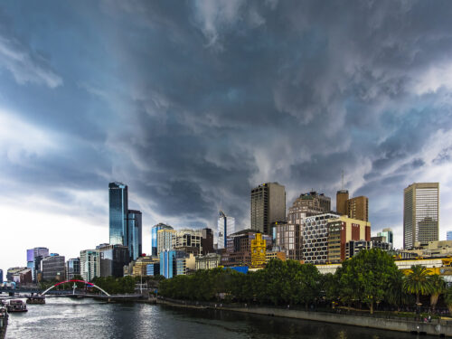
It is going to be a wild day for parts of southeastern Australia, with severe heat, catastrophic fire danger, severe thunderstorms, blustery winds and a welcome cool change all on the forecast. This dangerous mix of weather is being generated by a strong cold front, which will sweep across the region on Tuesday. A […]

A severe heatwave will continue to impact parts of Vic and SA early this week, bringing the first catastrophic rating in 14 years to the Wimmera. The heatwave began on the weekend for the southern states, with Adelaide recording temperatures in the low to mid 30’s on both days, while Melbourne’s mercury topped 33.2°C on Sunday. […]

Western Australia is set to sizzle during the next few days, bringing extreme heat and fire danger to some parts of the state. A high pressure system in the Bight is directing hot, dry easterly winds over WA over the next few days, causing temperatures to soar across much of the state. The temperature […]

The longest lasting heatwave Melbourne has seen in a season is expected from late this week, with the heat and wind expected to increase fire danger in Vic. After a relatively quiet December and January on the heat front, Melbourne’s temperature climbed to 37.5°C on Sunday, February 4. This first burst of summer heat was […]
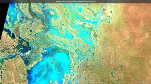
Satellites have captured images of floodwaters filling rivers and lakes in southwest Qld and northwest NSW, following heavy rain from ex-Tropical Cyclone Kirrily. Clouds, rain and thunderstorms have been a persistent feature over Australia’s eastern inland during the last fortnight. This late-summer soaking was caused by the overland journey of ex-Tropical Cyclone Kirrily, which made […]
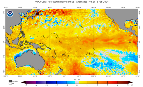
The oceans off the NSW and Qld coast are extremely warm and theoretically could provide enough energy to bring a tropical cyclone into NSW waters. The map below shows that the temperatures off the Coffs Coast and north are currently above 26.5 °C, which is 2-3°C above average for this time of year. […]

Australia’s tropical cyclone season is officially underway, but we may not see much activity for few months yet. The season runs from November to April, and for mining operators and businesses across northern Australia, 2026-27 is shaping up to be a season where the headline numbers and the real risk may not line up. On […]

A positive Indian Ocean Dipole is underway, but this one is unlikely to deliver the textbook dry spring and summer that businesses have come to expect from the pattern. The Bureau of Meteorology officially declared a positive IOD on Tuesday, October 27, which typically like El Niño can cause drier and warmer conditions over parts of […]

Waters off Indonesia have cooled in recent weeks, an indication that a positive Indian Ocean Dipole (IOD) event could be developing. It’s an important climate driver for Australia, and it could shape rainfall and temperatures heading into summer, with flow-on effects for farmers, energy and other industries. What is the Indian Ocean Dipole? The IOD […]

Leonora, WA, had its wettest September day on record earlier this month. Three weeks later, more than 1.3 million lightning pulses were detected within 800 km of the town in 48 hours. Why is a stalled trough delivering storms to mining country, and what it could mean for operations? The DTN Total Lightning Network detected […]
