
A severe heatwave will continue to impact parts of Vic and SA early this week, bringing the first catastrophic rating in 14 years to the Wimmera.
The heatwave began on the weekend for the southern states, with Adelaide recording temperatures in the low to mid 30’s on both days, while Melbourne’s mercury topped 33.2°C on Sunday.
Monday morning began hot for Melbourne, ith the temperature reaching the low 30’s by 10:30am.
The maps below shows that temperatures in the mid to high 30’s and in some areas the 40’s are forecast for SA and Vic over the coming days, before a cool change cools temperatures in Adelaide and southwestern Vic on Tuesday.
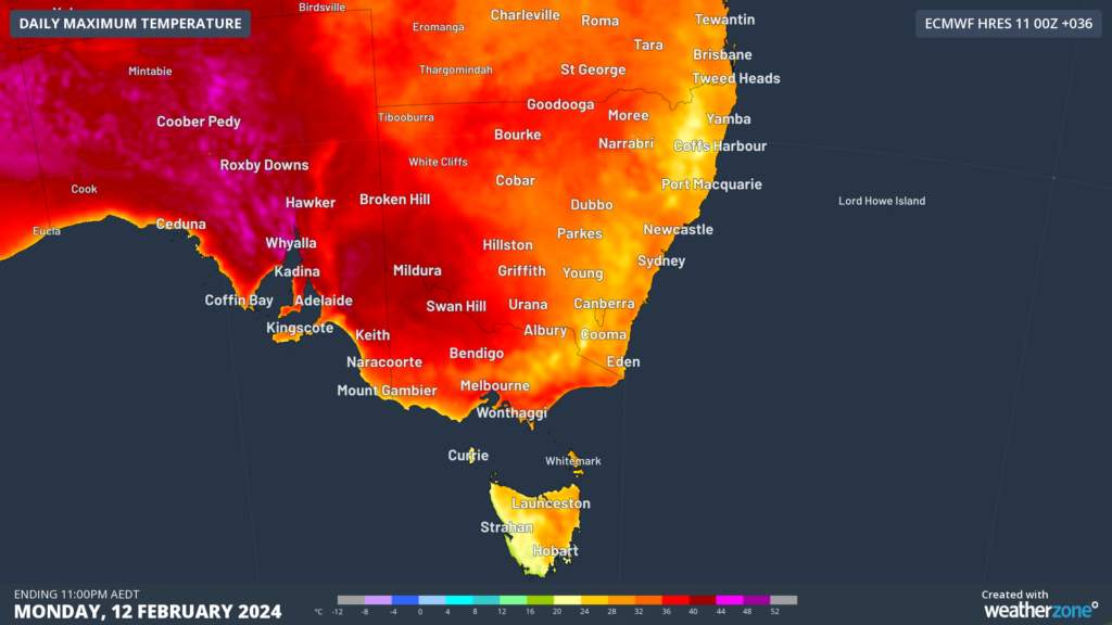
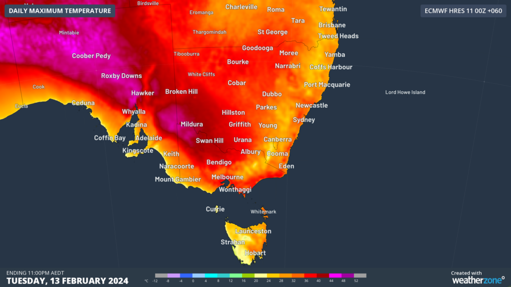
Images: Maximum temperature forecasts for Monday (top) and Tuesday (bottom), February 12 and 13, according to the ECMWF model.
This run of heat is causing severe heatwave conditions in parts of eastern Vic, with overnight minimums in the low 20’s providing little relief.
Melbourne’s temperature is expected to soar into the mid 30’s on Monday and Tuesday, with the overnight temperature on Monday night failing to drop below 21°C.
This run of days above 30°C will be the first Melbourne has seen since February 2023.
Fortunately for Melburnians, a seabreeze should move through the city on Monday afternoon, moderating the temperature slightly.
To the west, Adelaide will remain hot with 38°C on the forecast for Monday, before the temperature drops to 27°C on Tuesday behind a cold front.
This cold front is expected to sweep through Vic on Tuesday, arriving in Melbourne between 4:30 and 6:40pm local.
Ahead of the cold front, hot, dry gusty northwesterly winds will bring catastrophic to severe fire danger to northwestern Vic and parts of southeast SA on Tuesday.
The map below shows the catastrophic (red) fire danger in the Wimmera forecast on Tuesday, February 13.
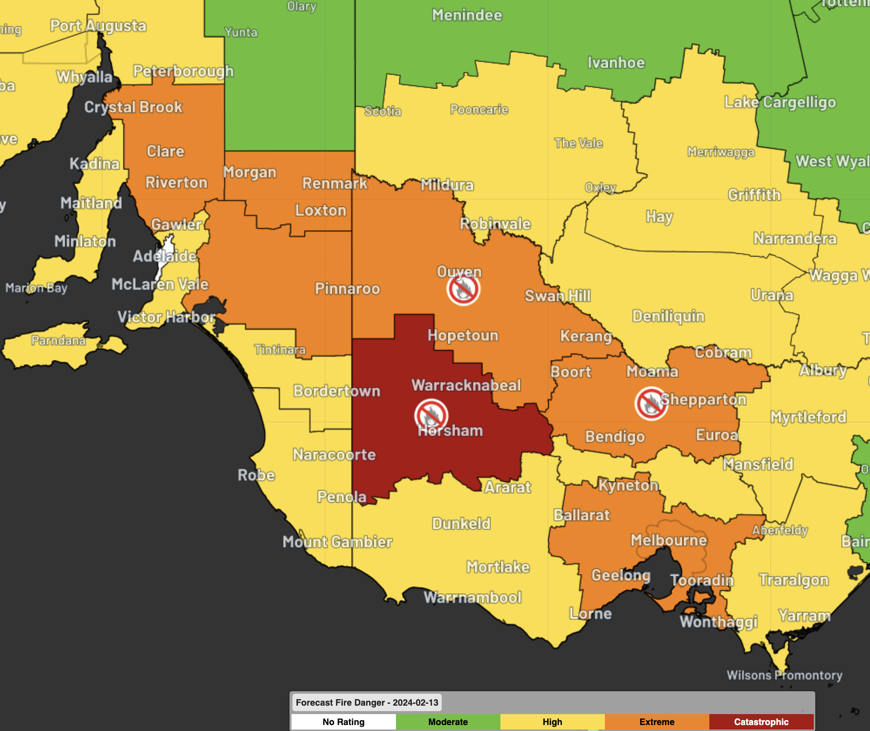
Image: Forecast fire danger showing catastrophic (red) and severe (orange) expected on Tuesday, February 13
This will be the first catastrophic rating in the Wimmera for 14 years, with the last in 2010.
Severe thunderstorms could bring the risk of damaging winds, large hail, and heavy rainfall to parts of central and eastern Vic on Tuesday as the front sweeps across the region.
Temperatures will drop several degrees in hours behind this cold front, bringing below average temperatures to the southern capital cities during the middle of this week.
Please keep abreast of the latest warnings as the strong cold front moves across the region on Tuesday.
For more information on our energy forecasts, please contact us at apac.sales@dtn.com.




