
Tropical Cyclone Mal is set to sideswipe Fiji overnight as a Category 2 or Category 3 tropical cyclone.
Tropical Cyclone Mal developed into a tropical cyclone on Monday evening and has since increased in strength to a Category 2 system on Tuesday morning. As of 3pm Fiji time (FJT), Mal has sustained winds of 100km/h, gusting up to 140km/h and is moving at a brisk 29km/h to the southeast.
Video: Enhanced infrared satellite showing Tropical Cyclone Mal pulsing with activity as it approaches Fiji
During the early and mid-morning of Wednesday, Tropical Cyclone Mal is forecast to sideswipe of Fiji’s western coast, including the tourist-hotspot of Nadi. Nadi International Airport is preparing for a night of rain, thunderstorms, low visibility (down to 1500m at times) and winds of 45 knots (83km/h), gusting up to 65 knots (120km/h).
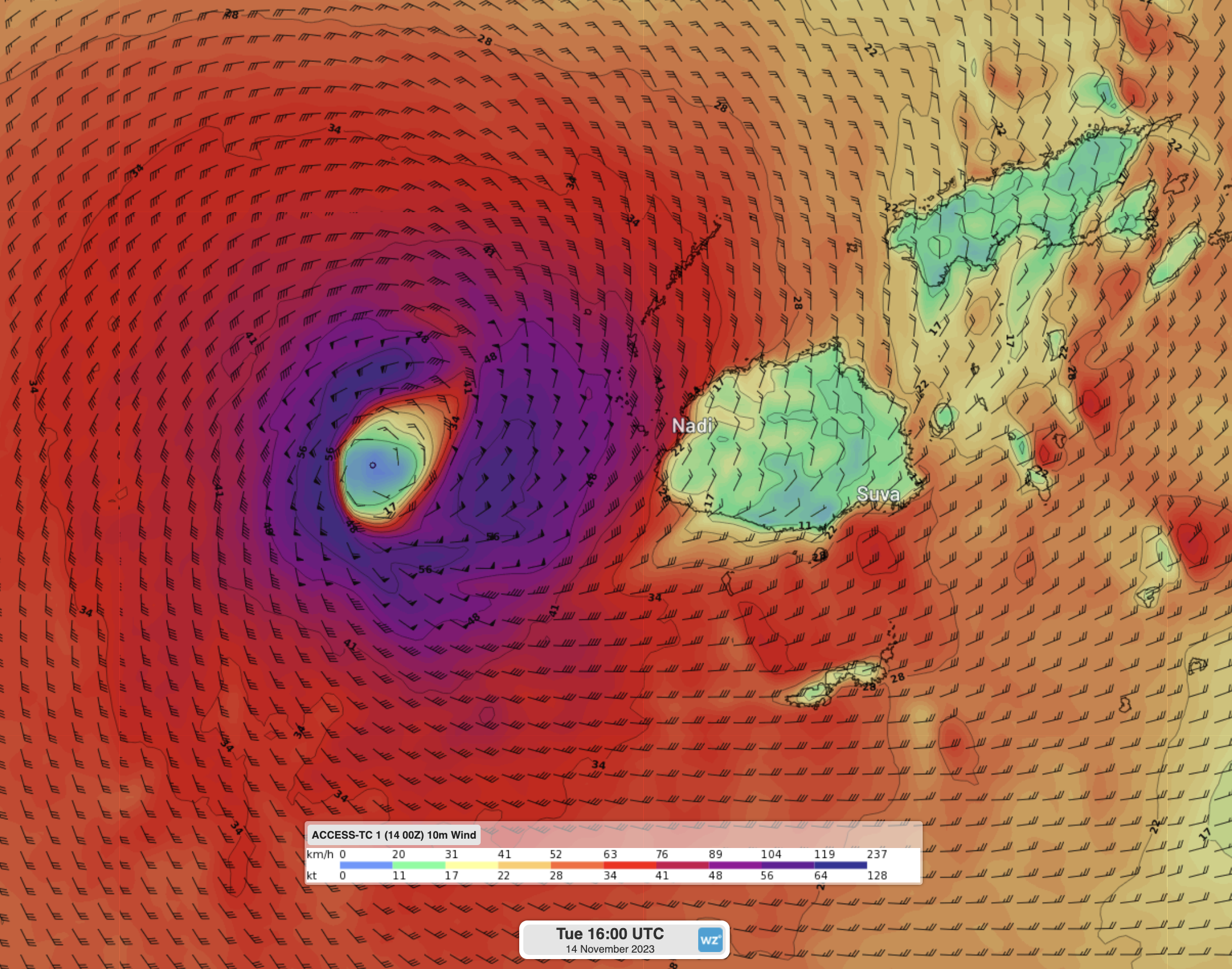
Image: Sustained winds from Tropical Cyclone Mal at 4am FJT when it’s at its closest to Fiji. Winds in red are gales exceeding 60km/h, with the strongest winds in purple representing storm (90km/h) and hurricane force (120km/h) winds.
Fortunately for Fiji, since Mal is expected to only clip the island, and since the system is moving so quickly, rainfall is not expected to be particularly heavy overall. However, thunderstorms could bring short-lived tropical deluges of more than 80mm/h.
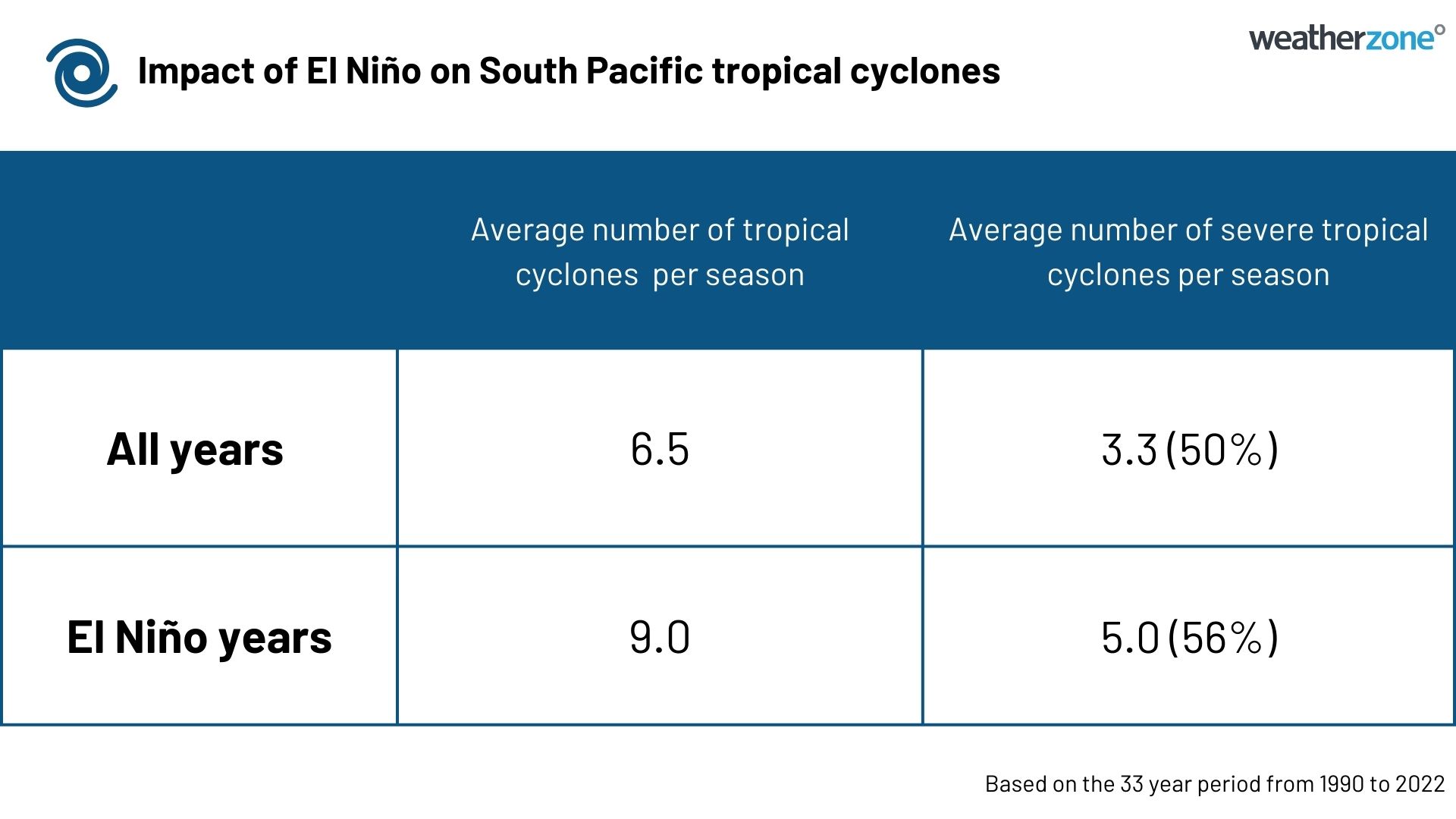
This is the South Pacifics first tropical cyclone of the season (runs from November to April), although notably comes second in the financial year to the record-breaking Severe Tropical Cyclone Lola in October. While El Niño does increase both the number of tropical cyclones expected in the South Pacific and the proportion of those that make it to Severe Tropical Cyclones (i.e. Category 3 or higher), it is still unusually early to see this many severe tropical cyclones.
You can see the official forecasts released by the Fiji Met service here, with more details about the system here.
DTN APAC and DTN can provide your business with tropical cyclone forecast and alerting services, no matter where you are in the world. To find out more, please visit our website or email us at apac.sales@dtn.com.


