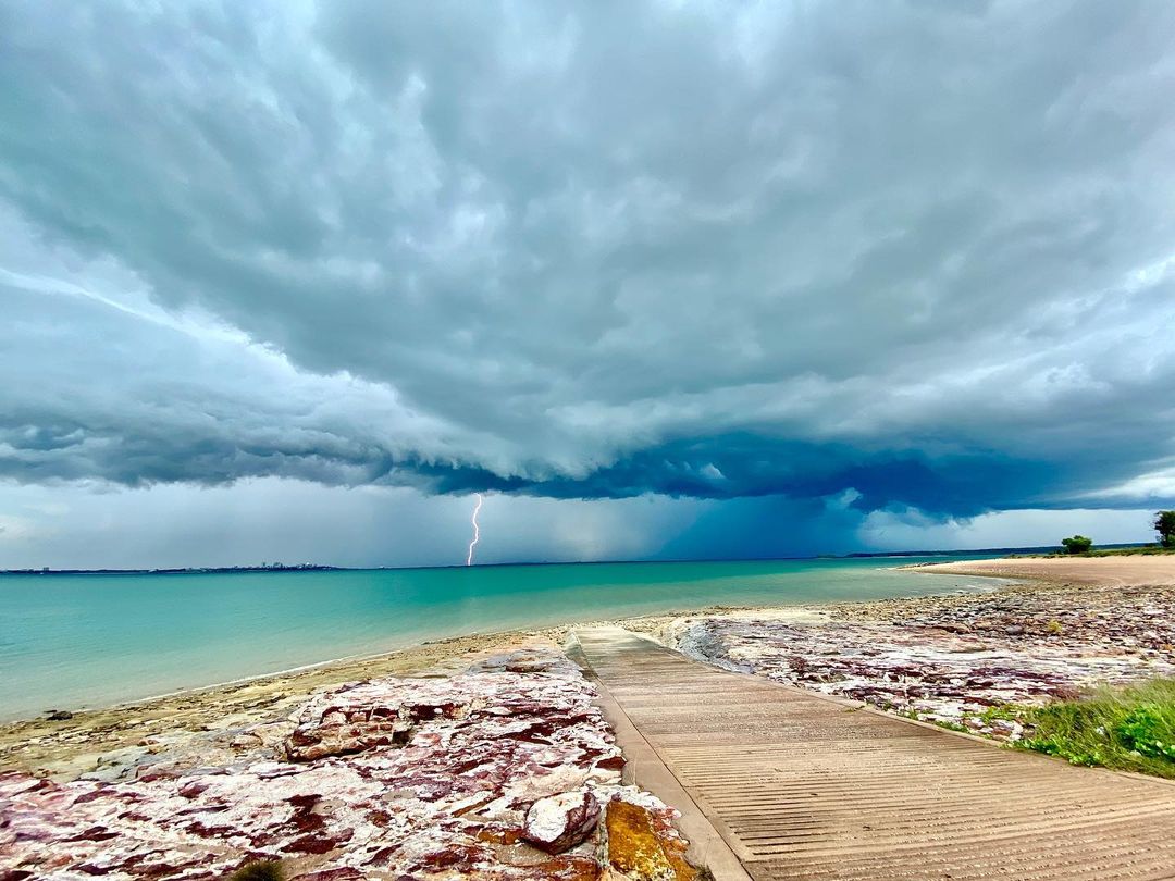
The tap across northern Australia is turning on this week, with daily thunderstorms and rain set to break the dry season for large areas.
Moisture laden air feeding into an area of low pressure across the northern tropics is behind the stormy and steamy week.
The map below shows the accumulated weekly rainfall predicted by one computer model is predicting across northern Australia this week. Based on this model’s forecast the heaviest rain should fall over Kimberley and western Top End this week.
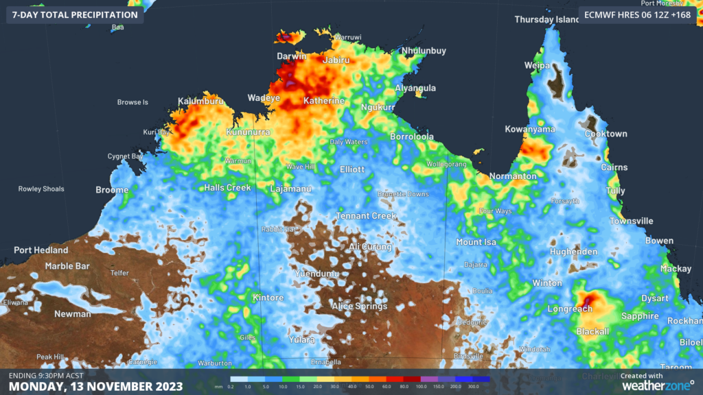
Image: ECMWF accumulated rainfall forecast for the week ending Monday, November 13.
Accumulated weekly rainfall totals could reach 50-80mm, with isolated areas possibly picking up more than 100mm in a week.
This is enough rainfall for the northern rainfall onset to be officially declared in some areas across northern Australia. The northern rainfall onset is the first rainfall of the season that is sufficient to stimulate plant growth. This is defined as the date when 50 mm or more rainfall has accumulated after September 1.
The wet week ahead is a sign that the ‘build up’ season is well and truly underway, which unofficially runs between September and December across northern Australia.
The ‘build up’ can be an uncomfortable time for some northern Australians, with heat and humidity rising steadily during this time. The steamy atmosphere during the ‘build up’ also sparks regular thunderstorm activity across the tropics.
The ‘build up’ is a precursor to the monsoon which typically arrives late-December, which brings cooler temperatures, heavy rain, thunderstorms, and an increased chance of tropical cyclone activity.
However, this year’s monsoon is expected to arrive late with El Niño active in the Pacific Ocean, most likely in January.
The potential late arrival of the monsoon means that rainfall should be well-below average during the first half of the wet season, but close to average in the latter half.
The map below shows that the northern rainfall during El Niño years tends to be drier than average between October and December, particularly for parts of the Top End, NT and QLD.
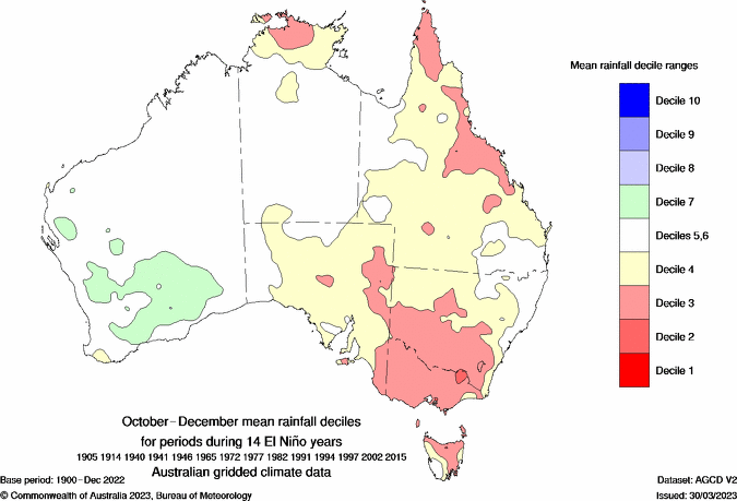
Image: Mean rainfall deciles between October and December during 14 Niño years Source: Bureau of Meteorology.
During El Niño year northern Australia typically observes below average cyclone activity during the season. This can also reduce the heavy rainfall and flooding that typically occur with these systems. Research has shown that Queensland is half as likely to see cyclones during El Niño compared to neutral years.
The map below shows one forecast model is predicting drier than normal conditions across northern Australia in December 2023.
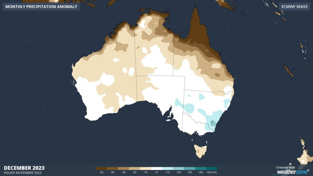
Image: ECMWF December 2023 rainfall anomaly forecast
Wet season 2022/23
The 2022-23 wet season was the 6th wettest on record, with some pockets recording the wettest season on record.
The above average rainfall was driven partly by La Niña, which was active in the Pacific Ocean between November 2022 and March 2023. October and November were particularly wet months across northern Australia, under the influence of the negative Indian Ocean Dipole (IOD) which broke down in December 2022.
The first monsoon onset arrived during December 2022, but the wet season started 1-2 months earlier than usual thanks to La Niña. The green shade on the map below shows the areas where the wet season arrived early.
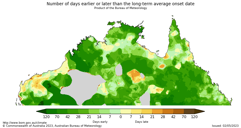
Image: Number of days earlier (green) or late than the long-term average onset date
The early arrival of the wet season meant that above average rainfall fell during spring and early summer.
The map below shows the rainfall that large areas received very much above average rainfall.
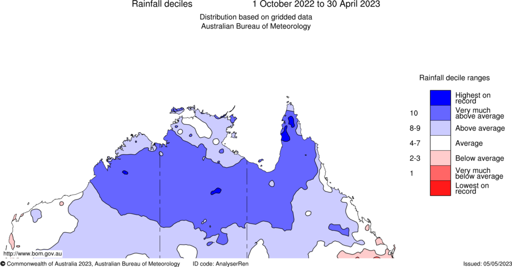
Image: Rainfall deciles between 1 October 2022 and 30 April 2023.
This wet season is forecast to be dramatically different to the last, with hot and dry weather forecast across the countries north.
Weatherzone is here to help this wet season, for more information please contact us at apac.sales@dtn.com.


